

Seattle weather: Summerlike Saturday, Rain Rolling Back In Sunday
Seattle weather: Summerlike Saturday, workweek rain rolling in
FOX 13 Meteorologist Ilona McCauley has your 7-day forecast.
Seattle - A beautiful day around Western Washington today! Plentiful sunshine with highs warming to the upper 60's and low 70's. The ridge of high pressure kept skies dry today, but will slowly move off the east overnight and early Sunday.
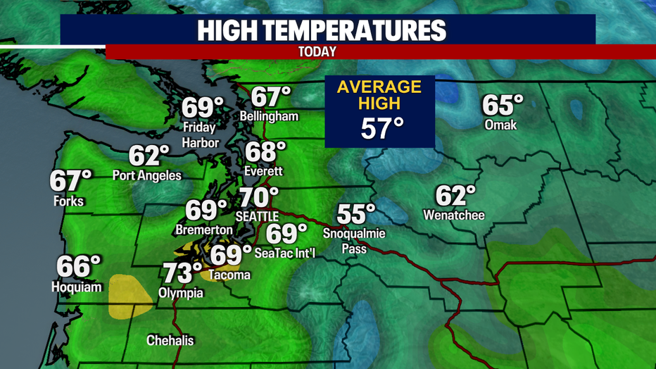
A beautiful afternoon with mild highs near 70 degrees.
Sunday will look quite different as we close out the weekend with rain returning to Western Washington. The front will arrive with rain along the coast during the morning and then slowly spread into the interior regions through the day. Some heavier downpours may be possible overnight Sunday. There is a slight chance of some thunder on Monday, mainly along the coast.
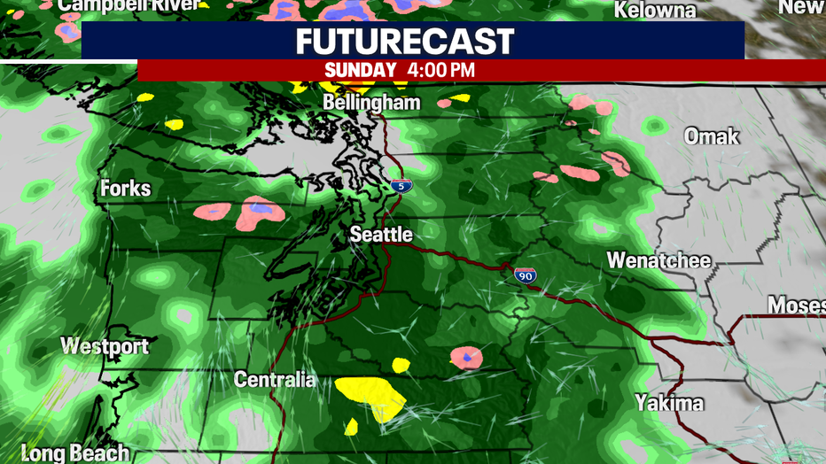
A cold front will push onshore during the day Sunday increasing rain through the day.
Our weekend will wrap up with cooler temperatures in the wake of the cold front passing through. While highs on Saturday were about 15 degrees warmer than normal, they will bump back down closer to average near 57 degrees.
Rain arrives by morning along the coast with it then spreading inland during the day Sunday.
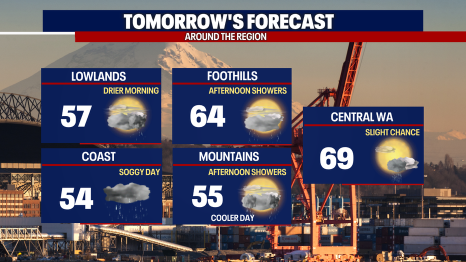
Soggy skies and breezy winds for early in the week. Some dry times are forecast too, especially Wednesday and Thursday. We'll have to wait a little while to see some 70s again.
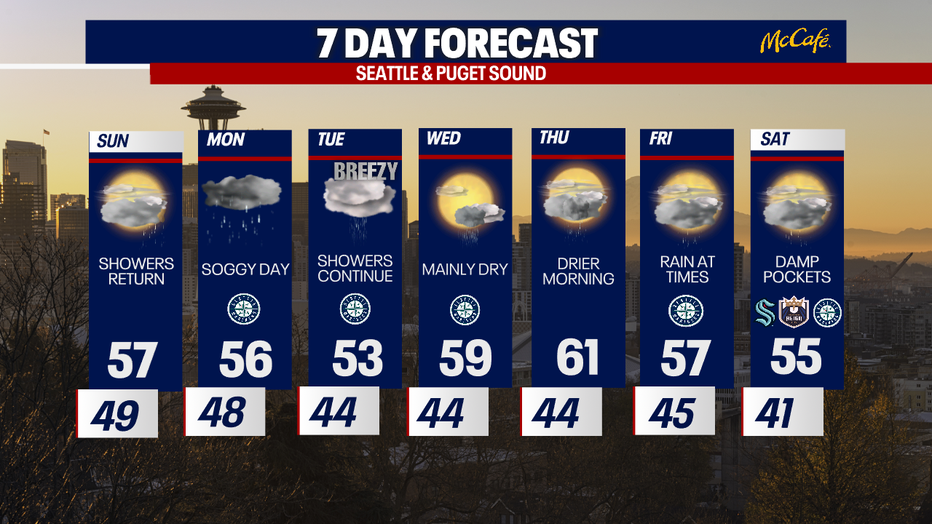
Chances for showers return this week with some dry times too.