

Seattle Weather: Some "green" on the Radar for St. Patrick's Day
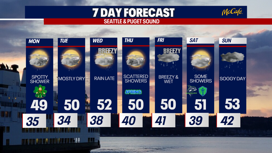
Seattle - A nearby disturbance will keep scattered showers around for Monday. Much like today, the showers will be spotty, except for the north sound where a convergence zone will set up increasing rain chances in that location. Rainfall amounts throughout the day will range between .10" to close to an inch along the coastal region. Light snow will fall in the mountains. While there is no winter weather advisory in place, drivers should be prepared for some slick roads through the passes.
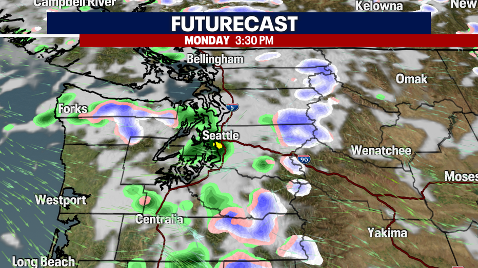
Another area of low pressure will keep scattered showers around for Monday. (FOX13 Seattle)
Our area mountain ski slopes picked up about a foot of snow over the weekend. Snow levels will hover around 2000' this week with additional chances for snow showers. The Cascades could pick up another 1-5" of snow on Monday.
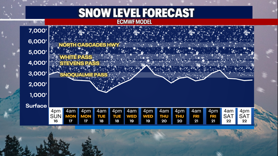
Snow levels will remain below pass levels this week, with more snow on the way. (FOX 13 Seattle)
While we are expecting to see some green on the radar tomorrow, don't forget to wear your leprachan color! Scattered showers will be around, so along with your green clothes you'll need to grab your umbrellas. Afternoon highs will again be cool in the upper40s to near 50 degrees.

A few showers around Seattle for St. Patrick's Day. (FOX13 Seattle)
An unsettled week ahead with more chances for lowland rain and mountain snow. Wednesday evening will turn breezy and wet with more rain welcoming Spring on Thursday.
An unsettled week ahead with more chances for lowland rain and mountain snow.