Seattle Weather: Record warmth this week
Record warmth ahead this week
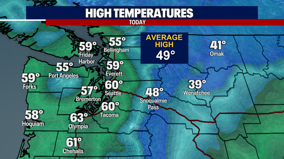
If you've stepped outside, you'd likely felt just how mild it is. We had a record-breaking warm day Sunday, and the rest of the week is looking just as temperate.
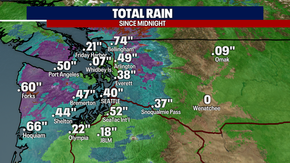
SEATTLE - We will see heavy rain late Saturday night and early Sunday morning, especially around the Olympic Peninsula and Skagit and Whatcom Counties. Amounts totaling near .50"-.75" in many locations.
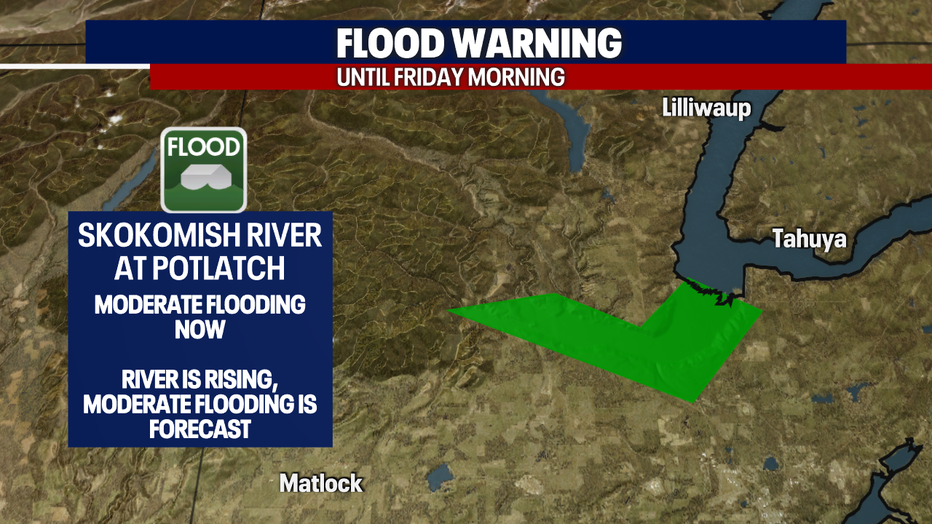
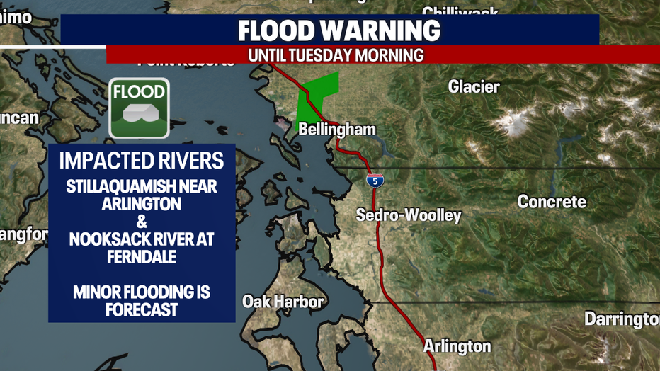
The heavy rain in the North Cascades and Olympics are also creating issues with runoff into area rivers sending many into a flood warning.
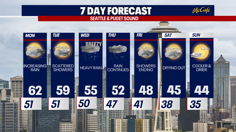
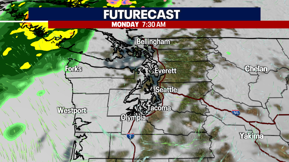
Much of Western Washington will get a break from the atmospheric river this evening and most of Monday as it pushes slightly to the north to B.C. A separate, weaker disturbance will arrive and bring scattered showers Monday night into early Tuesday. The atmospheric river will then drift back south by Wednesday, bring back the threat for moderate to heavy rain.
If you've stepped outside, you'd likely felt just how mild it is. We broke the record high officially at Sea-Tac today. We hit 60 degrees, breaking the old record of 57 set in 1992.
With the warm air sticking around, it is likely we will again break the records tomorrow and Tuesday.
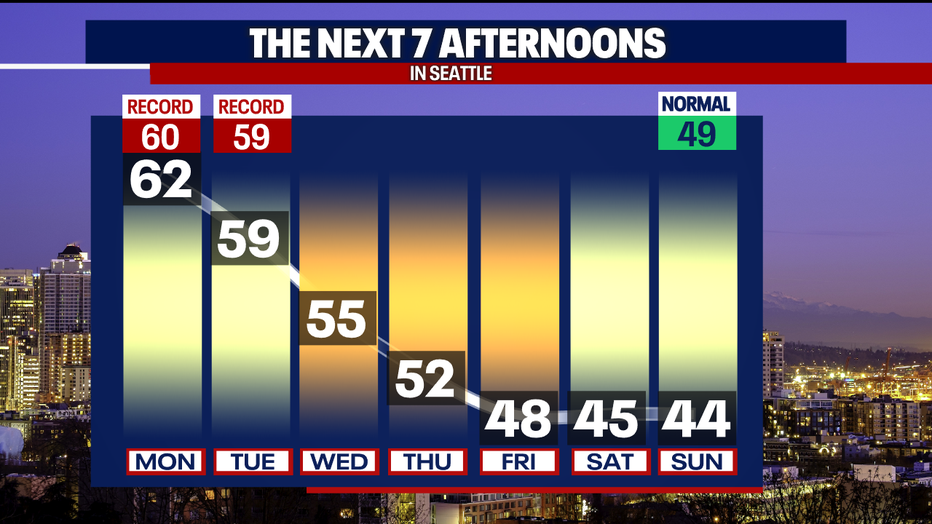
A gradual end to the atmospheric river is forecast by Thursday as it sinks southward into California, taking the mild temperatures along with it. We are expected to dry out and cool way back down by the end of the week and into next weekend.