Seattle weather: Rain, wind and heavy mountain continues tonight
Rain and cold temperatures around Puget Sound this week
FOX 13 Meteorologist Ilona McCauley has your week forecast. If you wanted lots of rain and just-above-freezing temperatures, you're going to have a great time!
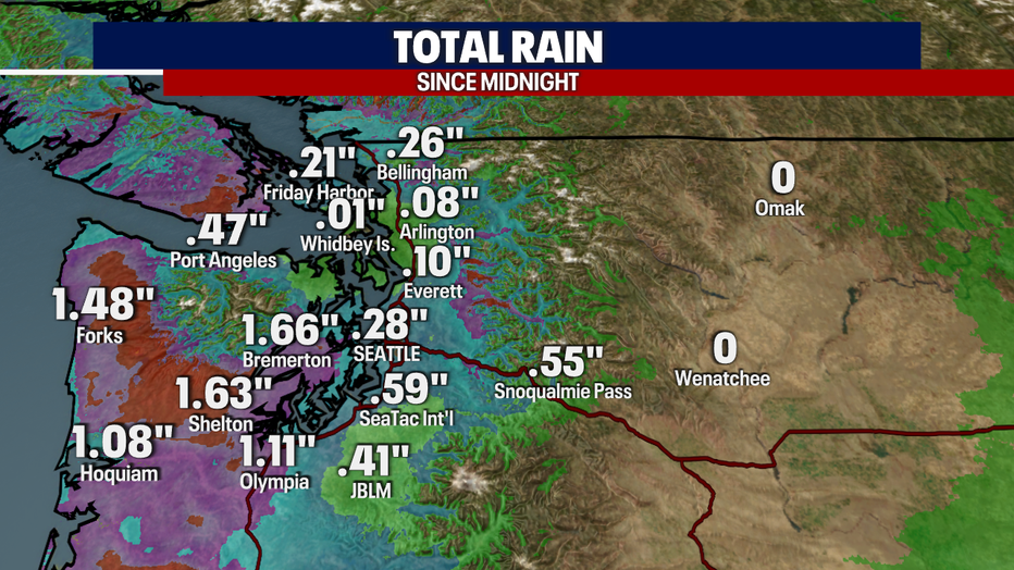
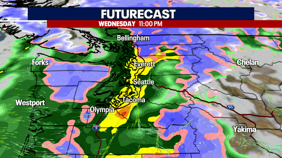
SEATTLE - It has been a wet and gusty day for the Pacific Northwest. Showers have been consistent today, with over an inch-and-a half of rain for some spots of the South Sound and along the coast.
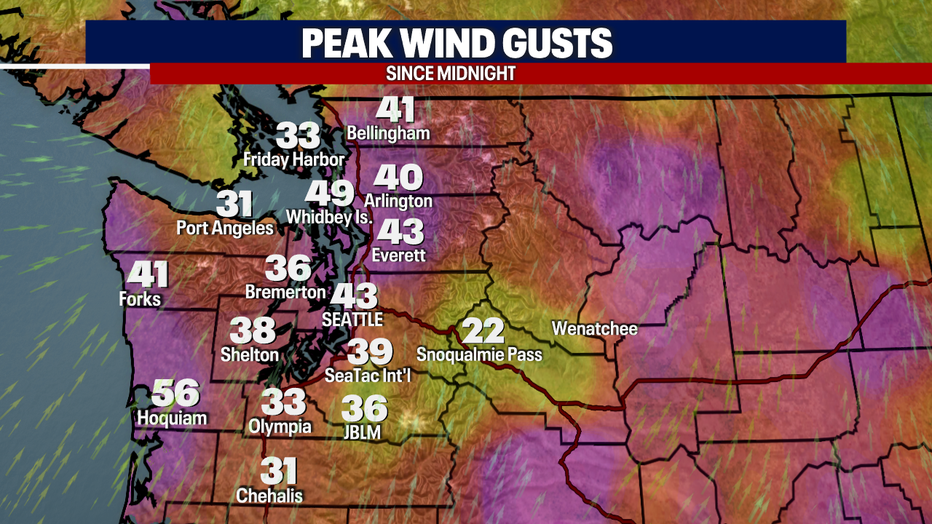
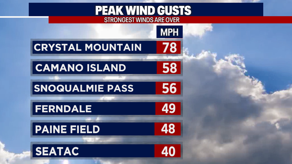
Winds have been strong with a Wind Advisory in effect through this evening around Western Washington. Peak winds today were over 40 mph for the lowlands, and even stronger for the mountains.
Heavy rain continues this evening, with a flood watch still in effect for the South Sound. Snow levels will slowly drop tonight with a few snowflakes possibly mixed in late tonight into early Thursday morning.
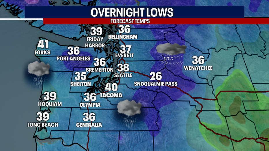
Overnight lows will be in the mid to upper 30s, with winds still gusty, but not as strong as earlier in the day.
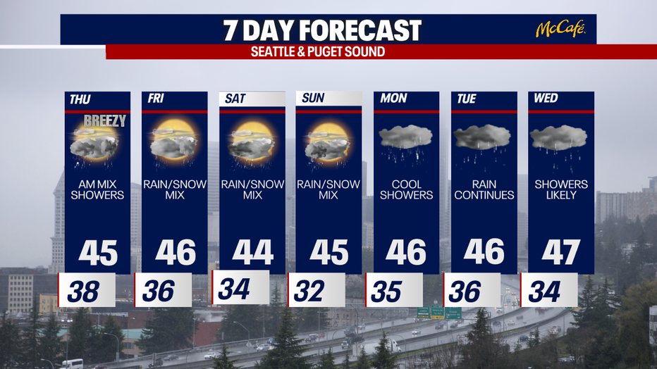
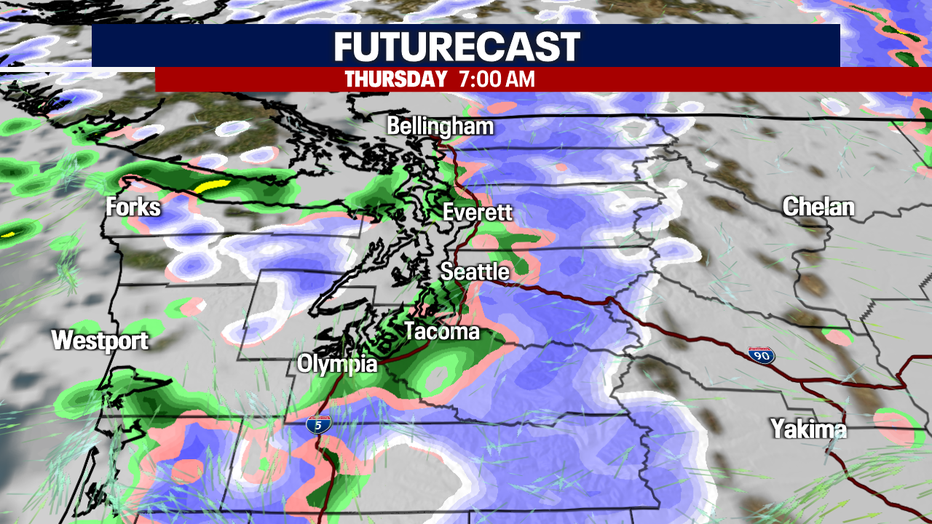
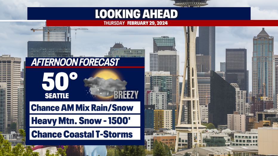
With lower snow levels to start Thursday, there is a brief chance of mixed rain and snow showers, with little to no accumulation expected. Winds will still be breezy into the afternoon, gusts around 20-25 mph.
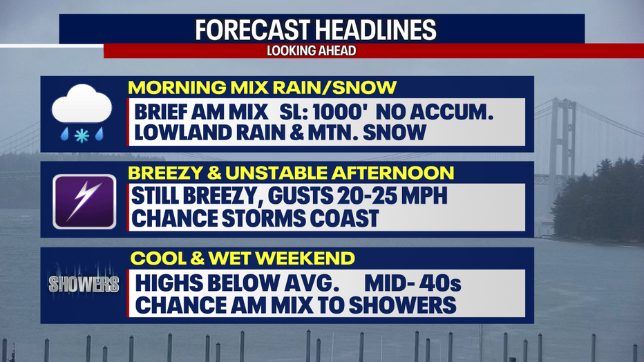
The best chance of snowflakes will be above 1000' and near the foothills. The cold front moving through will lead to more scattered showers throughout the day.
A chance of a rumble of thunder for the coast of tomorrow as unstable air fills in behind the cold front. There is the possibility of hail, lightning and heavy rain with these storms.
Heavy mountain snow continues tonight into Thursday with several feet total expected for the high mountains. Several more inches of snow through the end of the week into the weekend.
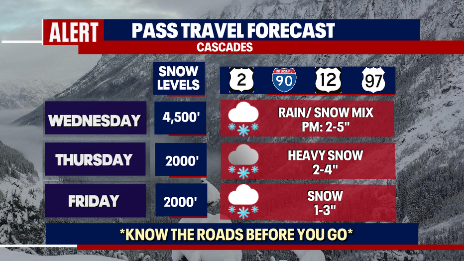
Cool and wet for the end of the week into the weekend with a chance of mixed rain/snow showers in the morning hours. No major accumulation is expected, but there will be a chance for every morning moving into next week.