

Seattle Weather: Late Season Winter Storm Brings More Mountain Snow
Seattle - Another round of scattered showers to close out our weekend. Lowland rain will ramp up overnight Saturday with showers lingering into Sunday. Overall, Sunday will be more dry than wet, but there will be enough instability that we may see some more isolated storms with lightning, small hail and brief downpours of rain.

Another round of light rain for much of Puget Sound overnight with more mountain snow through Sunday.
Snow levels will remain low, around 2000' on Sunday. This late-season winter storm will bring another round of mountain snow tomorrow. The Winter Storm Warning will expire at 11am with totals by the end of the weekend around a foot of snow.
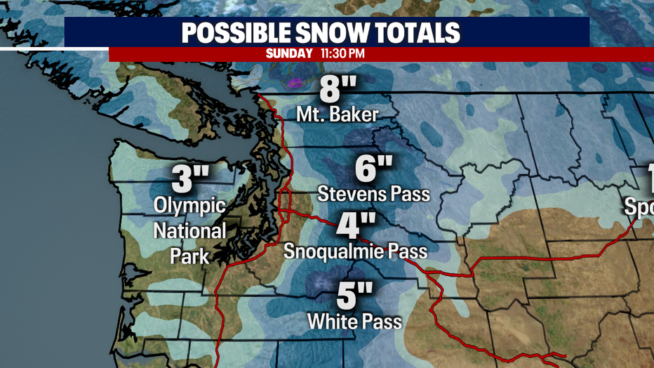
Another 4-8" of snow will be possible throughout the day on Sunday.
Afternoon highs will again be unseasonably cool on Sunday with temperatures topping out in the upper 40's. Be sure to dress in layers, keeping your rain gear handy.
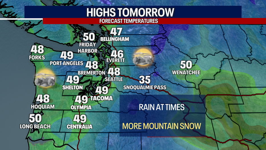
Afternoon high temperatures will be in the upper 40s and low 50s on Sunday.
More rain and snow to wrap up the weekend. A few spotty showers are possible as we celebrate St. Patrick's Day. We'll see a break in the rain by the middle of next week with highs back closer to normal.
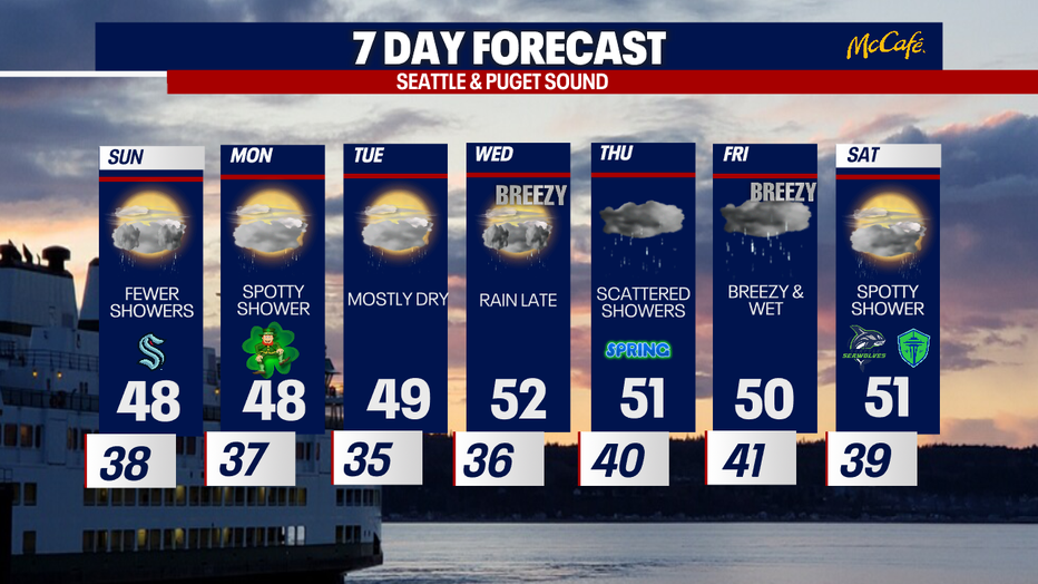
More rain and snow to wrap up the weekend. We'll see a break in the rain by the middle of next week with highs back near normal. (FOX13 Seattle)