

Seattle Weather: Atmospheric River Brings Wind and Rain on Sunday
Seattle weather: rain lingering through the weekend
FOX 13 meteorologist Ilona McCauley has the latest forecast
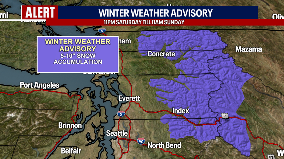
Seattle - An atmospheric river arrives in Western Washington on Sunday with breezy and wet conditions. Winds will be gusty at times, near 40 to 45mph at times. Rain will be heavy at times, especially along the coast and west slopes of the Olympics. Rainfall totals will range between 1-4" throughout the day.
An atmospheric river arrives on Sunday with breezy winds and wet weather.
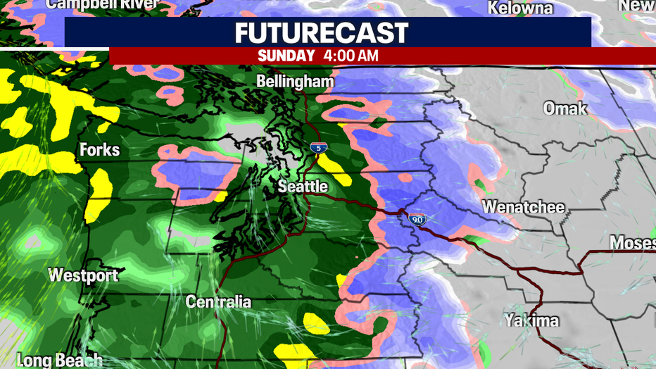
Snow levels will start around 3500' on Sunday morning with a chance for more measurable snow, especially from Steven's Pass north into the North Cascades. By the afternoon, snow levels will rise to near 7000' with snow quickly switching to rain even at higher elevations.
Snow levels will begin low on Sunday morning before rising to near 7000' by the afternoon. (FOX13 Seattle)
Afternoon highs will be a few degrees warm with the arrival of the warm front and atmospheric river. Many spots will be between the low to mid 50s.
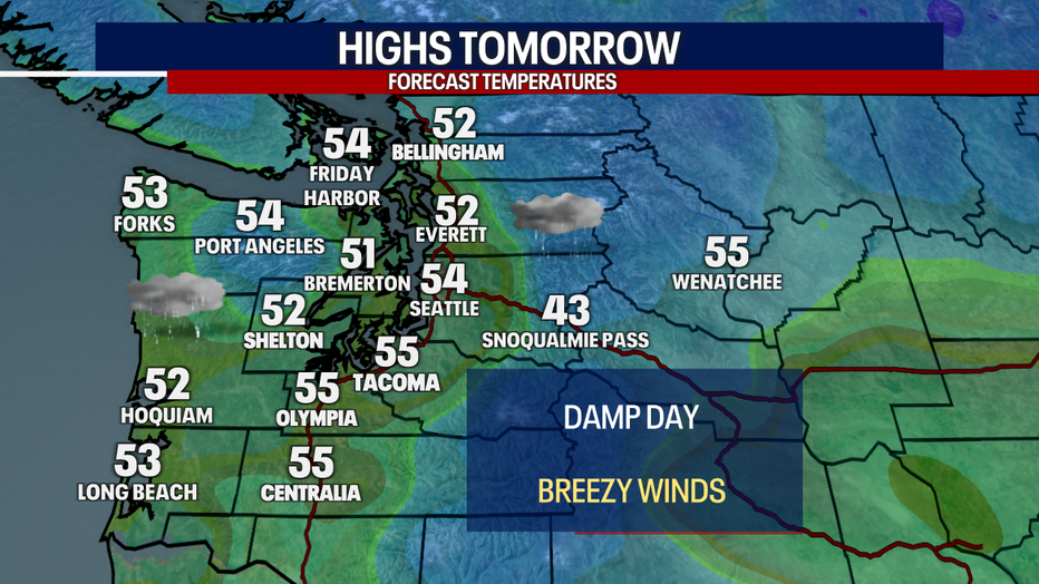
A warm front will arrive Sunday with slightly warmer afternoon highs.
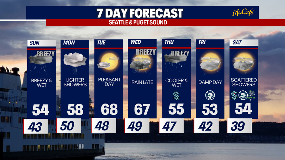
After our soggy Sunday, Tuesday will be beautiful with spring-like weather. It will easily be the warmest day so far this year. It will be short-lived with showers and a few storms back by Wednesday.
Warmer, milder weather will make an appearance in Seattle on Tuesday.