Seattle weather: Mild temperatures return to lowlands
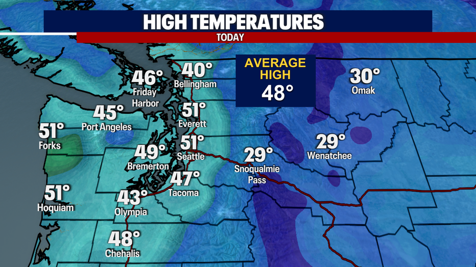
SEATTLE - As we head into the weekend, the frigid temperatures are behind us and we got to enjoy some milder weather with some sunshine today. Afternoon highs ranged in the upper 40's to low 50's.
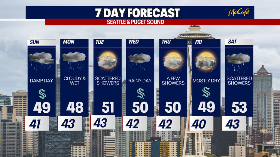
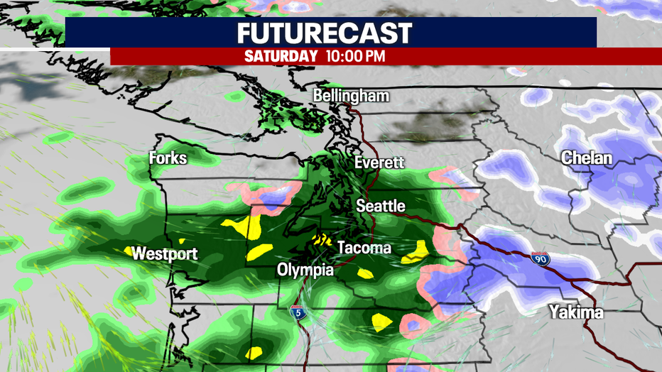
Rain is making a comeback though, so be sure to grab your rain gear for Saturday night. Much of Sunday will also be damp with some locally moderate to brief downpours.
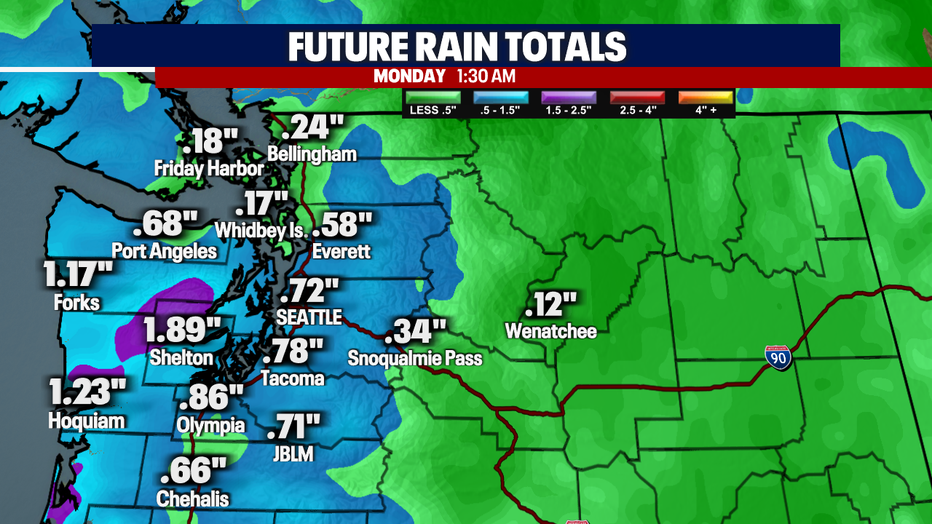
Rainfall amounts through Sunday night will total about .50"-.75" around much of Puget Sound with higher amounts stretching from Shelton out toward the coast.
Snow levels will be higher than the past week, up around 4500-5000'. The best chance for snow will be overnight Saturday and early Saturday morning. The snow will transition to a rain/snow mix through the passes on Sunday.

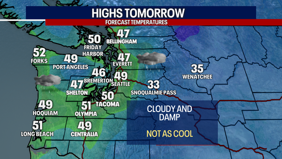
While Sunday is forecast to be a cloudy, wet day, afternoon highs will still manage to climb well into the 40 and low 50s.
Much of the week will remain unsettled with a chance for rain for each day. Wednesday may be potentially the wettest day of the week. Afternoon highs remain well above freezing with no threat for lowland wintry precipitation or freezing conditions.