Seattle weather: Winter white for the mountains, lowland flurries ahead
Temperatures to drop into 40s with gusty winds
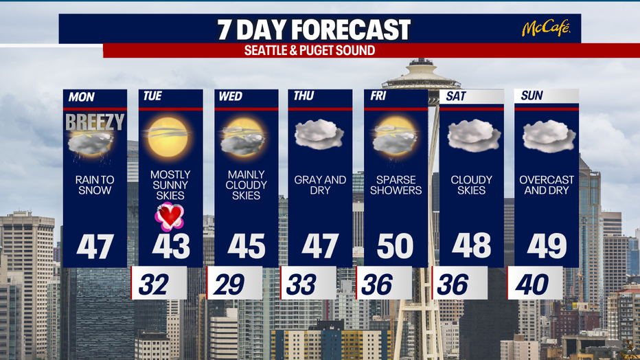
Highs will peak into the mid-40s, but gusty winds and heavy mountain snow will make it feel even colder at times.
SEATTLE - Monday will be wet and somewhat stormy across Western Washington. We're forecasting significant snow for the mountains. There's even a small chance for brief and isolated lowland snow tonight.
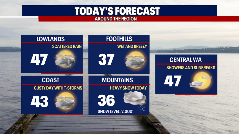
Highs today will reach the mid to upper 40s. It'll feel chilly with mostly cloudy skies.
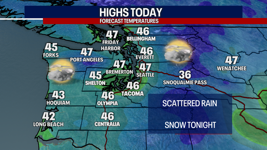
In addition to seeing scattered rain today, we can't rule out a few lightning strikes where downpours pop up. In some showers, small hail and graupel could mix with rain.
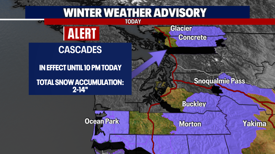
Heavy snow will slam the mountains today. The National Weather Service has issued a slew of alerts for the mountains. On top of the ongoing snow, gusts to 40 mph over the passes could lower visibility and make driving even more dangerous. Make sure to check WSDOT conditions before hitting the road! If possible, I'd postpone driving over passes until tomorrow morning.

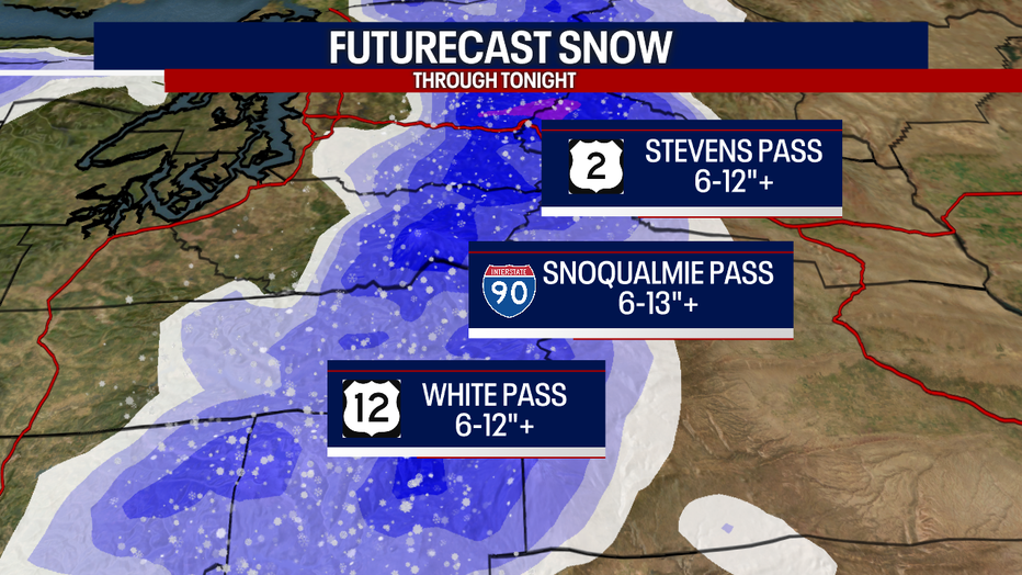
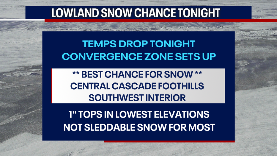
Later tonight, rain could change to snow in the lowlands as temperatures drop. Any lowland snow will wrap up by early Tuesday morning (likely prior to 5 a.m.). This event doesn't look widespread or significant for the lower elevations; however, minor accumulations are possible where bands of snow set up, particularly where a convergence zone develops tonight.
Outside of the passes, the Central Cascade foothills and valleys (think North Bend, Index and Baring) and the Southwest Interior (e.g. Centralia, Raymond, Pe Ell and LeBam) have the best chance for accumulating snow. Under 500 feet, any accumulations look super minor - perhaps amounting to a quick coating on the ground, mainly less than an inch. There could be localized higher totals under heavier bands of snow.
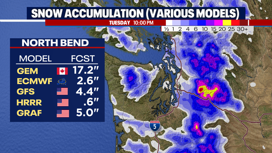
Over places like North Bend, upwards of two to five inches could stack up late tonight into early Tuesday. Bear in mind: these snow totals depend on how cold the temperatures get and whether there's enough moisture to produce snow. Below is a graphic that shows what the various weather models are forecasting for North Bend. As you can tell, the GEM model is the outlier. The other models only hint at a handful of inches. We'll watch this closely.
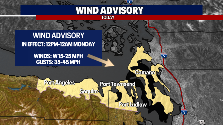
Along with the lowland rain and mountain snow, it'll be windy today for the typical spots. Even though this isn't a major wind event by any stretch, there may be some damages and power outages for the North Sound and the coast. Wind Advisories are in effect for those areas.

A High Surf Advisory is posted for the coast where breaker waves could be dangerous.

While the passes could be icy tomorrow, Tuesday will be a bluebird day along the slopes. Highs will be chilly and certainly below average. No new snow is in the forecast for Wednesday and Thursday over the Cascades. Light mountain snow could return Friday into next weekend. Below is a snapshot of the seven-day forecast for the Cascade passes.

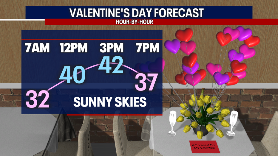
Back down here in the lower elevations, Valentine's Day is looking frigid but sunny. Enjoy the beautiful weather!
Weather should be quiet and mostly dry into next weekend. Light showers could make an appearance on Friday. We'll watch the latest developments for you throughout the week, so stick with us :)
Take good care,
Meteorologist Abby Acone
Follow me on Twitter @abbyacone, Instagram @abbyaconewx, TikTok @abbyaconetv and Facebook (Meteorologist Abby Acone)

