

Seattle weather: Widespread rain, significant mountain snow ahead
Seattle weather: First day of spring to start with rain
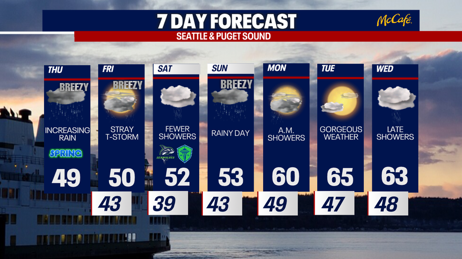
After some off and on showers, we will see clouds early Thursday morning, light showers by midday and then rain by the afternoon.
SEATTLE - Scattered showers will continue through Thursday afternoon with cool temperatures and heavier rain arriving by the evening commute.
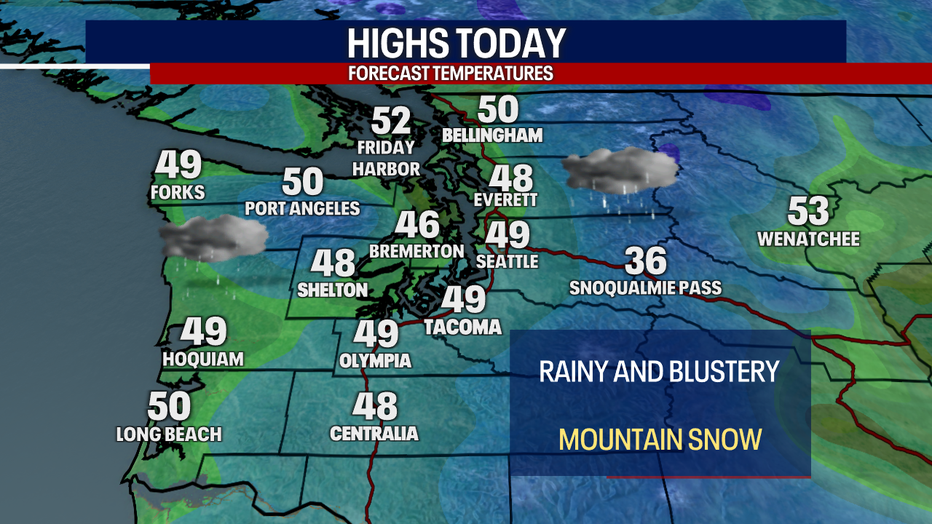
Widespread rain returns to the western Washington lowlands Thursday afternoon into early Friday morning. Lowland rain, gusty wind, and more mountain snow will impact the area. This system will pack a bigger punch than Wednesday night’s storm with more significant precipitation.
Friday will be showery, with drier conditions expected Saturday.
By the numbers:
In the Cascades, snow levels will remain between 2,500 and 4,000 feet through Saturday. Higher passes, like Stevens and White passes will see 12 to 24 inches of snow through Saturday morning.
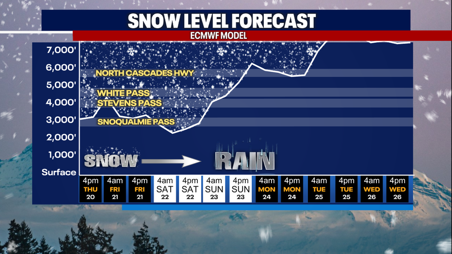
On Sunday, an atmospheric river will impact the area with another round of widespread rain. This system will be much warmer, sending snow levels climbing.
Monday through Wednesday will be warmer with highs in the 60s!
The Source: Information in this story comes from weather models interpreted by FOX 13 Seattle meteorologists Brian MacMillan and Abby Acone.
MORE TOP STORIES FROM FOX 13 SEATTLE
Top aide for WA Gov. Ferguson resigns over workplace complaints, report
Seattle police arrest man accused of more than 20 bank robberies
Here's where Seattle renters are relocating
Seattle's Capitol Hill Block Party announces 2025 lineup, changes to event
Could Bryan Kohberger’s autism defense for capital murder set a precedent?
To get the best local news, weather and sports in Seattle for free, sign up for the daily FOX Seattle Newsletter.
Download the free FOX LOCAL app for mobile in the Apple App Store or Google Play Store for live Seattle news, top stories, weather updates and more local and national coverage, plus 24/7 streaming coverage from across the nation.