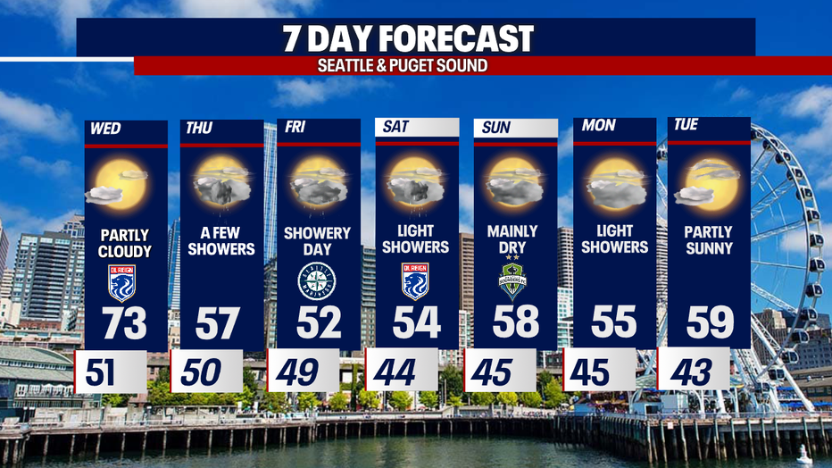
Seattle weather: Warm Wednesday, then back to cool & showery conditions
Temps in the 70s for Wednesday before dropping again this week
A few showers will pick up Thursday before more rain comes in Friday.
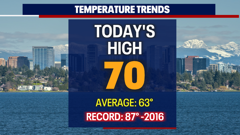
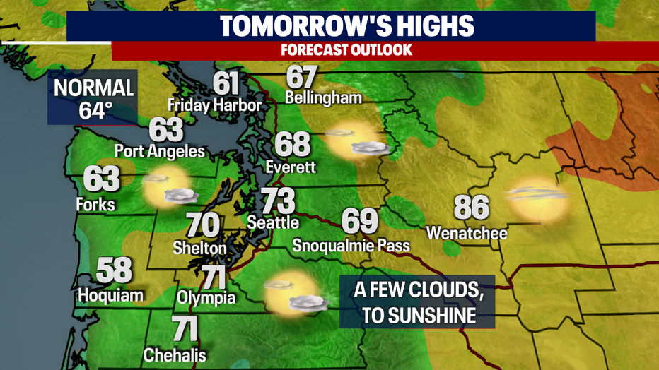
SEATTLE - Highs Wednesday went soaring into the upper 60s to low 70s across Western WA. Seattle hit 70 while Shelton and Bremerton landed at 73!
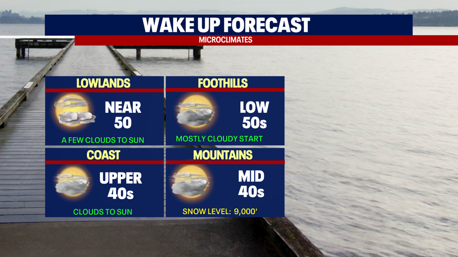
Look for partly to mostly cloudy skies overnight with mild temperatures.
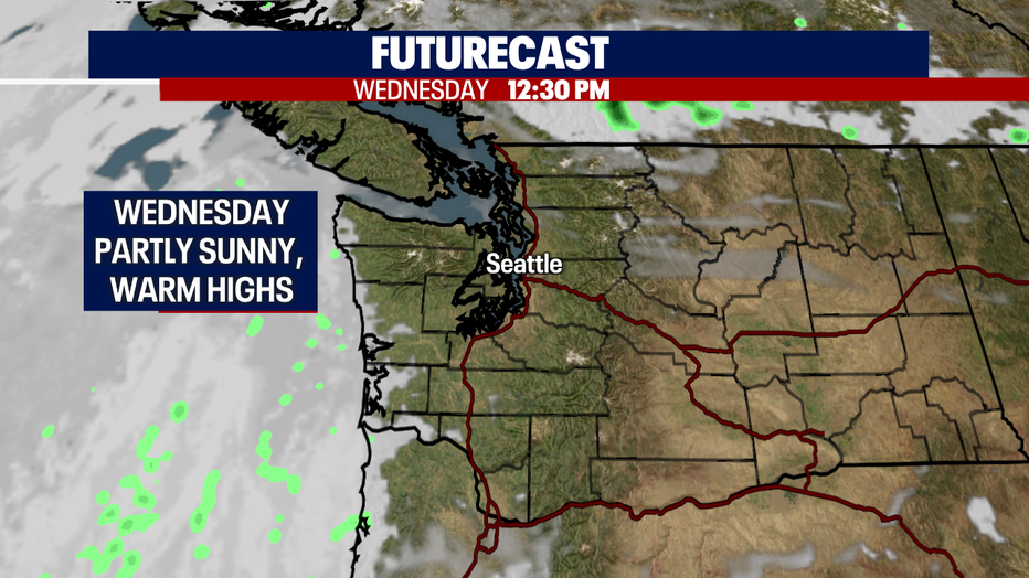
Clouds clear out quickly leaving us with another gorgeous spring day on Wednesday. Highs warm into the low 70s for the metro area with upper 60s north and at the coast.
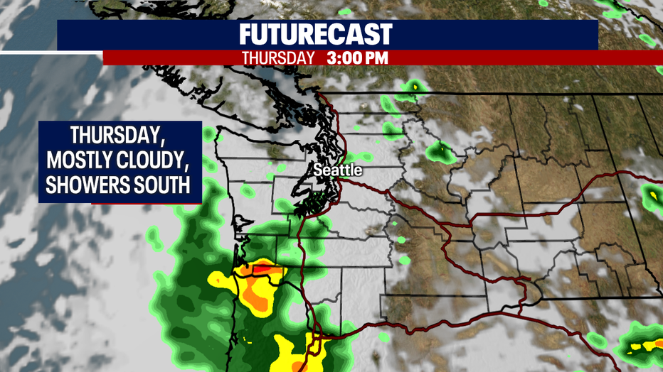
Thursday is mainly dry through much of the day under mostly cloudy skies. By late afternoon/early evening, a few showers find their way into SW Washington. We're keeping a close eye on the potential threat of thunderstorms firing up too.
Highs Thursday cool into the upper 50s with even cooler highs heading into the weekend.
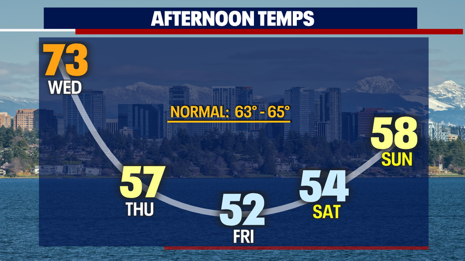
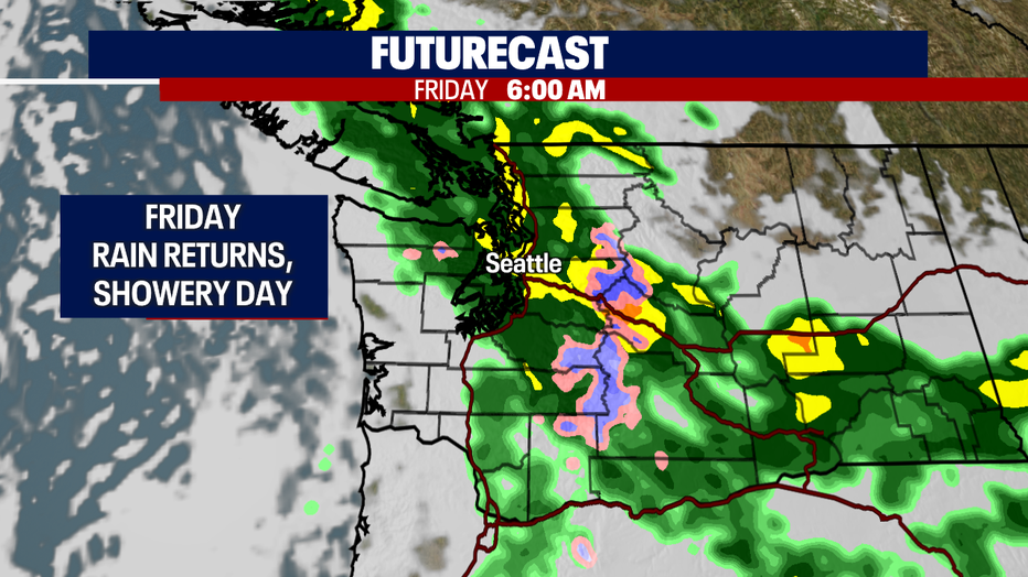
Rain returns overnight Thursday into Friday for a showery day. Highs Friday will feel chilly, only warming into the low 50s.
We expect cooler highs with a chance of showers through the weekend.
Next week starts off with light showers, but we rebound with a drier and warmer pattern moving forward. Enjoy!
Have a great night! ~Erin Mayovsky, FOX 13 Forecaster
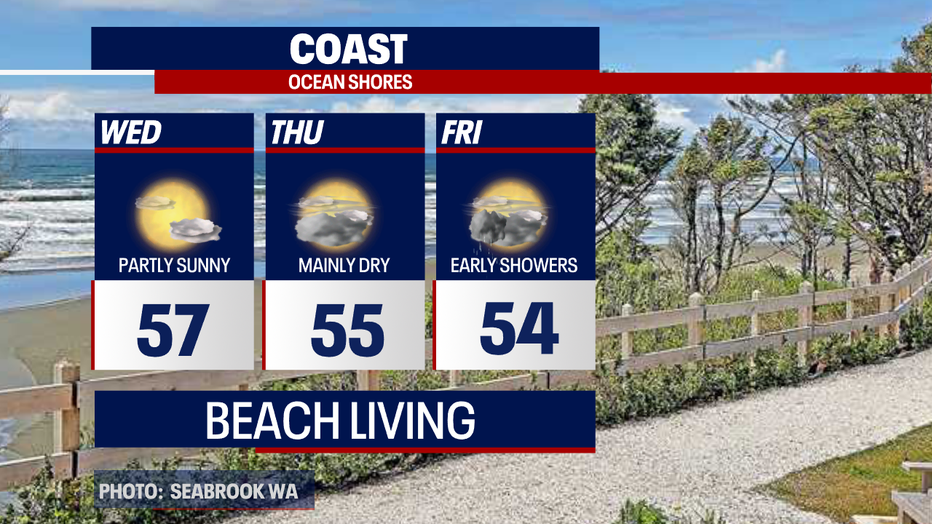
*Coast Forecast
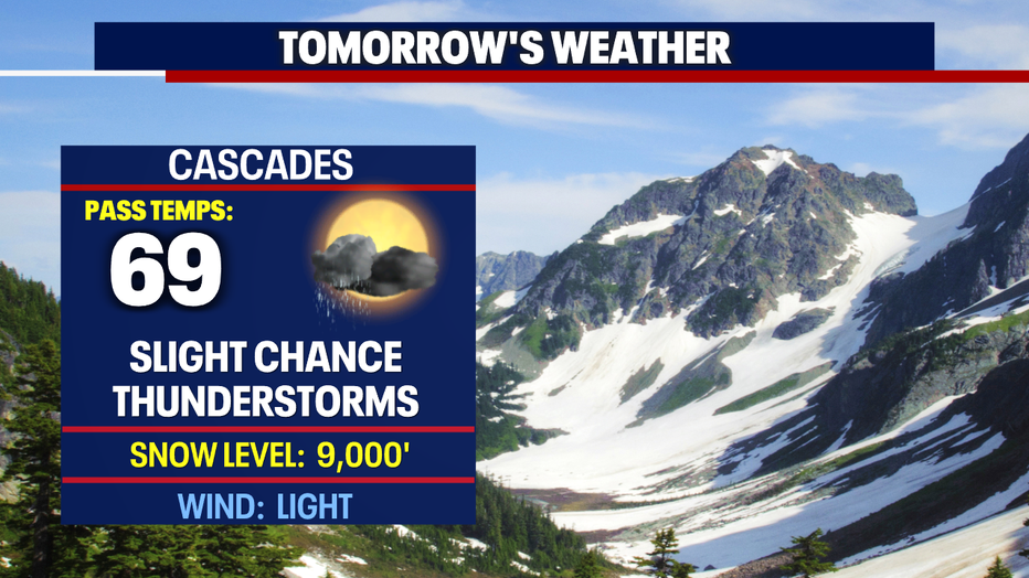
*Mountain Forecast
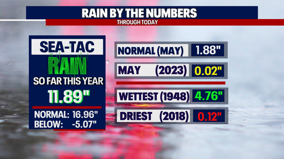
*Rain Almanac SeaTac