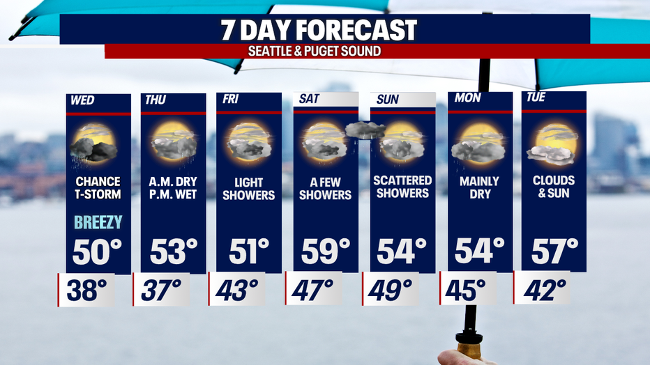
Unsettling weather continues for the PNW
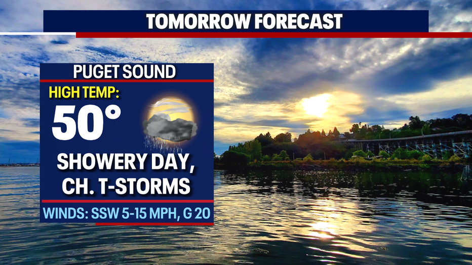
Chance of thunderstorms Wednesday as rain continues on and off into the week
We're staying cool and showery this week with highs only in the low to mid 50s. Saturday highs could warm to near normal.
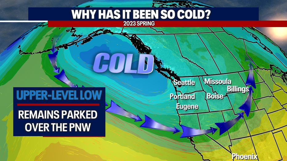
SEATTLE - Are you tired of the cooler and showery spring weather so far this season? We know many of you are and this is why: An upper-level low continues to hang just offshore pushing unsettling conditions in Western WA.
We'll remain in this pattern this week with a chance for warmer and drier weather into the weekend briefly before jumping back into the cooler and showery forecast.
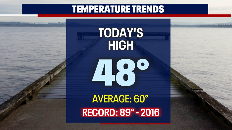
High temperatures Tuesday only warmed into the upper 40s for most around the region.
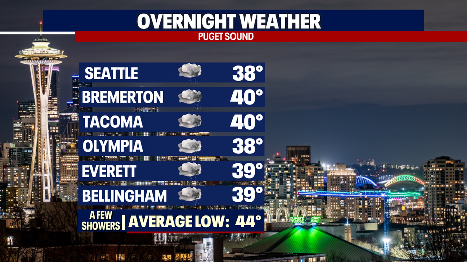
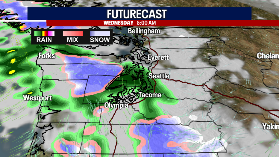
Overnight is mainly dry with a few showers developing for the early morning commuters around Puget Sound. Temperatures bottom out in the upper 30s to low 40s. Brr!
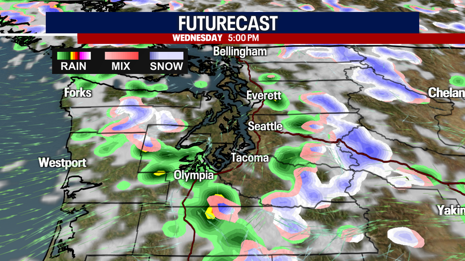
Pockets of showers will hang with us Wednesday throughout the day with a chance of a thunderstorm firing up too.
By the evening commute, skies are clearer and mainly dry. High runs on the chilly side of 50.
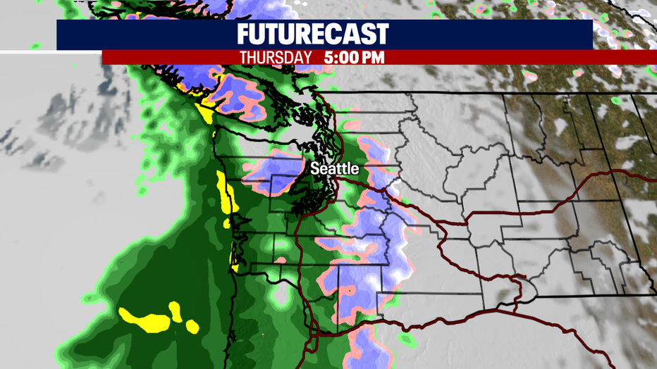
Thursday starts off dry, but rain is looming off the coast and will march inland through the day.
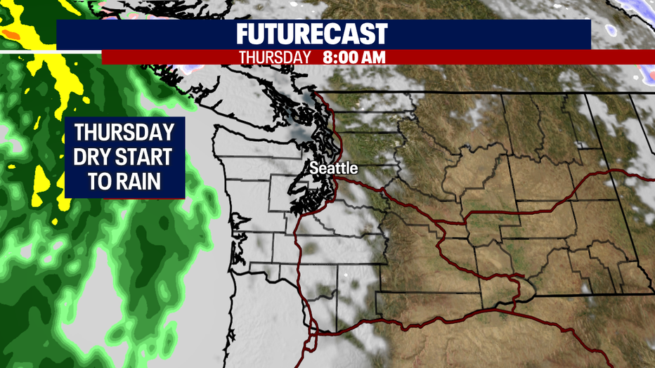
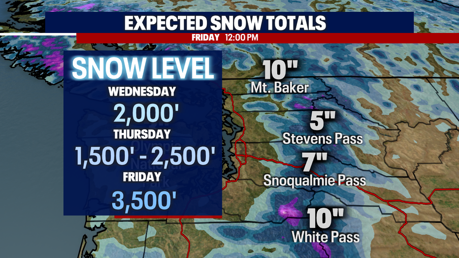
Rain hits the I-5 corridor around 5 p.m. The mountains will also see showers with snow levels between 1,500' - 2,500'. And with lower snow levels pass travelers may experience slick roads traveling through the mountains. Know the roads before you go!
High pressure will try to build into the area by Friday into Saturday for drier and warmer days. Stay tuned!
Have a great week all! ~Erin Mayovsky, FOX 13 Forecaster
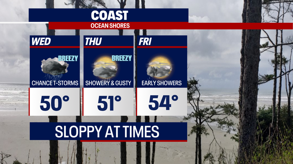
*Coast Forecast
*Mountain Forecast
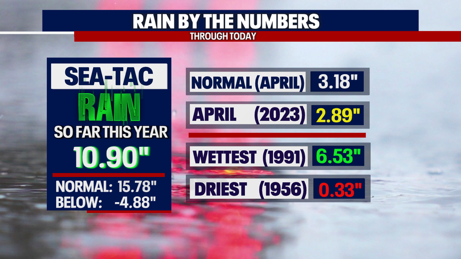
*Rani Almanac Seatac