

Stunning display of turbulent clouds spotted over Seattle at sunset
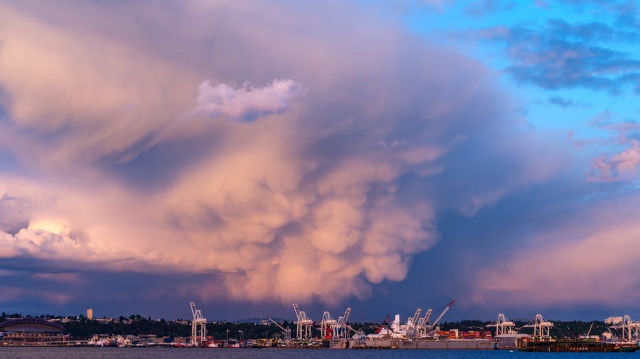
Mammatus clouds over Seattle on May 19, 2021. (Photo: Sigma Sreedharan Photography)
SEATTLE - The skies were a bit turbulent to say the least over Seattle Wednesday evening as a storm cell moved through south of downtown.
But it wasn't just the rain and breezes with this event; the cell brought along a stunning display of rare mammatus clouds.
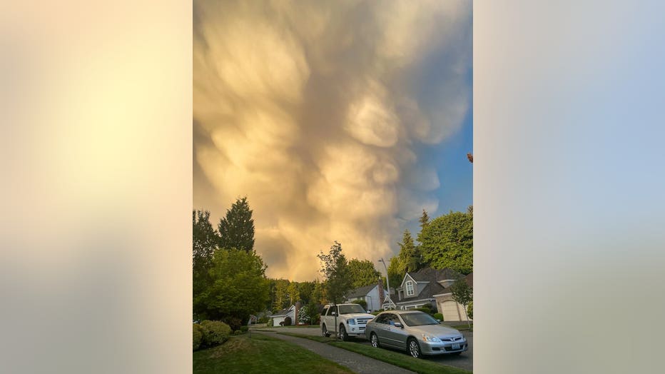
Mammatus clouds over Seattle on May 19, 2021. (Photo: Tim Durkan)
The bumpy clouds are usually spotted near rather intense showers or thunderstorms, and in areas of the world where the weather is more ornery, can be a sign of severe weather.
The clouds are formed when air descends outside the cloud and the cloud droplets evaporate, according to the National Weather Service. The evaporation process requires energy and thus the surrounding air becomes cooler, making the air heavier and descending even faster. Sometimes during the process, the clouds are "dragged down," creating these bumpy appearances, says the NWS.
Mammatus clouds over Seattle on May 19, 2021. (Photo: Chris Fabregas)
Add a dash of color at sunset and you get some dramatic scene!
Q13 WEATHER RESOURCES:
DOWNLOAD: Q13 Weather and News Apps
WATCH: Forecast and Radar
READ: Closures and Delays
CHECK: Latest Weather Alerts and Live Traffic Map
INTERACT: Submit your Weather Photo
FOLLOW: Lisa Villegas, MJ McDermott, Tim Joyce, Erin Mayovsky, Grace Lim and Scott Sistek