

Seattle weather: Strong October storm bringing lowland rain, mountain snow
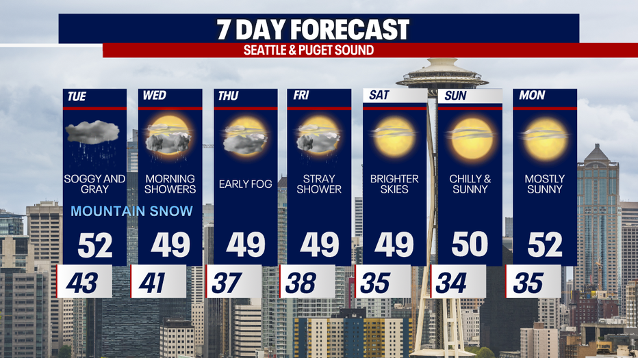
Brighter (and cooler) days ahead!
FOX 13 Meteorologist Abby Acone is tracking a sunny weekend coming up, but don't expect it to be especially warm!
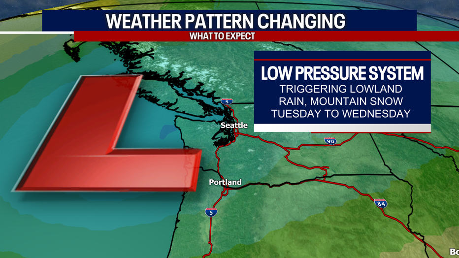
SEATTLE - Buckle up for a super active and wet weather pattern Tuesday to Wednesday morning. An incoming low pressure system will trigger lowland rain, mountain snow and breezy conditions for some.
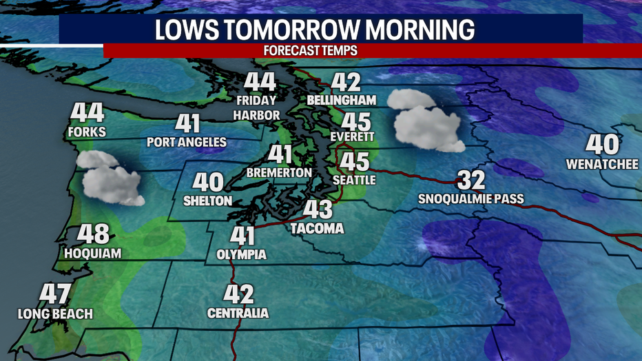
Tonight and overnight, there might be a light shower, but most will be dry. Temperatures early Tuesday plunge to the low to mid 40s for many.
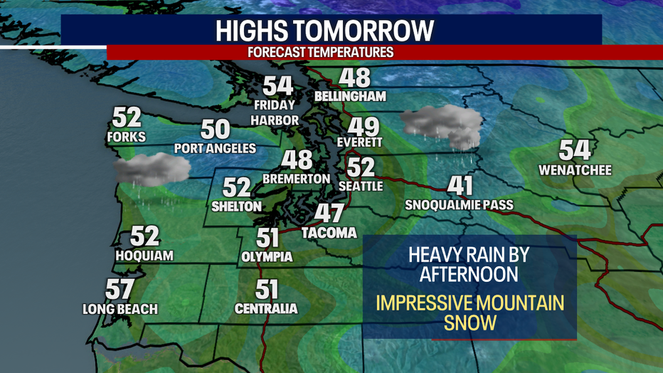
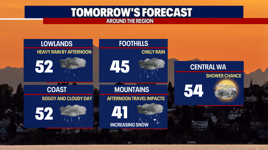
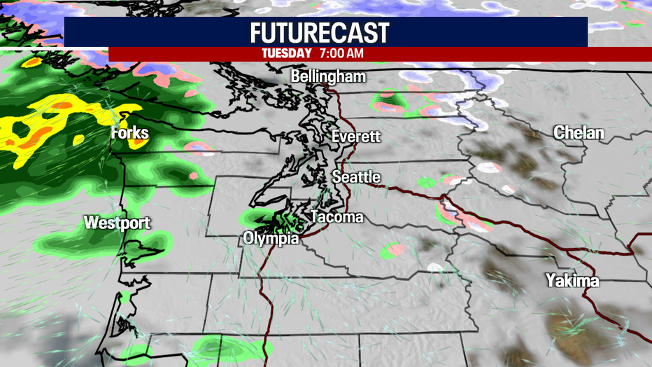
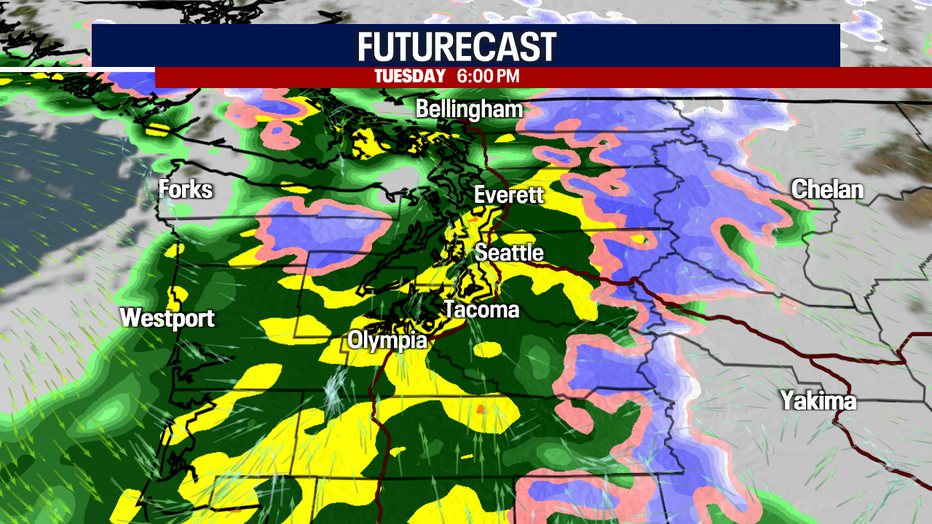
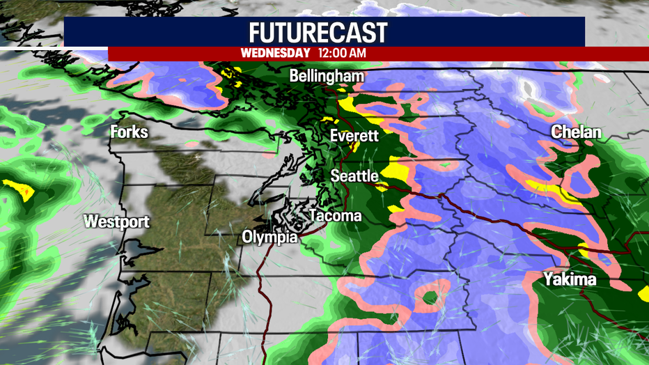
Rain sweeps into the coast and Olympic Peninsula by 7 a.m. Tuesday. Heavy lowland rain and significant mountain snow fire up by Tuesday afternoon. The evening drive will be super difficult in the lower elevations due to ongoing rain, lowered visibility and slick roads. As mountain snow intensifies in the afternoon and evening, roads over the passes could be incredibly treacherous.
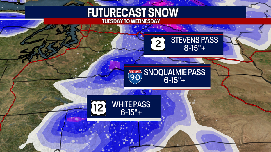
Over Stevens Pass, between eight and 15 inches of snow (or more) could accumulate between Tuesday and Wednesday. Between six and 15 inches (or more) could stack up over Snoqualmie and White Passes.
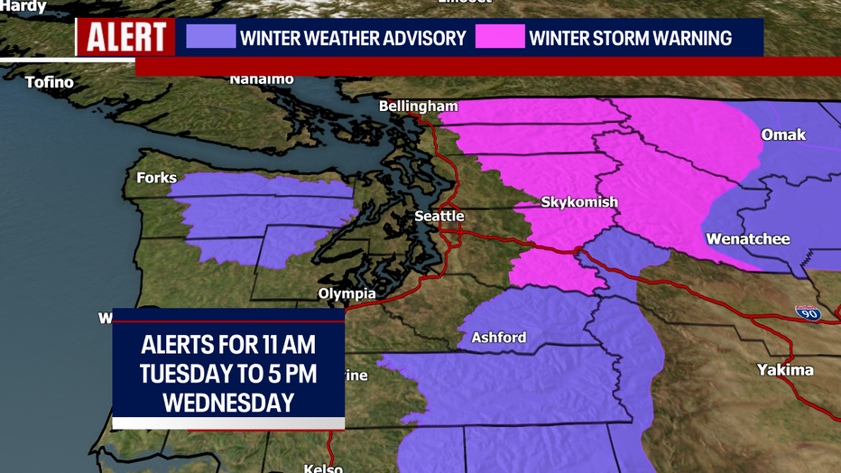
In the pink, there's a Winter Storm Warning. In the purple, a Winter Weather Advisory is in effect. These alerts remain in place across Western Washington from 11 a.m. Tuesday to 5 p.m. Wednesday above 3,000 feet.
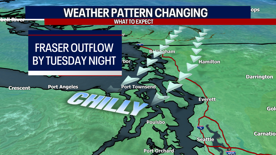
Cooler air is arriving via the Fraser River Valley in the North Sound by Tuesday night. At times, it could be breezy there. An area of low pressure is responsible for the damp and unsettled weather.
Take a look at Futurecast:
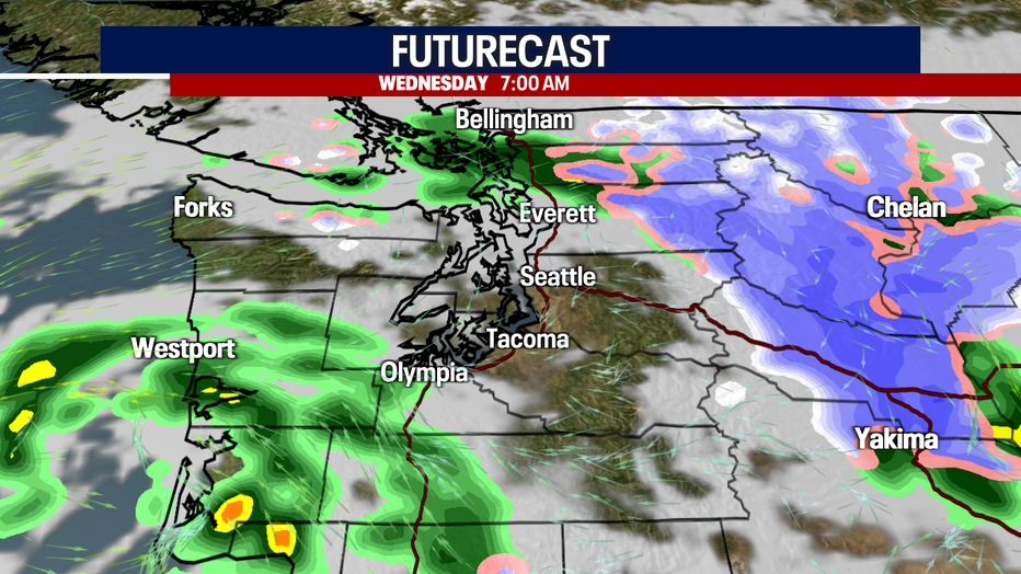
Most will dry out Wednesday afternoon. Thursday could be shower-free, but fog is possible in the morning. A stray shower can't be ruled out on Friday with light snow for some of the passes, but there's some uncertainty about whether the wet weather will actually happen.
Drier weather is forecast for this weekend into Monday. Overnight lows will be brutally chilly in the 30s!
PS: right now, it looks like Halloween night will be dry but cool. Stay tuned for updates!
Warmly,
Meteorologist Abby Acone
Follow me on Facebook (Meteorologist Abby Acone), Instagram @abbyaconewx, TikTok @abbyaconetv