Seattle weather: Snow possible for some Valentine's Day night into Thursday
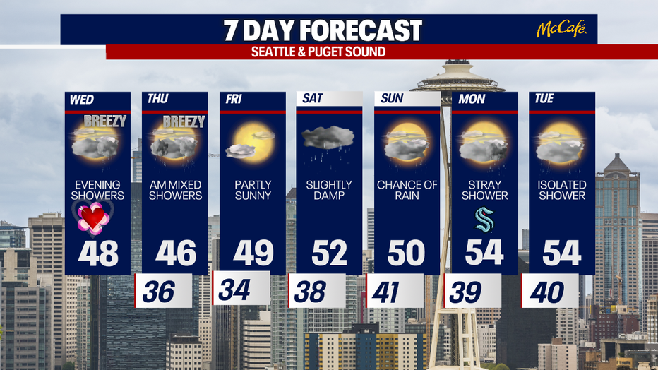
Seattle weather: Evening showers on Valentine's Day
Seattle weather: Evening showers on Valentine's Day
SEATTLE - The next weather system will bring rain and a chance for accumulating snow for some areas of Western Washington Wednesday night into Thursday morning.
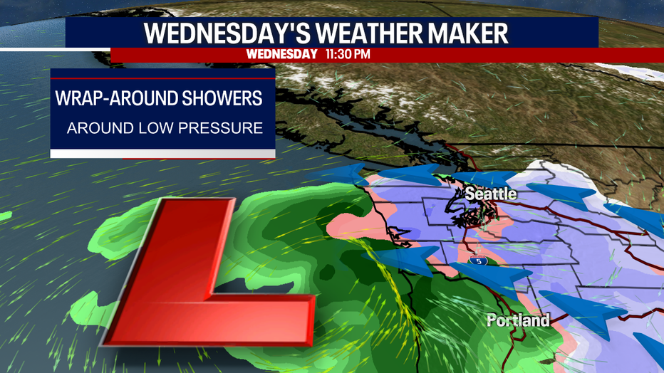
A low pressure system approaching the Washington Coast will spin up precipitation tonight through Thursday morning. That precipitation will interact with chilly easterly winds, bringing a potential for light snow accumulations in the south sound and over the Kitsap Peninsula. There is a smaller chance for snow in the central and north sound, because temperatures look too warm.
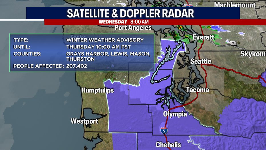
The best chance for snow will be in the purple areas in the map below. This is where the National Weather Service has issued a Winter Weather Advisory.
If you're heading out to celebrate Valentine's Day tonight, expect it to start raining after dinner time. At some point after midnight, that rain could turn to snow over the Kitsap Peninsula, Hood Canal, and other areas of the south sound.

By tomorrow morning, no snow is expected in the north Puget Sound. There is a slight chance for sticking snow in the central sound, though it looks too warm to cause any impacts to the roads.
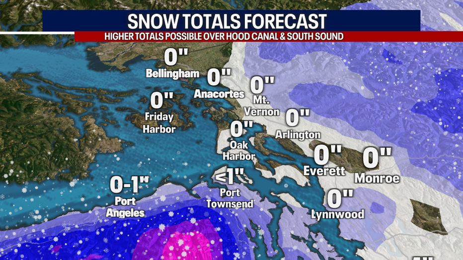
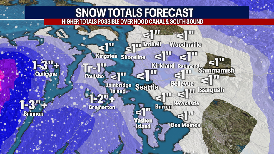
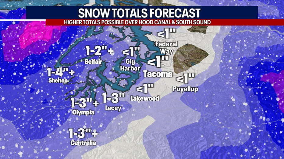
In the south sound, we could see 1 to 3 inches of wet snow in Olympia with more expected near Hood Canal and western Kitsap County. Areas of Mason and Grays Harbor County could also see 1 to 4 inches. These areas will be seeing more snow because of a potential for cooler air and heavier precipitation.
Whatever does fall in the lowlands will not last long. Snow showers will transition to rain Thursday morning and temperatures should warm into the 40s for everyone by Thursday afternoon. The switchover will happen quickly.
After Thursday, the forecast looks showery at times with temps back into the 50s by Saturday.
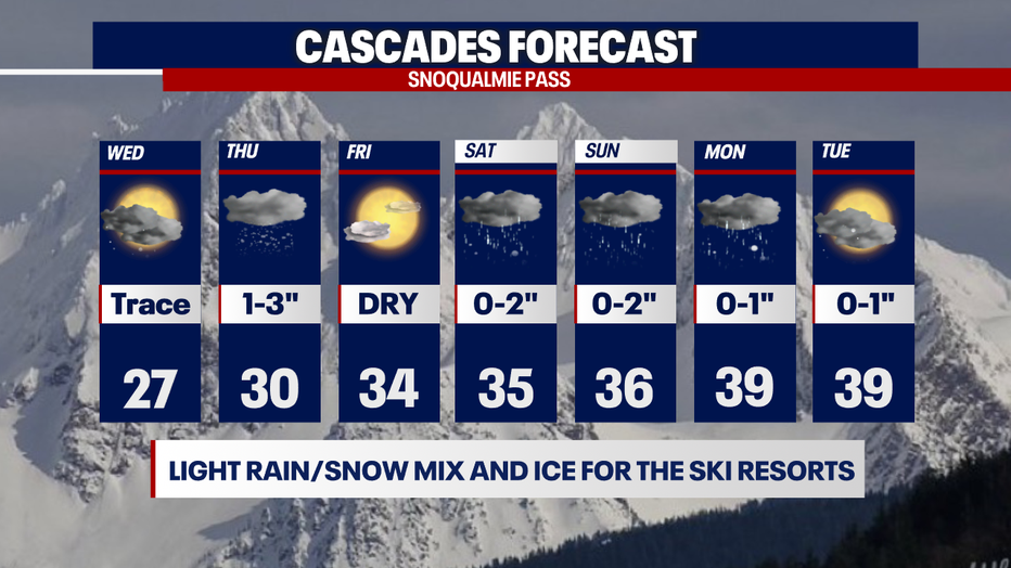
In the mountains, the southern Washington Cascades will see the most snow, with 4 to 10 inches possible. Snoqualmie and Stevens passes will be looking at just a few inches. As the precipitation moves north, the cold dry air will zap out the moisture.
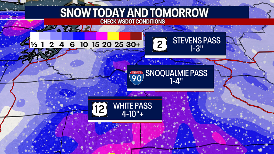
It doesn't look like a great week for the Cascades, but we will be seeing a light rain/snow mix for the ski resorts this week.