Showers and sunbreaks Thursday
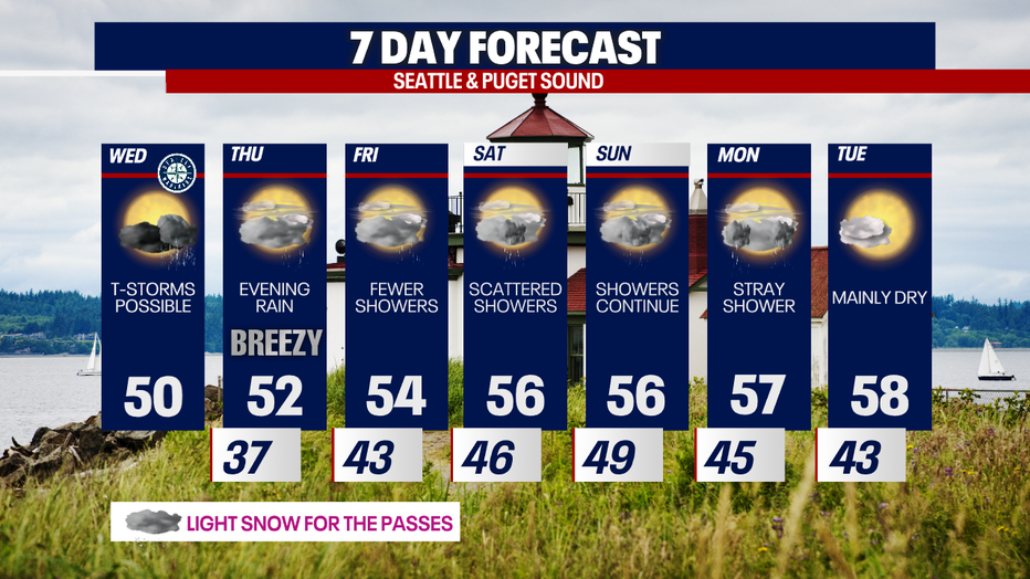
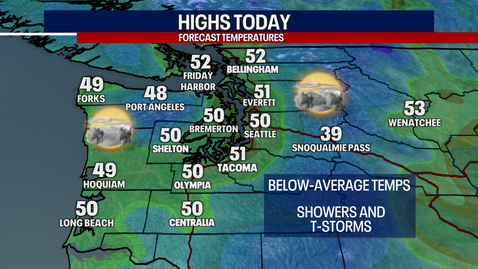
Seattle - Cold air and showers will linger over the Pacific Northwest Wednesday as another round of isolated thunderstorms, clouds, and sunshine return.
High temperatures will only be a couple of degrees warmer than Tuesday, making it into the low 50s for most spots Wednesday afternoon. Highs today will be about ten degrees below the daily average.
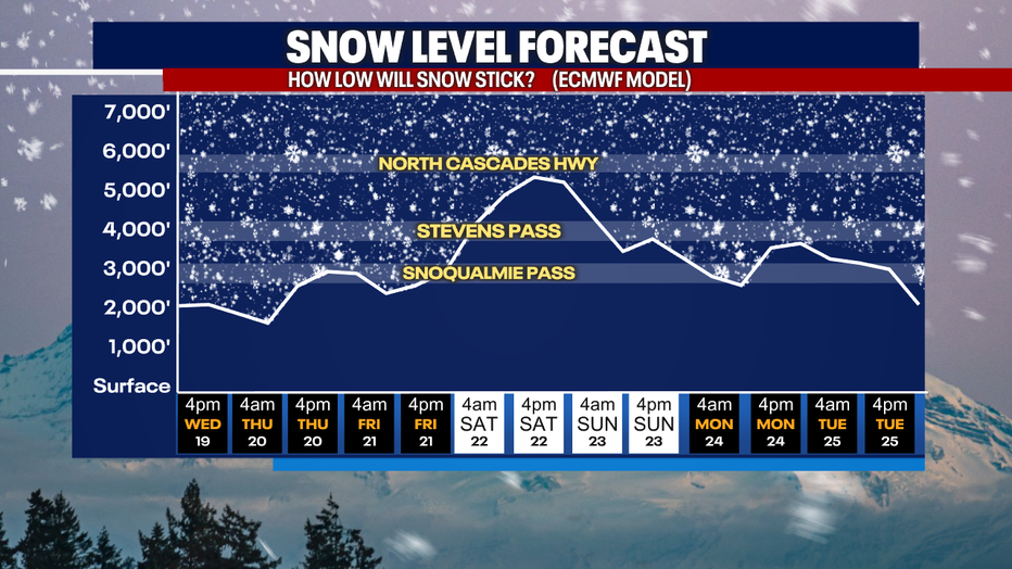
Snow levels will remain below pass levels the next few days, which means you need to be prepared for winter driving conditions through the end of the work week.
The next round of widespread rain will hit the Puget Sound area Thursday afternoon and evening and will continue as showers into Friday.
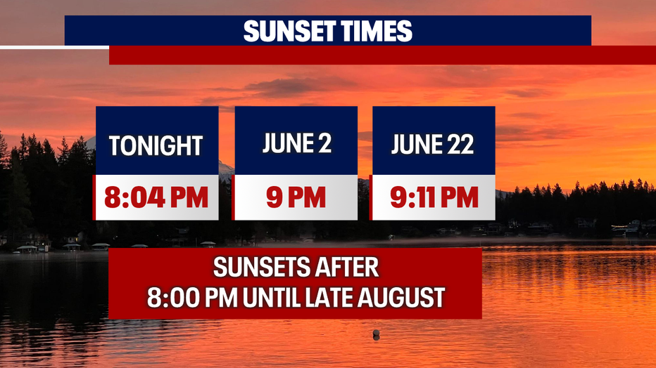
The good news is that sunsets are after 8:00 PM and we are continuing to gain daylight. We won't see another 7:00 hour sunset until late August.
This weekend will feature passing scattered showers with temps warming to the mid 50s. There's a chance for a nice warmup late next week, but that's still a ways out to be confident.