

Seattle weather: Temperatures rising with a lightning threat in Eastern Washington
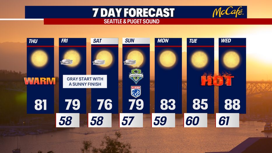
Temperatures will start to increase this weekend
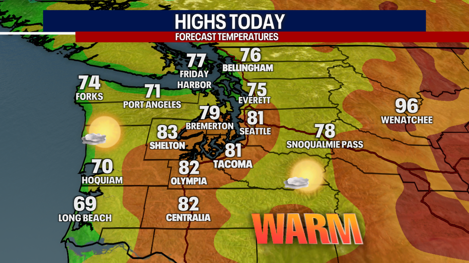
Thursday starts out partly cloudy with clearing throughout the day. Highs will warm into the upper 70s for the metro area with slightly cooler temps to the north and warmer to the south. The foothills warm into the mid-80s.
SEATTLE - Puget Sound is warming up by a solid 5-10 degrees today. While Western Washington stays mainly dry and sunny, Eastern Washington is facing an ongoing threat for wildfires.
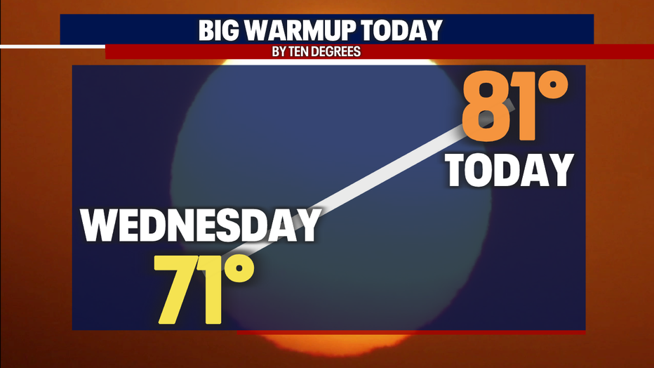
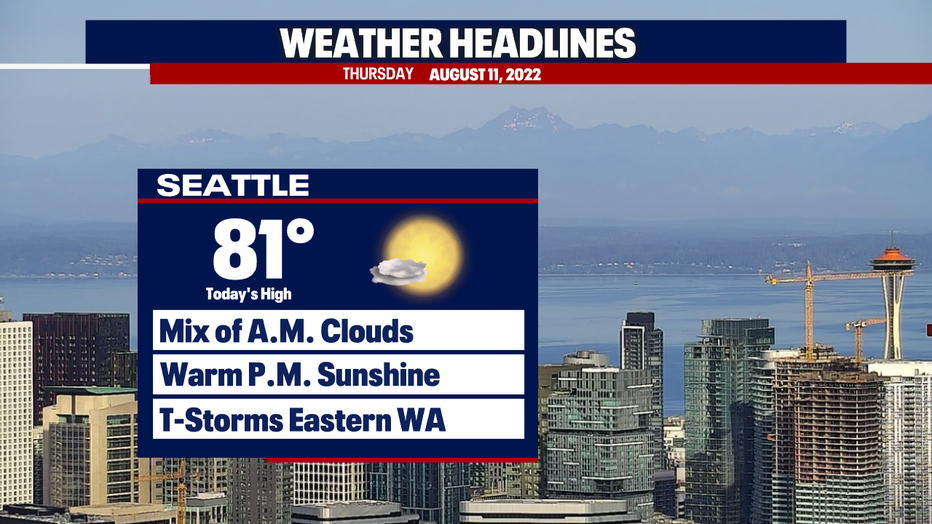
Highs today in Seattle will warm to about 81 degrees. We've got a mix of clouds this morning, but sparkling sunshine is on tap for later this afternoon.
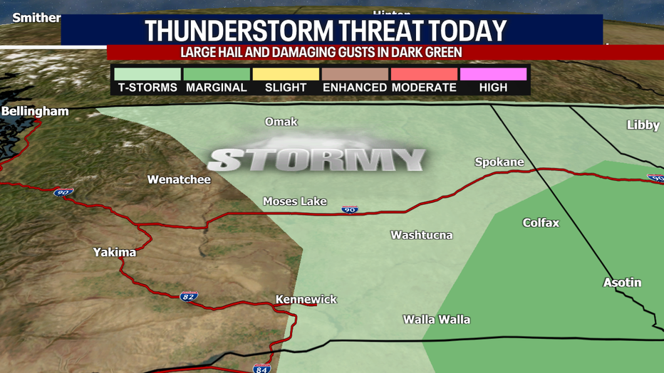
Early this morning, rounds of lightning moved through parts of Eastern Washington and the Cascade Crest. The threat for wildfires is real today on the east side of our state; lightning can obviously ignite new fires, and the gusty outflow winds can make those fires grow rapidly for several hours after the storm has passed.
Because of this risk, the National Weather Service has issued a Red Flag Warning for everyone in red on the map below. This alert continues until noon today.
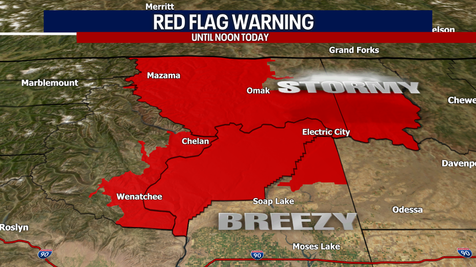
The North Cascades could experience a few rumbles of thunder - we'll watch that closely. Everyone in light green has a chance for lightning and small hail. In the dark green, there's a level one of five for "severe" storms (defined by having large hail and damaging gusts).
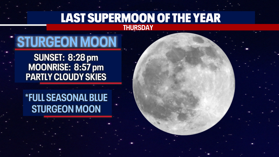
If you want to check out the last supermoon of the year, you can plan on partly cloudy skies tonight with the moon rising at 8:57 p.m.
Friday will start cloudy with afternoon sunshine. Saturday looks mild. Mostly cloudy skies will make the mid 70s feel cooler. Tons of sunshine is on the way for Sunday - fabulous weather for the Sounders and OL Regin matches at Lumen Field.
Starting next week, Mother Nature cranks up the heat! Highs will get awfully close to the 90s on Wednesday in Seattle. Stay tuned for updates on the forecast!
Hope you have a wonderful day,
Meteorologist Abby Acone
Follow me on Twitter @abbyacone, Instagram @abbyaconewx, TikTok @abbyaconetv and Facebook (Meteorologist Abby Acone)