

Seattle weather: Smoke to move out of Western Washington
Seattle weather: Warm weather continues before temperatures return to normal
FOX 13 Meteorologist Brian MacMillan has your forecast.
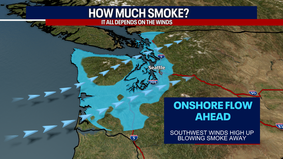
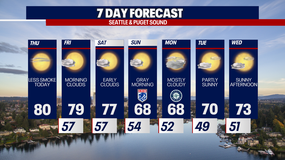
SEATTLE - Any smoke today will stay elevated high above the surface; this means that any leftover haze probably won't likely impact air quality at the ground.
This smoke is coming from fires burning in Canada. Northerly winds dragged this haze into our skies yesterday. Today (and going forward in the short-term), a return to "onshore flow" will push lingering smoke out of Western Washington, ushering in cleaner ocean air.
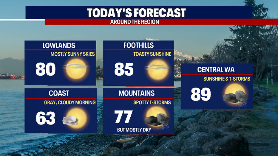
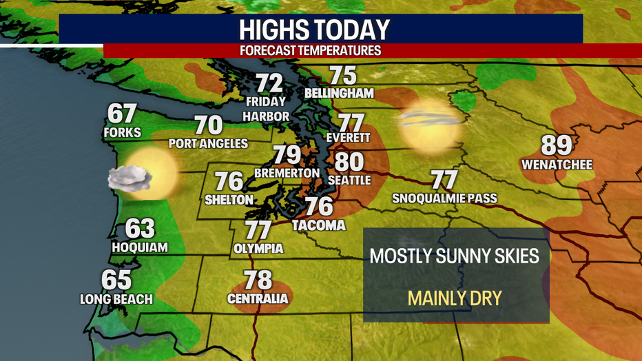
Otherwise, you can expect mostly sunny skies today with highs in the upper 70s and low 80s for the Puget Sound lowlands. It'll be much cooler along the coast. That's because the westerly winds are delivering cooler air to the beaches.


Preparing for a hazy season as wildfire smoke trickles into Puget Sound
Smoke from nearly 100 wildfires burning in Canada has made its way into our area, and while the air quality isn't bad just yet, experts warn this is an early start to the hazy season.
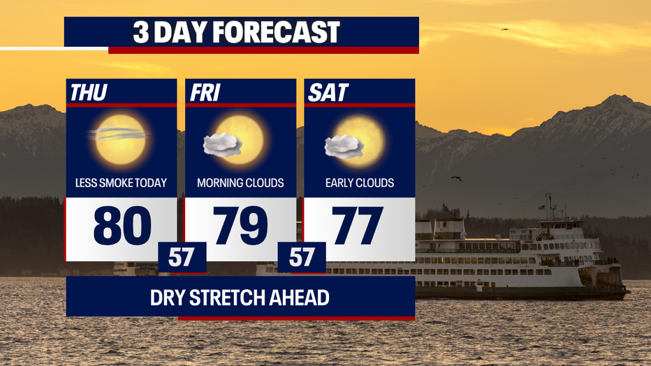
Morning clouds and afternoon sunshine are on tap Friday, Saturday and Sunday. By Sunday, highs drop to the upper 60s. Believe it or not, the upper 60s are considered normal for this time of year.
Monday looks mostly cloudy. Partly sunny skies are on the way for Tuesday and Wednesday as temps rebound to the low to mid 70s.
Hope you have a wonderful day. Thanks so much for choosing FOX 13 and Good Day Seattle!
Warmly,
Meteorologist Abby Acone
Follow me on Twitter @abbyacone, Instagram @abbyaconewx, TikTok @abbyaconetv and Facebook (Meteorologist Abby Acone)