

Seattle weather: Showers, wildfire haze return to Western Washington
Seattle weather: Showers, wildfire haze return to Western Washington
Our forecast this weekend is a little weird: we're tracking isolated showers, high-level wildfire haze and warm temperatures.
Our forecast this weekend is a little weird: we're tracking isolated showers, high-level wildfire haze and warm temperatures.
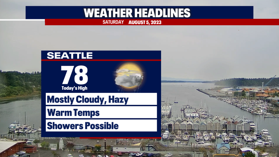
Thankfully, the smoke from fires burning in British Columbia and Eastern Washington is staying high up in the atmosphere. Because the smoke won't mix to the surface, we're not expecting a hit to air quality. We'll let you know if this forecast changes! It may be difficult to discern between the clouds vs smoke today and tomorrow. Mostly, you'll just notice the skies will be grayer this weekend compared to recent weeks. It's possible that the clouds and haze will lead to temperatures being cooler than we currently expect. Stay tuned!
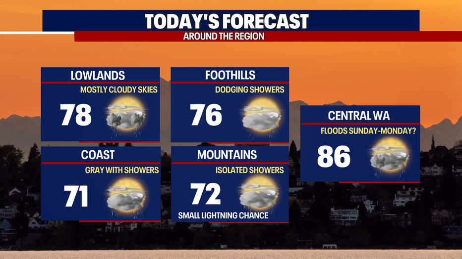
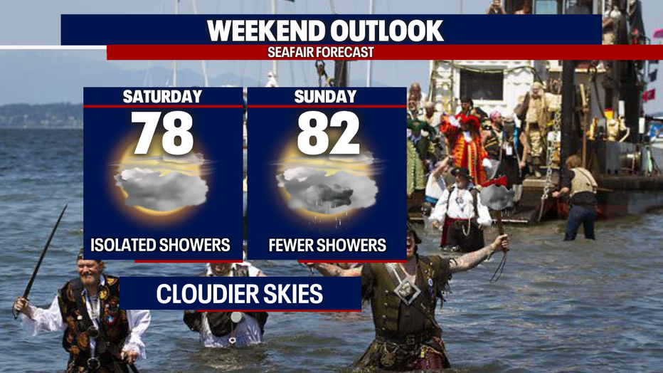
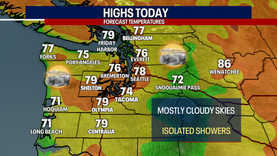
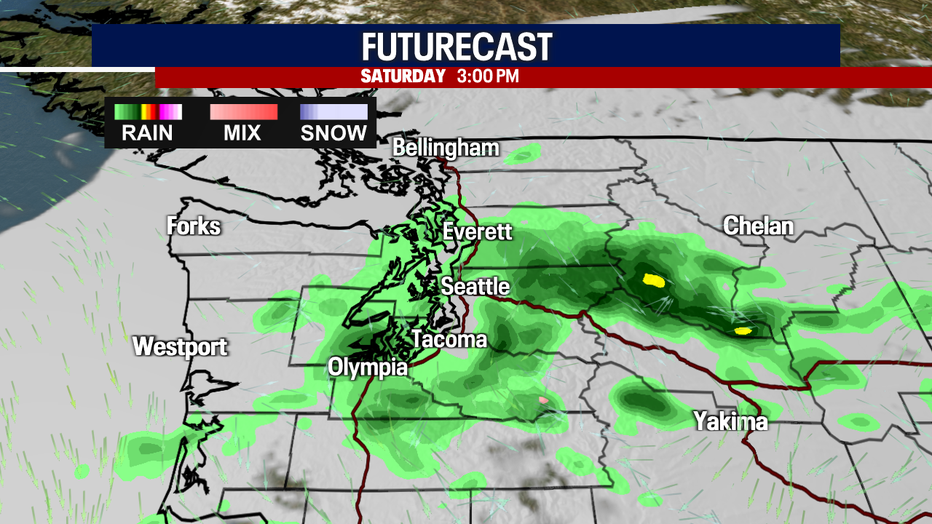
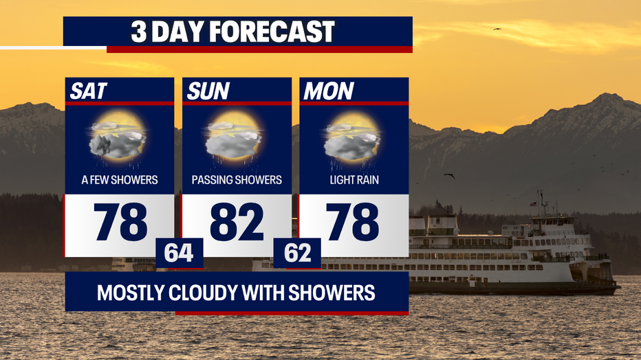
Isolated showers are on the way today, primarily for the Cascades, the Olympic Peninsula and communities in Snohomish County through the Oregon state line. Showers won't be widespread or constant, but where they happen – it'll be a nuisance and inconvenience (especially when it comes to important events like Seafair!).
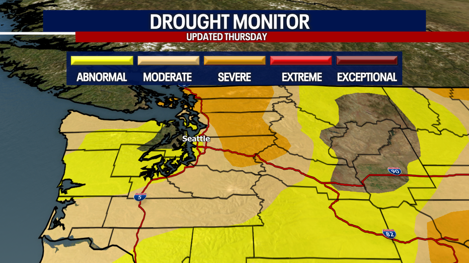
Our landscape certainly needs the moisture, particularly in the North Sound which is currently dealing with "severe drought" conditions as seen in the map below.
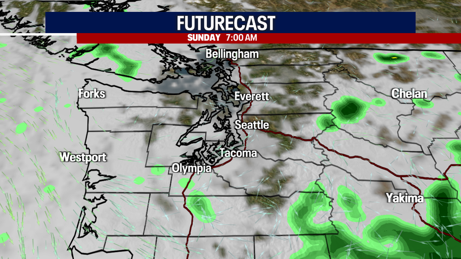
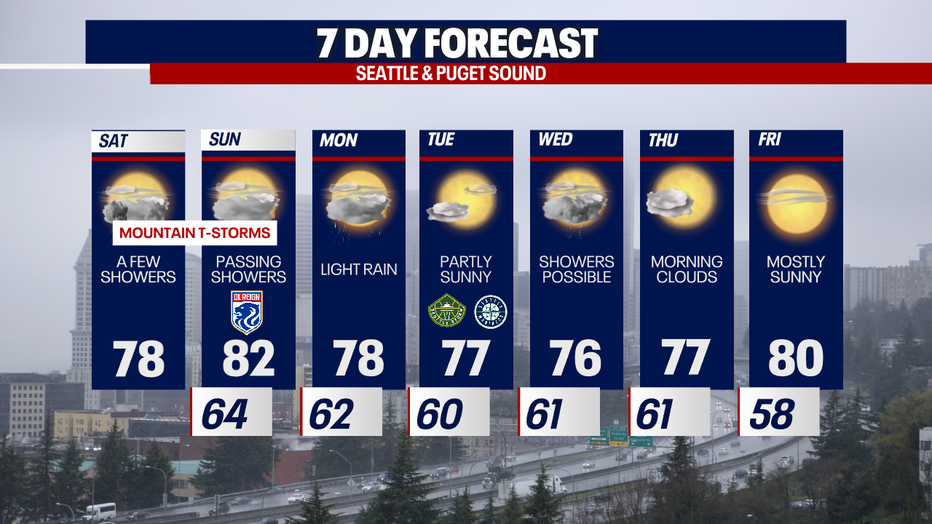
Sunday will offer far fewer showers. Both today and tomorrow, there's a small chance for lightning mixed with rain. The best chance for this will be over the mountains, but we can't rule out a rogue lightning strike or two in the lowlands.
Take a look at Futurecast:


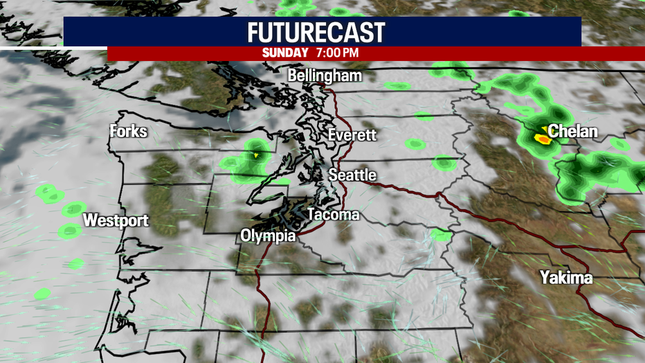
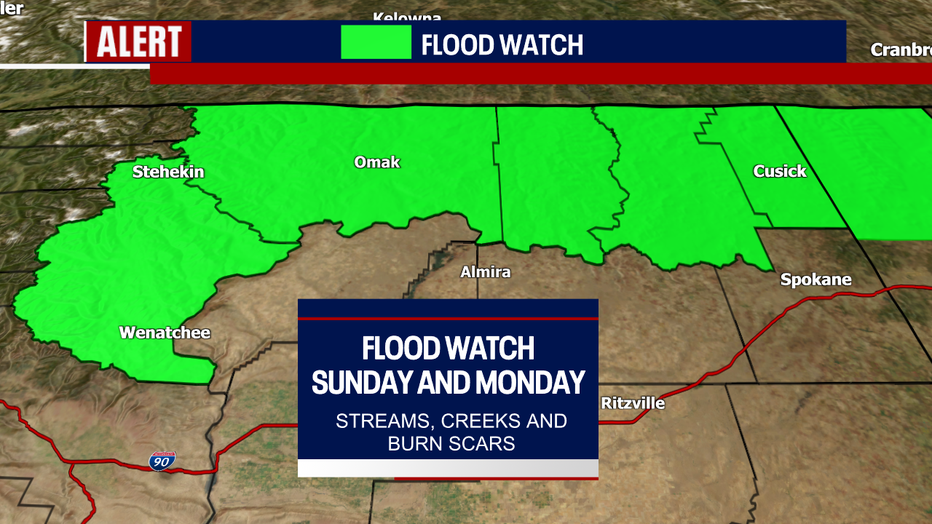
The rain could be too much of a good thing for parts of Central and Eastern Washington. Check out the Flood Watch in effect Sunday and Monday for the highlighted areas in green. There could be flash flooding under heavy downpours over streams, creeks and burn scars (including the recent Eagle Bluff Fire burn scar).
A few pockets of showers linger into Monday, but it won't be a washout. Highs will dip to the upper 70s.
Tuesday will be beautiful with partly sunny skies and a high of 77. It's possible that showers could make a comeback for the middle part of the week, but the chance for rain is rather unimpressive.
Morning clouds will lead to afternoon sunshine Thursday. Friday will be sunnier as highs warm to about 80 degrees.
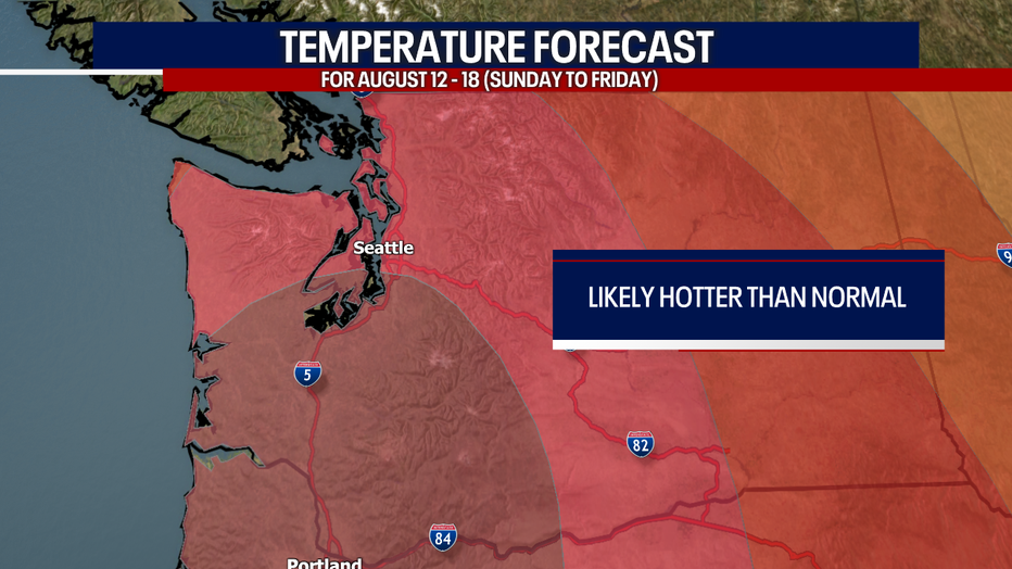
Next weekend and the following workweek (of August 13 and beyond) could be super hot. Highs could reach at least the low 90s for the Seattle region. Some backyards could experience temperatures nearing 100 degrees. Right now, it doesn't look like this heat wave will be as extreme as the one we had in June 2021. Remember: the extended part of the forecast has plenty of time to change. Stick with us for the latest!
PS: Wildfire haze should push out of our region Monday through the workweek thanks to a return to a westerly flow.
Warmly,
Meteorologist Abby Acone
Follow me on Twitter @abbyacone, Instagram @abbyaconewx, TikTok @abbyaconetv and Facebook (Meteorologist Abby Acone)