This browser does not support the Video element.
Hotter temperatures over the next few days
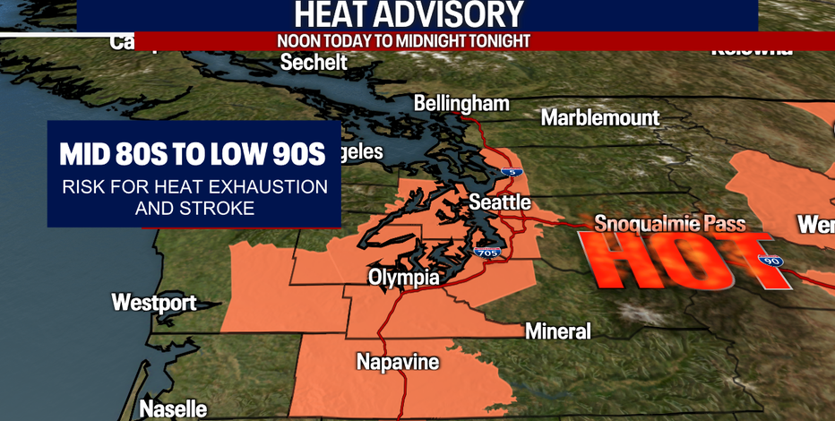
A Heat Advisory will go into effect Tuesday as the heat kicks up. This will remain in effect through Thursday with temperatures ranging in the mid-80s to low 90s across the Sound.
SEATTLE - September may be knocking on our door, but the summer heat is not done here in Western Washington.
Highs today will skyrocket to the upper 80s and low 90s. The National Weather Service posted a Heat Advisory that runs from noon today to midnight tonight.
Make sure to drink plenty of water and find ways to stay cool today! Remember to always wear a life jacket if you're doing any activities on the water. Fire danger is also elevated.
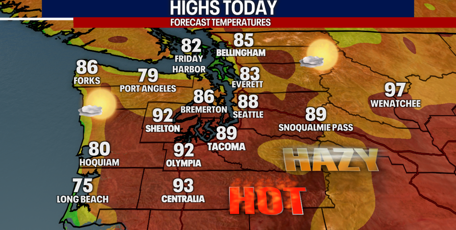
On top of the heat, there might be a slight haziness in our skies at times this week due to wildfires burning in parts of Oregon and California. However, we're not expecting air quality to drop here at the surface – that's great news!
Tomorrow will stay hot! The coast and South Sound may start the day with some clouds, but Central and North Puget Sound will probably be sunny from beginning to end. Some showers and thunderstorms could pop up in the afternoon and evening, primarily over the Cascades. Unfortunately, any lightning this time of year could spark new wildfires. We'll watch for that closely.
Here's a look at the communities with the best chance for thunderstorms tomorrow:
The weather this Labor Day weekend looks absolutely beautiful. Enjoy the summer warmth while we have it!
Sincerely,
Meteorologist Abby Acone
Follow me on Twitter @abbyacone, Instagram @abbyaconewx, TikTok @abbyaconetv, and Facebook (Meteorologist Abby Acone)