

Seattle weather: Lowland rain, mountain snow returning
Seattle weather: Lowland rain, mountain snow returning
Seattle weather: Lowland rain, mountain snow returning
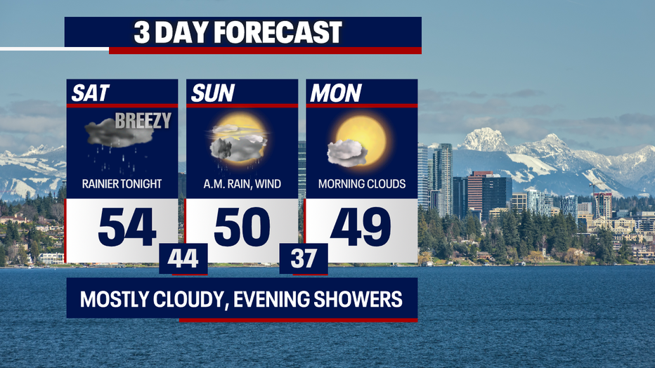
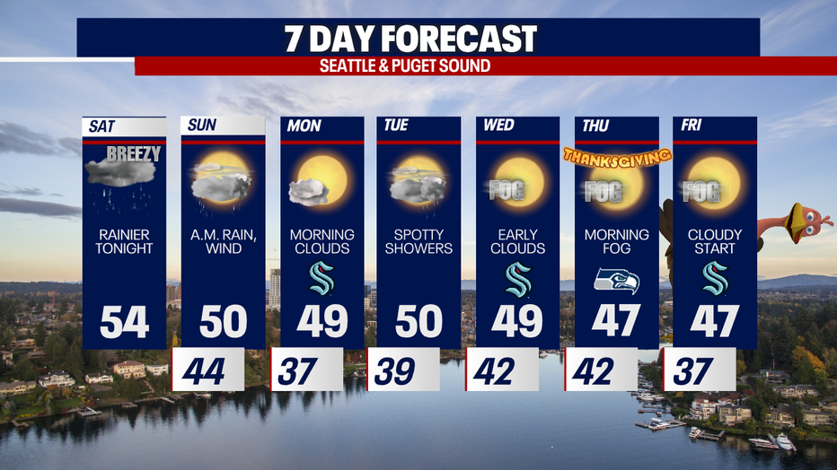
Lowland rain, mountain snow and breezy weather surge back into Western Washington tonight through Sunday.

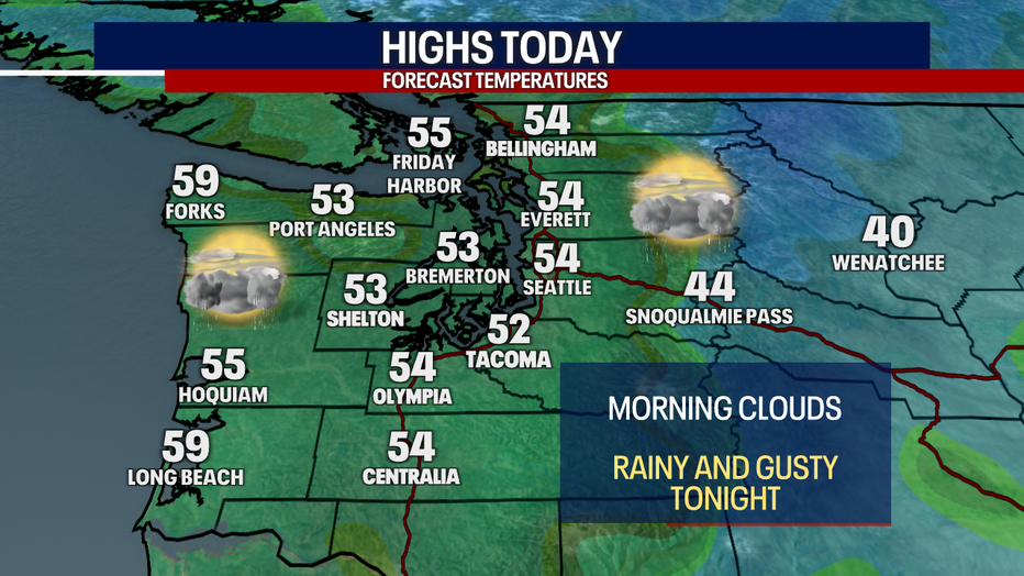
Earlier this morning, we woke up to pockets of frost and freezing fog. Highs will make it into the low to mid 50s for most backyards. We'll enjoy sunshine for the middle part of the day, but clouds thicken this afternoon and tonight.
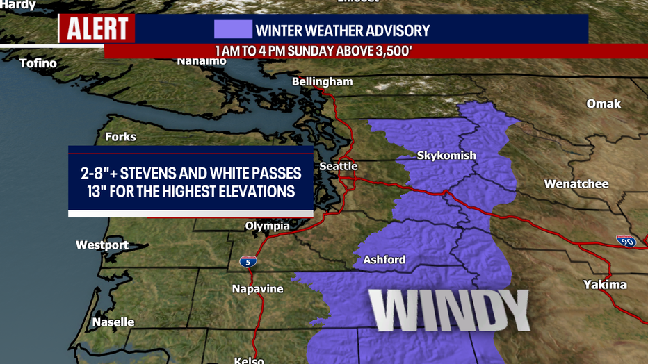
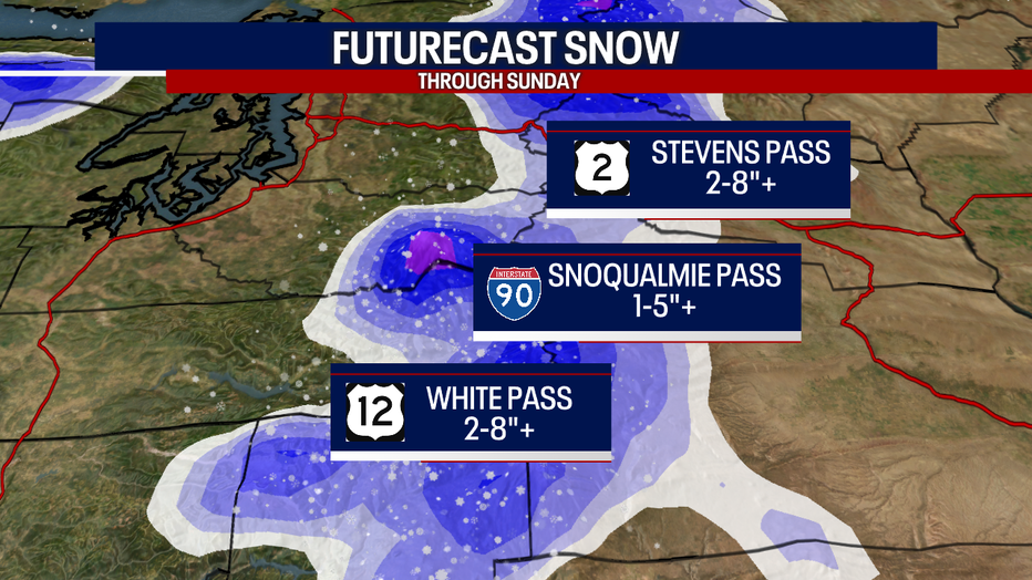
As a cold front sweeps through the region late tonight, rain spreads across the lowlands. Behind the cold front into early Sunday morning, snow starts piling up over the mountains.
A Winter Weather Advisory remains in effect from 1 a.m. to 4 p.m. Sunday. Between two and eight inches of snow are possible for Stevens and White Passes. Should heavier bands of snow develop, there could be even higher amounts! It'll take longer for the air to cool at Snoqualmie Pass, and as a result - forecast snow totals are less there, perhaps amounting to one to five inches (like at the other passes, higher totals can't be ruled out should more intense pockets of snow fire up). Gusts could reach 40 mph over the passes, creating lowered visibility and more dangerous conditions for drivers.
Monday will be quiet with morning clouds/fog.
Wednesday will start cloudy with isolated fog, but breathtaking sunshine will reappear in the afternoon. Thanksgiving and Black Friday will feature the same weather pattern! Gray skies will clear for beautiful afternoon sunshine. Not bad for late November in our neck of the woods :)
Take good care! Thanks so much for choosing FOX 13 - we appreciate you so much.
Warmly,
Meteorologist Abby Acone
Follow me on Twitter @abbyacone, Instagram @abbyaconewx, TikTok @abbyaconetv and Facebook (Meteorologist Abby Acone)