

Seattle weather: Heavy rain, gusty winds and cool temperatures continue Monday
Seattle weather: Heavy rain, gusty winds and cool temperatures continue Monday
Wet, breezy, and cold conditions will be felt across western Washington Sunday night into Monday.
It was a wet and gray day in the Pacific Northwest with plenty of showers into the evening.
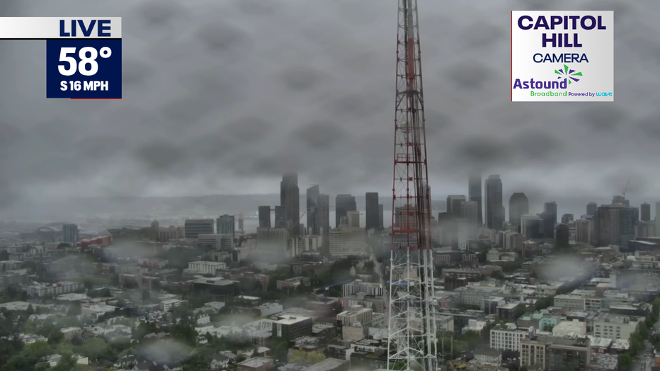
Capitol Hill Camera
Rainfall totals as of 10:45pm Sunday reached almost record values for SEA, and over an inch of rain was reporting along the coast.

Rain Since Midnight Western Washington
This is a particularly wet June system as we have a late-season atmospheric river set up pointed right at the Pacific Northwest.
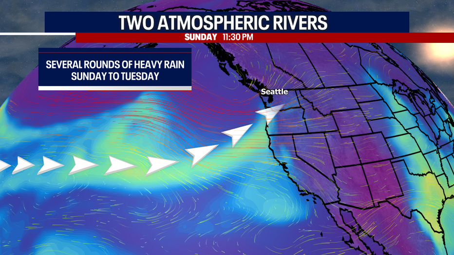
Atmospheric River GRAPH
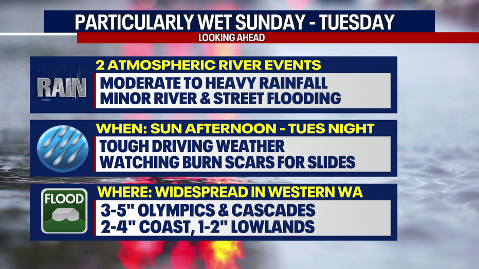
The heaviest rain is expected from Sunday night into Monday morning and then again from Monday night into Tuesday morning. Watch for standing water on the roads and possible localized flooding.
WET WEATHER AHEAD
The atmospheric river will bring excessive rainfall, so there is a Flood Watch in effect now until early Wednesday morning. Minor flood stages are possible for some of our flood-prone rivers.
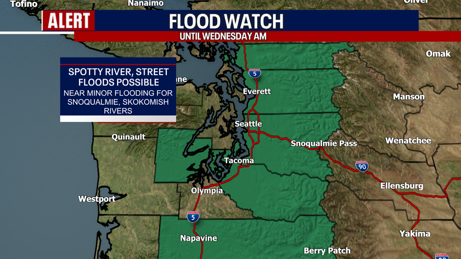
Flood Watch
Rain will continue overnight along with breezy winds and mild temperatures in the upper 40s to low 50s.
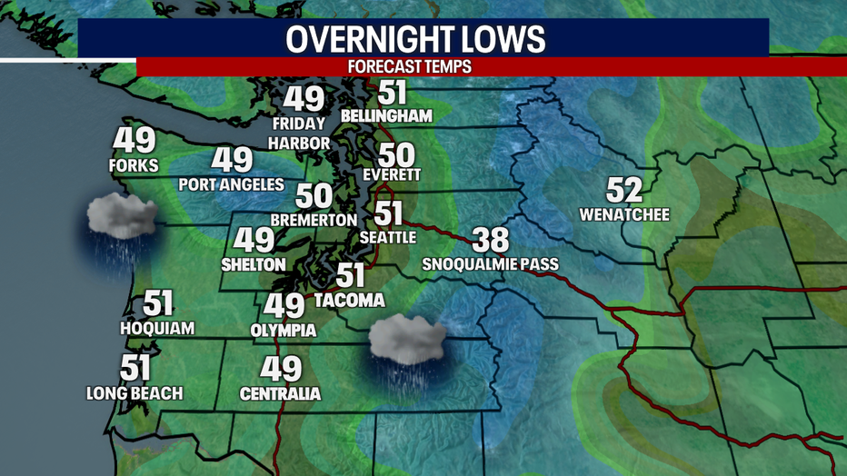
Regional Overnight Lows
Showers will be around at the beginning of the morning, moderate to heavy at times.
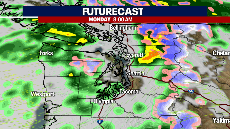
FUTURECAST NEXT 48 HOURS (FOX 13 Seattle)
Temperatures will again be below seasonal average, only reaching the upper 50s to low 60s.
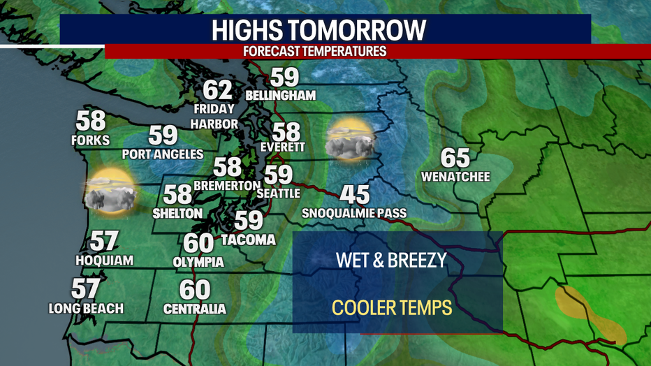
Highs Tomorrow (FOX 13 Seattle)
A break in the atmospheric moisture waves will allow for some dry time in the afternoon, even a sunbreak is possible.
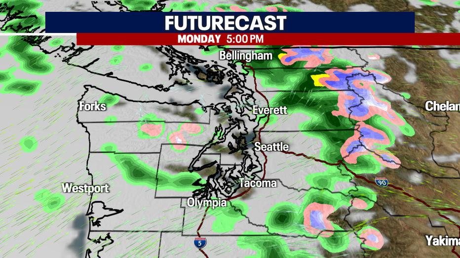
FUTURECAST 5 pm
Heavier showers will push in again with our 2nd wave of moisture late Monday into early Tuesday. It will be wet, but not as strong as the first push on Monday.
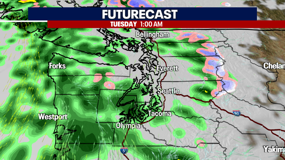
FUTURECAST Overnight
Showers will taper late Tuesday with drier skies from Wednesday into the weekend. High pressure will build and block any new rain showers and will warmer our temperatures well above average.
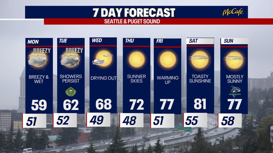
7 DAY Forecast