Seattle weather: Heavy rain, gusty winds and mountain snow Wednesday
Increasing rain, heavy mountain snow and gusty winds
FOX 13 meteorologist Claire Anderson has the latest forecast.
SEATTLE - Impressive snowfall totals this morning for the North Sound. The convergence zone overnight dropped quite a bit of snow for some!

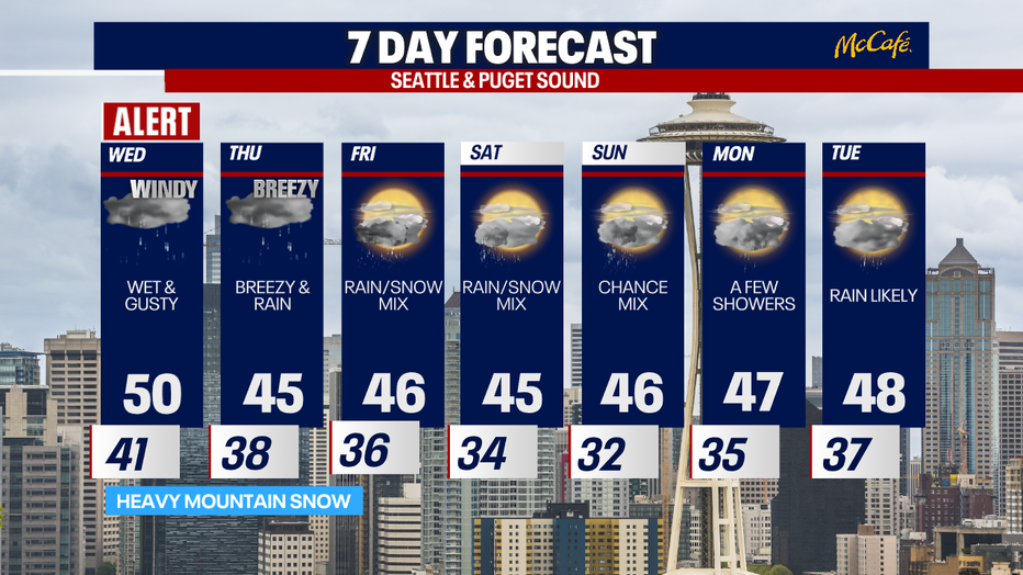
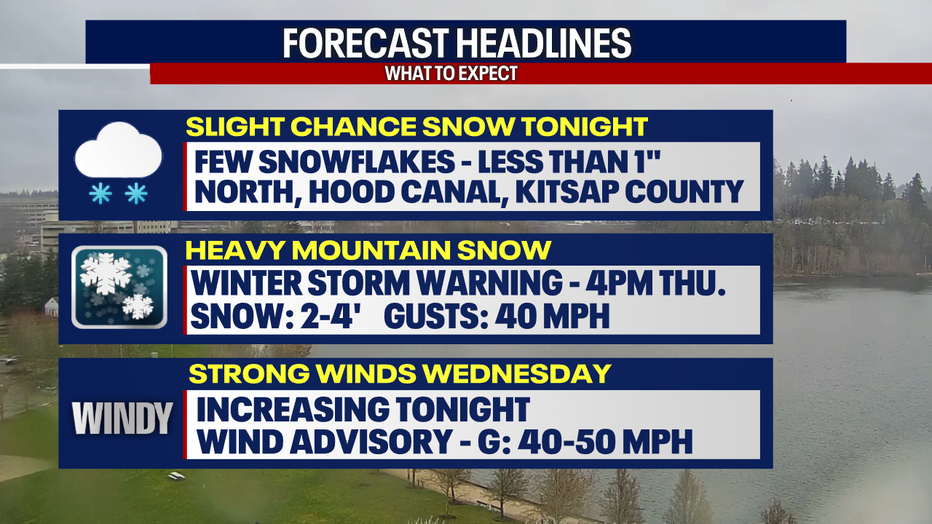
Tonight's headlines feature a few snowflakes mixed in mainly for the northern interior, Hood Canal and Whatcom County, with less than an inch of snow expected. More heavy snow for the mountains overnight through Thursday with high avalanche danger. Winds will increase tonight, as well.
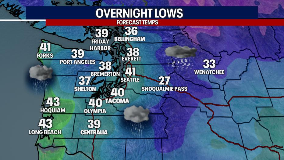
Tonight's overnight lows will be mild, with highs above freezing and plenty of rain showers. Winds will pick up by 4:00 a.m. Wednesday.
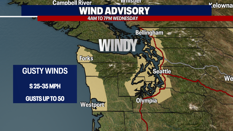
A Wind Advisory goes into effect from 4:00 a.m. Wednesday through 7:00 p.m. Wednesday with wind gusts up to 50 mph. Watch for downed tree branches and possible power outages.
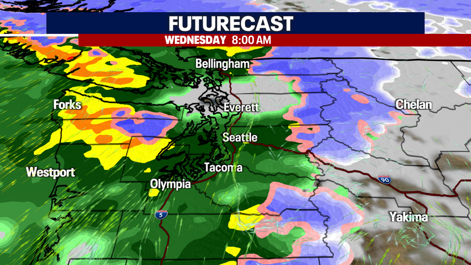
It will be a wet day on Wednesday, with plenty of rain showers for the morning commute and the heavy rain continues into the evening hours.
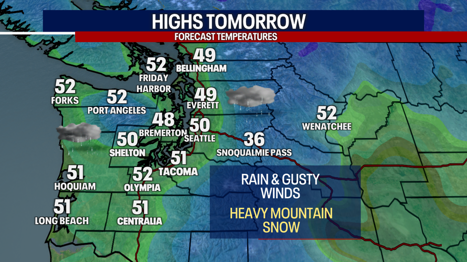
Highs on Wednesday will be mild, topping out in the upper 40s to low 50s. The southerly winds and rain will keep things mild.
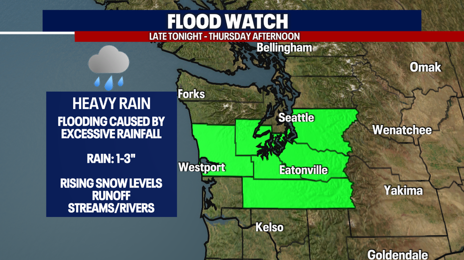
With heavy rain expected, a Flood Watch is in effect through Thursday afternoon. We will be watching our local streams and rivers closely.
Snow levels will drop from Friday through the weekend with a chance of mixed snow and rain showers again for Western Washington. Stay tuned!