Seattle Weather: Heavy rain at times Wednesday, mild temps
SEATTLE - Tuesday marked the third day in a row for Seattle to see a 60-plus degree day, while also setting a daily record high. This is only the second time in recorded history that Seattle has seen three consecutive 60-plus degree days in January.
Olympia also set a new record high of 59F, beating 56F in 1960.

Tonight, showers will push inland with gusty winds for the Cascades and along the coast. The Cascade foothills will see gusts between 30-40mph.
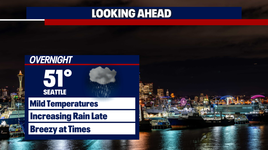
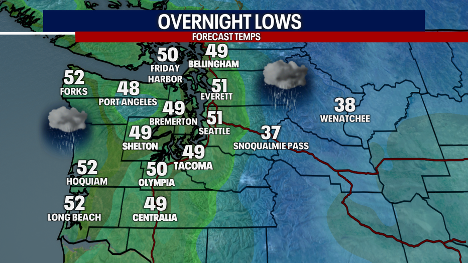
Overnight lows will stay in the upper 40s to low 50s, which is still well above the average overnight lows.
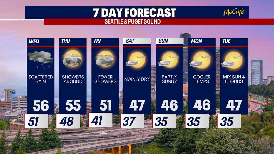
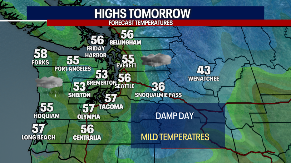
A wet day for Wednesday with plenty of rain expected. Make sure to grab a rain jacket. The rain will continue through the evening.
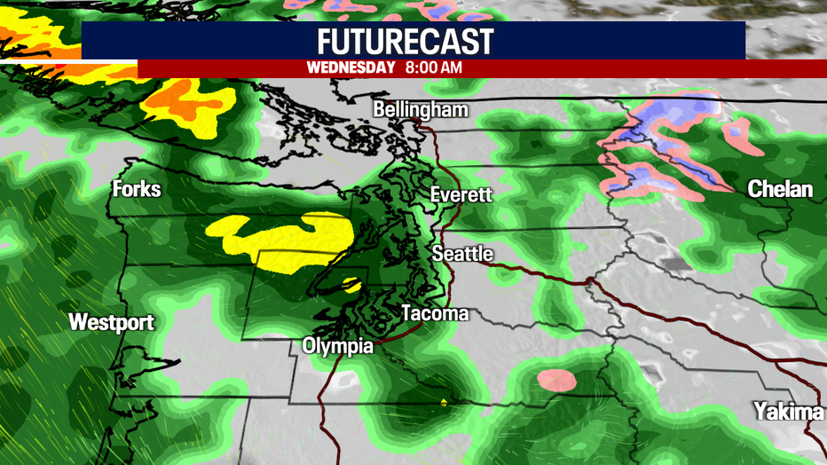
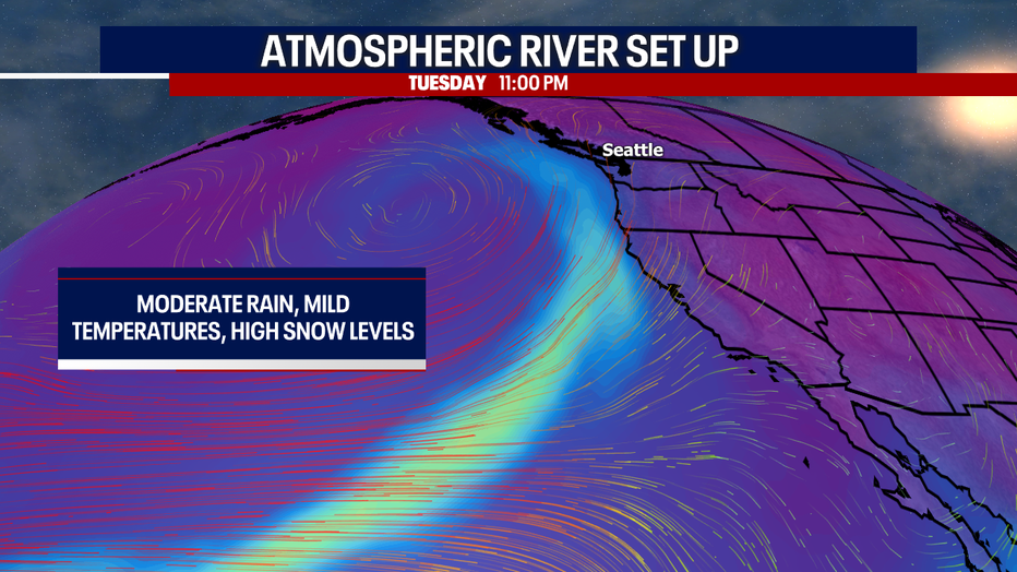
The rain late Tuesday through Thursday will be associated with an atmospheric river that will bring mild temperatures, heavy rain and times and high snow levels. Concerns about rising rivers, potential flooding and landslides will continue through the end of the week.
Highs Wednesday will still be above average, but temperatures will be several degrees cooler. We are not expecting to break any new record highs for the day.
Snow levels will remain high through Wednesday and temperatures will remain above average through the end of the week. Expect to see better chances of pass snowflakes by Thursday, but the precipitation dries out by the weekend.