

Seattle Weather: Dry start, mixed rain/snow & freezing rain possible Tuesday PM
Dry start, mixed rain/snow & freezing rain possible Tuesday PM
FOX 13 meteorologist Claire Anderson has the latest forecast.
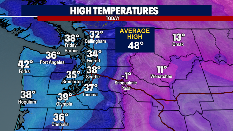
SEATTLE - We saw dry and cold conditions for Western Washington on Monday. Highs today were finally above freezing-- the first time since last week.
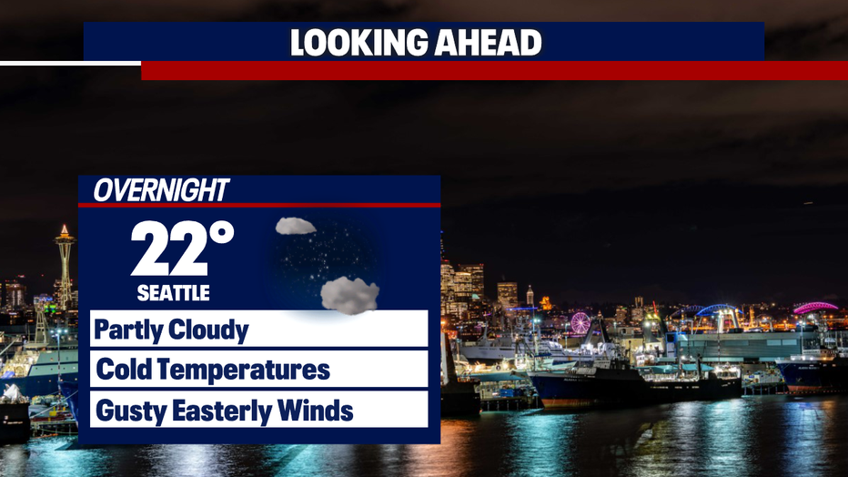
Overnight, temperatures will once again drop below freezing into the low 20s and teens. Gusty winds remain near the Cascade gaps as well.
We will start our day dry and cold with even some sunbreaks. High clouds will start to drift in by midday. Highs in the mid 30s.
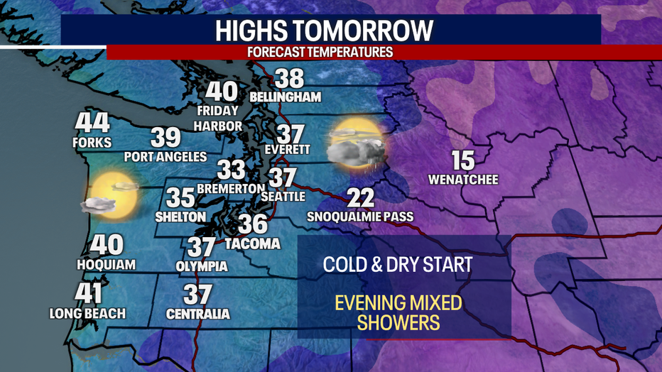
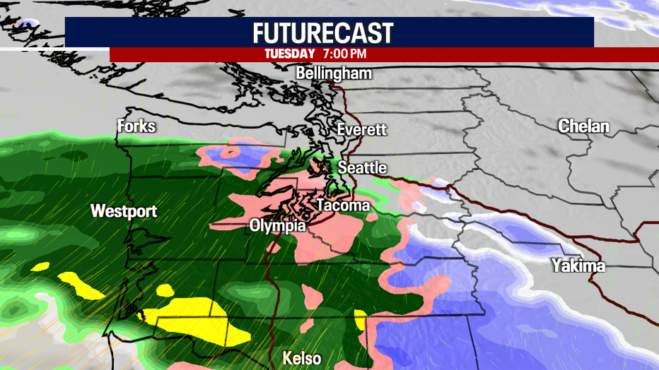
After 5 p.m. and through the evening hours, we will need to be watching for our next system moving into the PNW. This could bring evening commute problems.
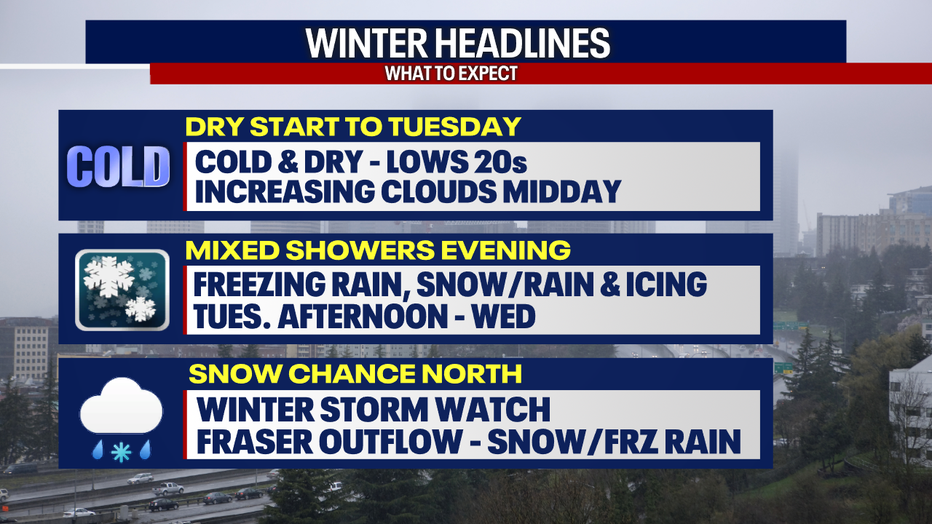
The biggest threat will be freezing rain starting in the south sound around 7 p.m. We could see mixed rain and snow showers slowly moving northward as the evening continues.
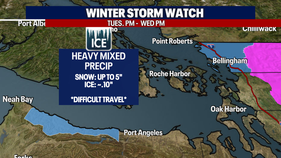
A Winter Storm Watch goes into effect Tuesday evening for potential snow and ice for Whatcom County and along the strait.
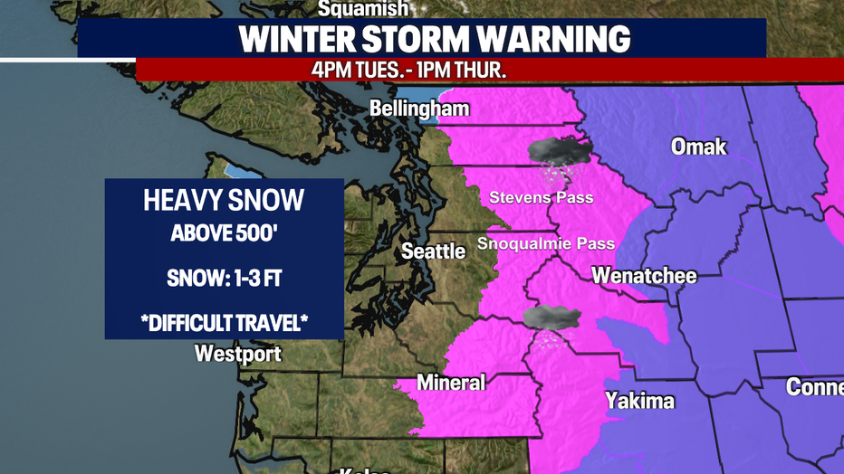
Heavy snow will start to fall in the Cascades Tuesday afternoon. A Winter Storm Warning goes into effect 4pm Tuesday through 1pm Thursday for heavy mountain snow over the passes.
Temperatures will slowly start to moderate by the end of the week. Showers are in the forecast through the weekend, with a chance of mixed showers on Thursday.
