

When will WA get its first snow of the season?
Light to moderate rain for Monday
The first atmospheric river, will take aim at our region Monday, sparking light-to-moderate rain. Get ready for wet roads! Commuting could be tricky at times tomorrow.
SEATTLE - After enjoying glorious sunshine and highs in the 70s this weekend, we’re forecasting a noticeably cooler and wetter week in Seattle and across Western Washington.
Stevens and White Passes could even experience its first snow of the season between Wednesday night and Thursday!
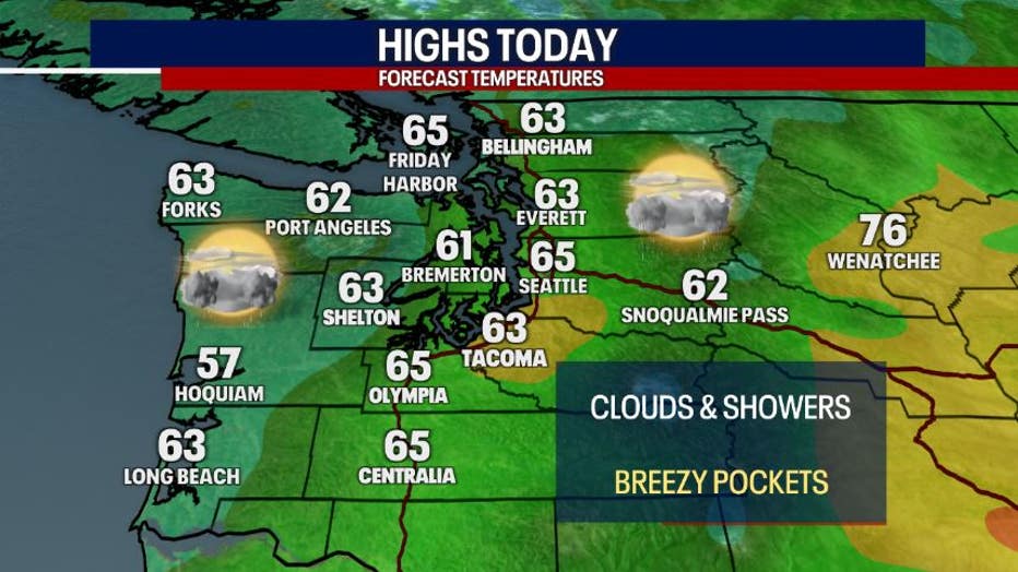
This afternoon, highs will climb into the low to mid-60s, which is a gentle cooldown from the weekend. You can expect partly to mostly cloudy skies. Rain returns this afternoon and tonight. In some areas, the rain could be heavy. Keep a waterproof jacket nearby and wear waterproof shoes. It may be slightly breezy in the typical spots as well.
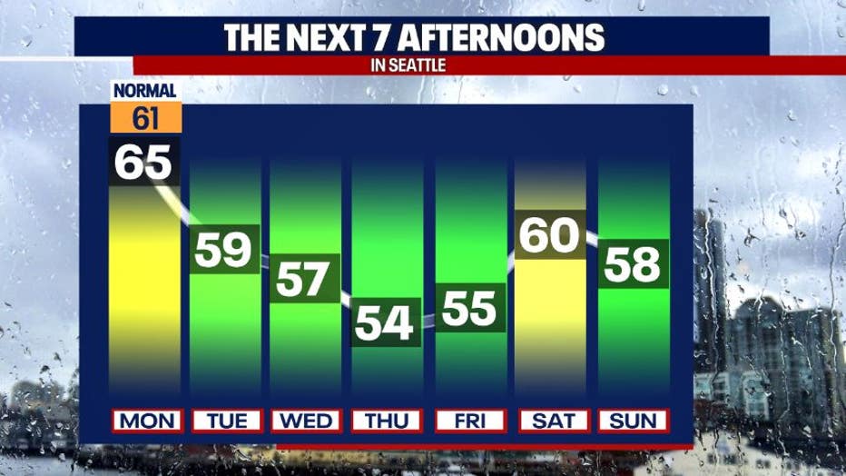
Showers taper tonight with dry weather forecast for much of the region on Tuesday morning. Another weak atmospheric river pattern (a.k.a. a corridor of moist air) will take aim at Western Washington on Tuesday afternoon, providing us with another round of showers.
After a cold front sweeps through the area Wednesday morning, temperatures cool further. Wednesday will be an interesting weather day, featuring breezy pockets, sun breaks, occasional showers, isolated thunderstorms and mountain snow.
Snow could start firing up over the mountains Wednesday evening, lasting through part of the day on Thursday. There might be an inch or two of snow accumulation over White and Stevens Passes. While I can’t rule out a brief and minor rain/snow mix (what some lovingly call "chunky rain") over Snoqualmie Pass, we’re mostly just anticipating a cool rain there.
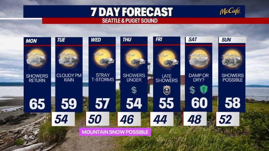
On-and-off showers take us into the weekend.
Take good care!
Warmly,
Meteorologist Abby Acone and Chief Meteorologist Brian MacMillan