

Rare atmospheric river events for June in Seattle this week
Seattle weather: Rainy weekend with cooler temperatures
FOX 13 Seattle Meteorologist Abby Acone has your latest weekend weather forecast for western Washington!
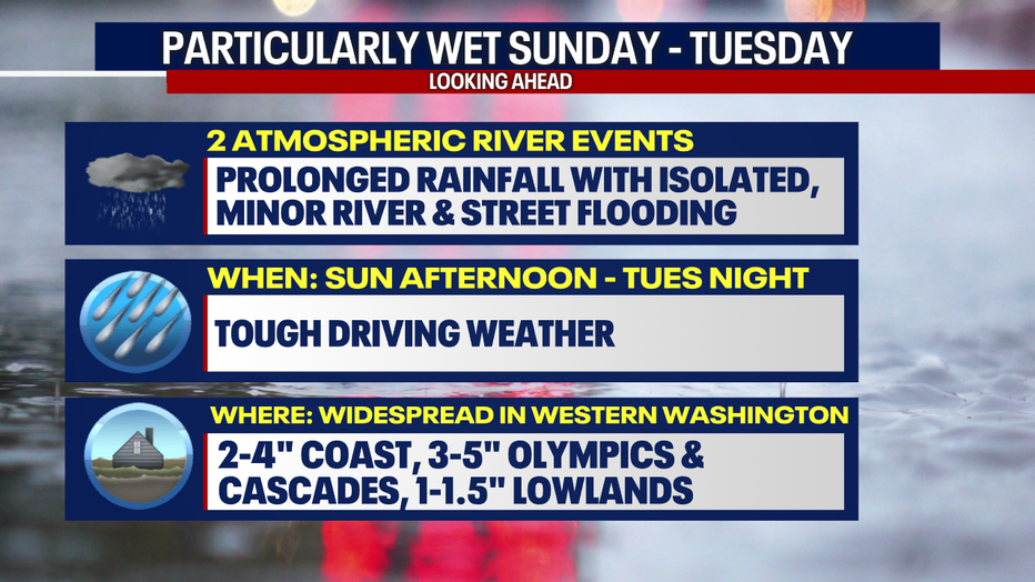
We're tracking two atmospheric river events to impact Western Washington between Sunday and Tuesday. Get ready for rounds of heavy rain and gusty weather. There may be isolated, minor street and river flooding. We'll need to monitor the burn scars for flooding issues should downpours develop (we'll especially watch the Bolt Creek burn scar for potential impacts along the highway).
Rounds of heavy rain could trigger localized, minor street and river flooding. (FOX 13 Seattle)
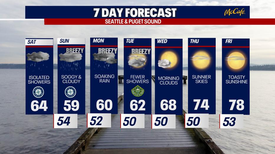
For today, the weather will be fairly quiet. Light hit-or-miss showers are in the forecast. Highs will be below average, reaching the low to mid 60s for most. Keep a rain jacket with you!

Highs Saturday will be below average in Western Washington. (FOX 13 Seattle)
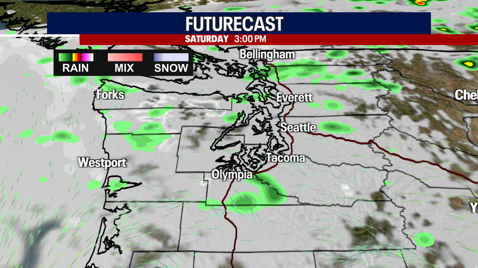
Only spotty showers are possible for Western Washington Saturday afternoon. (FOX 13 Seattle)
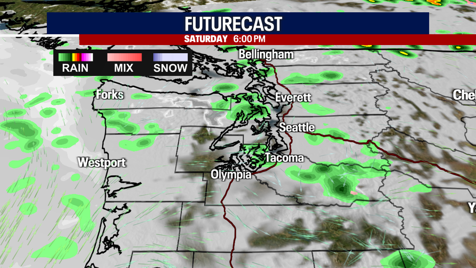
Stray showers linger in Western Washington Saturday evening. (FOX 13 Seattle)
The first atmospheric river will arrive Sunday. The second will follow on Monday. Just like an actual river of water, an atmospheric river is super moist: it's a corridor of saturated air in the mid levels of the atmosphere. This type of weather pattern is famous for dumping soaking rain along the West Coast. That's exactly what we'll see in the days ahead.
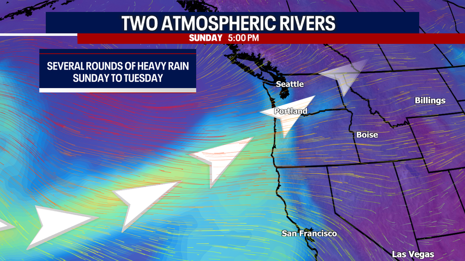
Two atmospheric rivers will impact Western Washington Sunday to Tuesday. (FOX 13 Seattle)
Due to the possibility for many rivers nearing minor flooding stage, the National Weather Service has posted a Flood Watch for the areas in forest green below. This goes from Sunday morning to Wednesday morning. Where there's poor drainage, we can't rule out spotty, minor street flooding. At the bare minimum, the wet roads will make driving slippery and a bit treacherous. Drive carefully!
The Snoqualmie River near Carnation has the best chance for minor flooding. At this time, it looks like other rivers will be rising but not meeting the flood stage threshold.

A Flood Watch is in effect from Sunday morning through Wednesday morning. (FOX 13 Seattle)
There could be new record rain totals with these incoming systems!
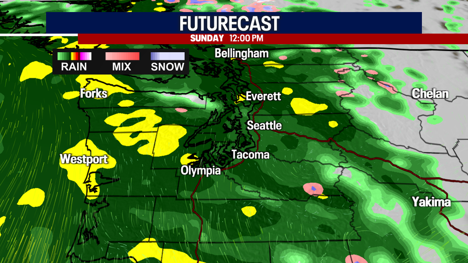
Heavy rain envelops much of Western Washington by noon Sunday. (FOX 13 Seattle)
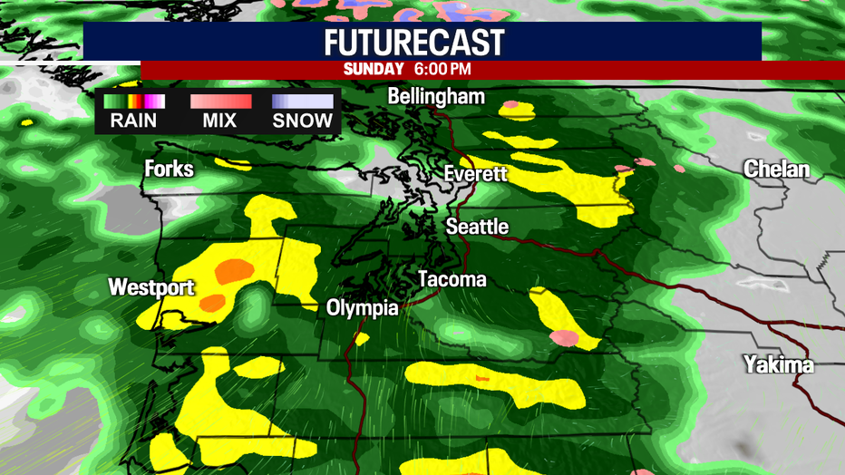
Rain will be stubborn, lasting all afternoon and evening on Sunday. (FOX 13 Seattle)
It'll be blustery as well. Winds could gust between 15 and 30 mph (especially on Monday). Some gusts could reach about 35 mph in the typical areas (e.g. the coast, inland waters and the Cascades).
Morning clouds will give way to afternoon sunshine on Wednesday. Sunnier and warmer weather returns on Thursday and Friday.
Stay weather aware the next few days! We'll be updating the forecast and watching conditions carefully.
Exceptionally active weather is on the way for Seattle from Sunday to Tuesday. (FOX 13 Seattle)
Warmly,
Meteorologist Abby Acone
Follow me on Facebook (Meteorologist Abby Acone), Instagram @abbyaconewx, TikTok @abbyaconetv