Seattle weather: Puget Sound area could see the coldest morning in decades Saturday
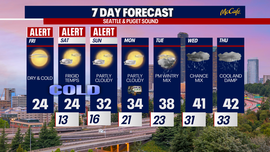
Seattle weather: Dry skies, frigid temperatures for Friday
Friday is a Weather Alert Day and there will be dry skies and frigid temperatures to start the weekend.
Seattle - Extremely cold temperatures will stick around through the weekend with overnight lows in the teens and daytime highs in the mid 20s.
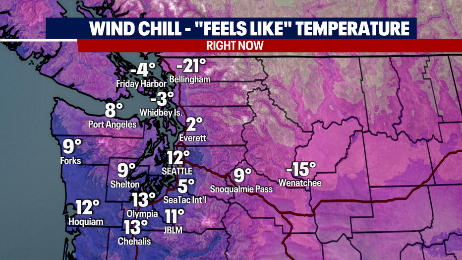
At 8:00 this morning, Bellingham had a bone chilling wind chill of -21 degrees as Fraser Valley winds from the northeast gust to 45 to 55 mph.
Most of the day will bring sunshine to the Puget Sound area, with high temperatures remaining in the teens and twenties. Breezy wind will continue in the north sound, but gradually decrease later tonight.
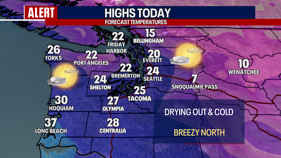
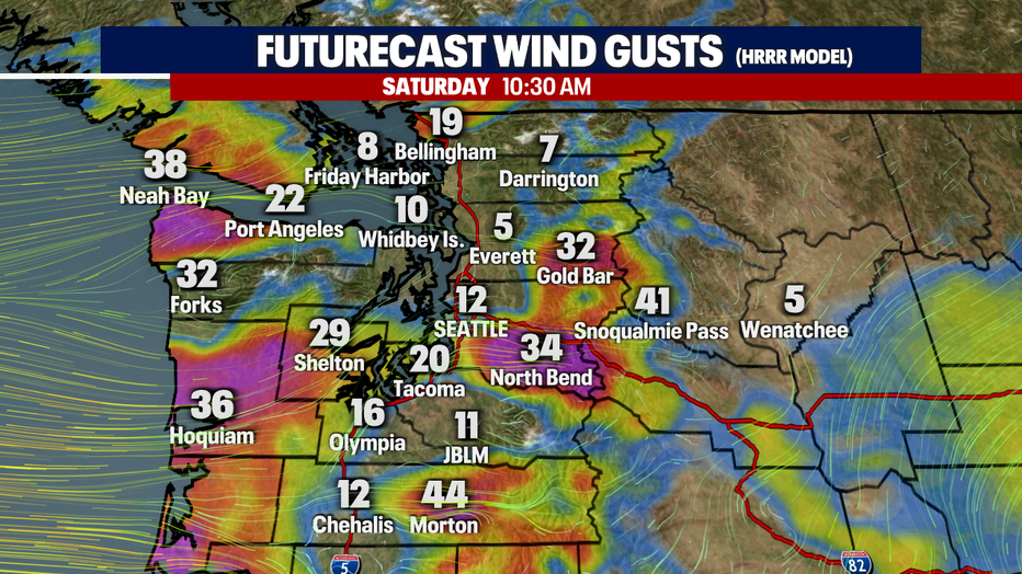
As the Fraser Valley winds ease up, easterly Cascade gap winds will pick up tonight and Saturday. Gusts could reach 40-50 mph in the usual spots influenced by the Cascade gap winds, like Enumclaw, North Bend, Monroe, and Maple Valley. Wind chill temperatures will be very cold in those spots tonight. In Seattle, we could see the coldest night in decades. The forecast low is 13 degrees at Sea-Tac by early Saturday morning. If that verifies, it will be the coldest low temperature recorded at Sea-Tac since 1990.
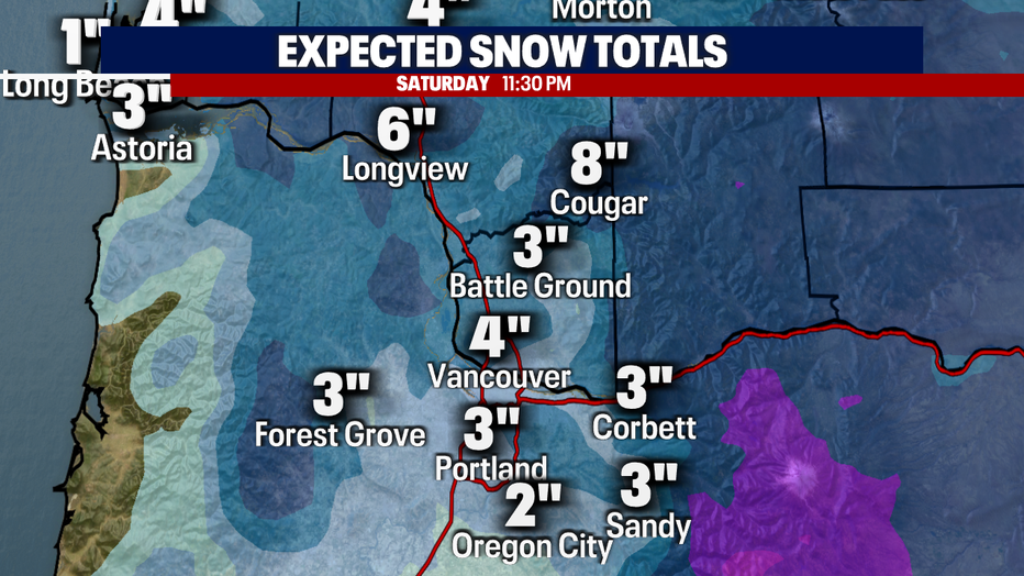
Saturday morning, a weather system will move into Oregon, bringing freezing rain and snow. As this system progresses inland during the afternoon and evening, snow showers will move north into Lewis County.
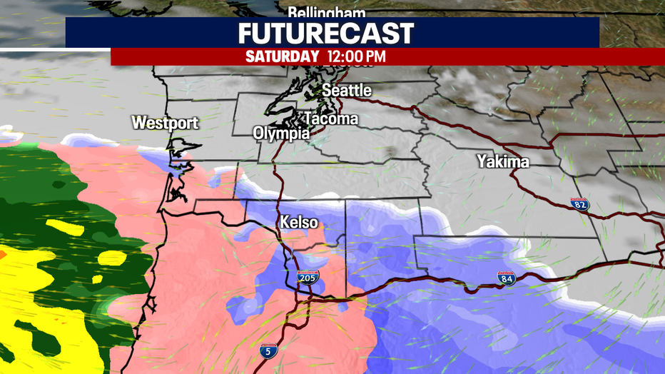
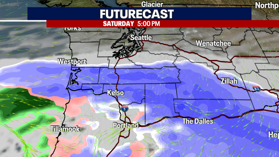
By 5:00 PM, widespread snow showers are expected as far north as the south ends of Pierce and Thurston counties, and along the southwest Washington Coast.
Areas in the valleys of Lewis County could see two to four inches of snow Saturday afternoon and evening.
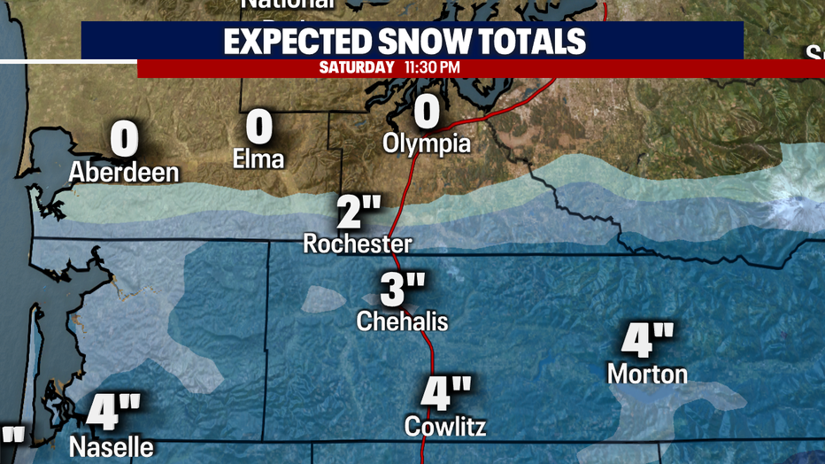
Even the coast could see some snow. One to four inches is expected in Pacific County on the southwest Washington coast with less the farther north you go.
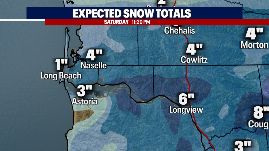
The area with the most snow will be around the Portland/Vancouver metro area and north into Cowlitz County. Three to eight inches is possible. Oregon's Central valleys could also see some freezing rain and ice accumulation, which would severely impact travel through areas like Salem.
As temperatures start warming up next week, we have another chance for a rain/snow mix Tuesday night into Wednesday. Temps will continue to warm through late week.