

Seattle weather: Morning fog Thursday with rain returning Friday
Another round of dense fog
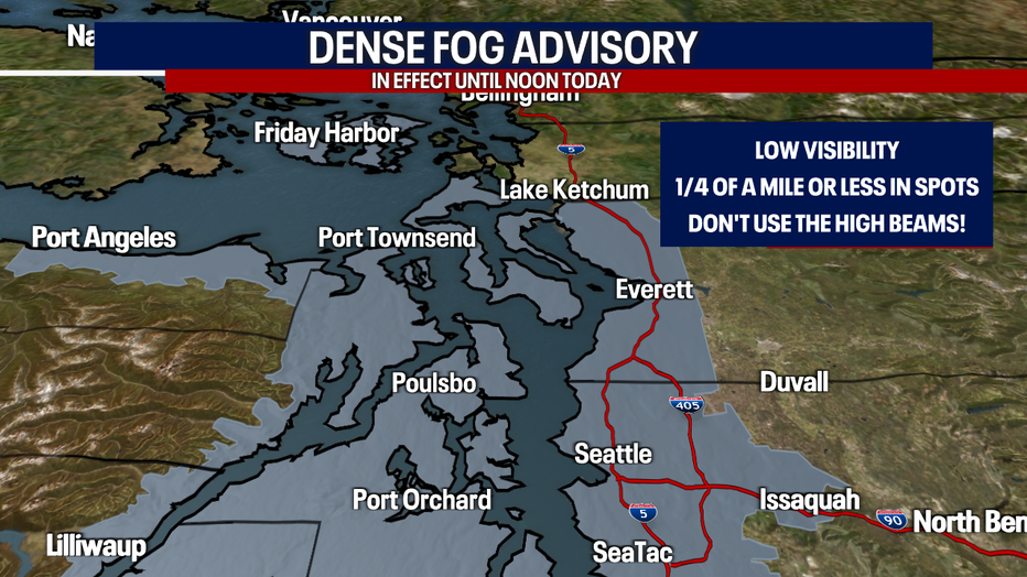
A Dense Fog Advisory is in effect again through Thursday for most of the Puget Sound lowlands.
Some communities are waking up to dense fog and lowered visibility. Conditions should improve gradually by noon for most.
A Dense Fog Advisory expires at noon and applies to the neighborhoods covered in gray in the map below. Even once the fog lifts, the skies will be mostly cloudy this afternoon.
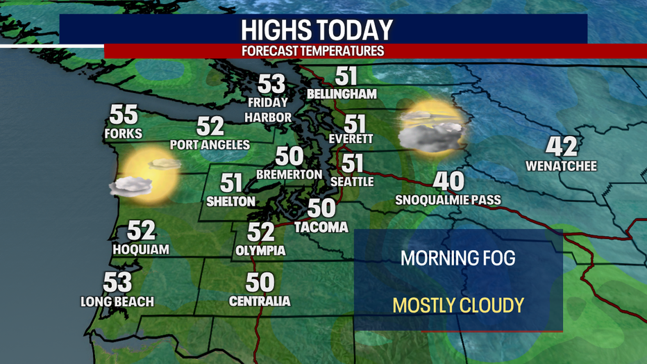
Highs this afternoon will reach the low 50s for most.

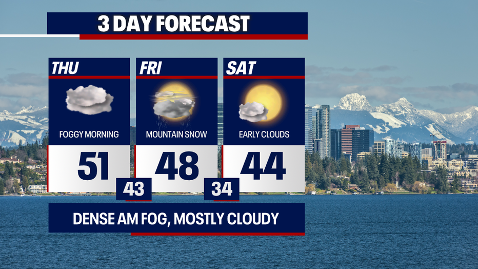
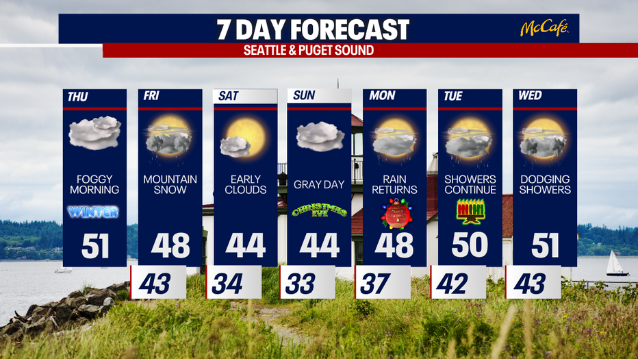
We'll be dry today, but lowland rain and a little mountain snow return on Friday. We're forecasting around five inches of snow (more or less) for Stevens and Snoqualmie Passes with lighter amounts for White Pass. Be careful if you're traveling over the mountains! It'll be breezy (locally windy) tomorrow as well.


Saturday will start cloudy with patchy fog. Sunbreaks will make an appearance during the afternoon.
Christmas Eve will be dry albeit cloudy – nice and dry for doing last-minute errands!
Christmas Day will be mild with highs in the mid to upper 40s: this is about average for this time of year. Sorry to all the kids dreaming of a white Christmas in Puget Sound – we're not expecting any flurries in the lowlands :( However, the mountains could see some light snow!
Tuesday and Wednesday, we'll be alternating between sunbreaks and pockets of wet weather.
One note: river levels could be rising in places next week, particularly the Skokomish River in Mason County. Right now, we don't expect major or even moderate flooding. We'll let you know if things change!
Take care! Thanks so much for choosing FOX 13. We appreciate you greatly!
Warmly,
Meteorologist Abby Acone
Follow me on Twitter @abbyacone, Instagram @abbyaconewx, TikTok @abbyaconetv and Facebook (Meteorologist Abby Acone)