

Seattle weather: Morning clouds to summer sunshine Friday
SEATTLE - Highs went soaring above average today into the low 80s for the Central Sound. SeaTac hit 81 at the airport. We'll cool off some into the weekend, but the heat is on as we sail into the 4th of July holiday.

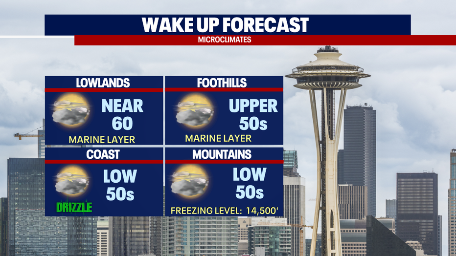
Overnight, look for partly cloudy skies with temperatures cooling into the upper 50s to near 60 for Seattle. Near sunrise the marine layer blankets Puget Sound for a mostly cloudy start. Areas to the south, like Olympia, could see patchy fog.
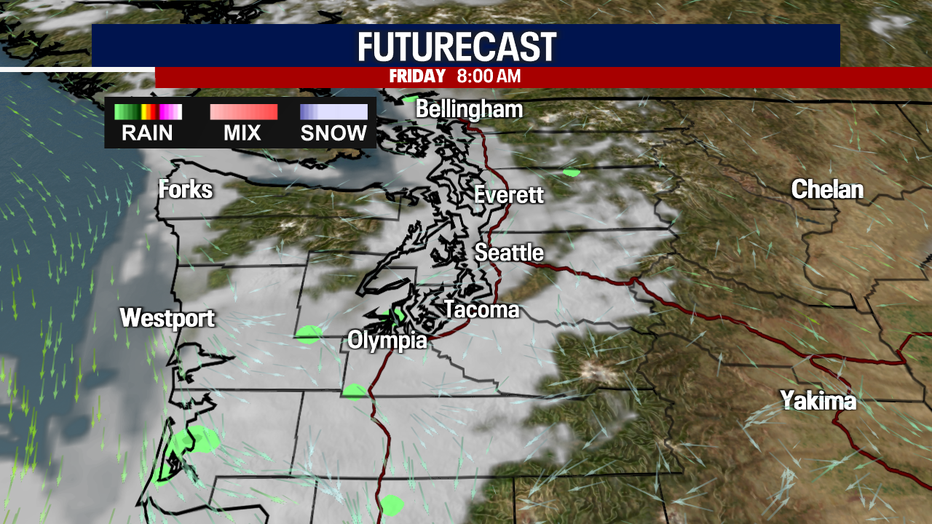
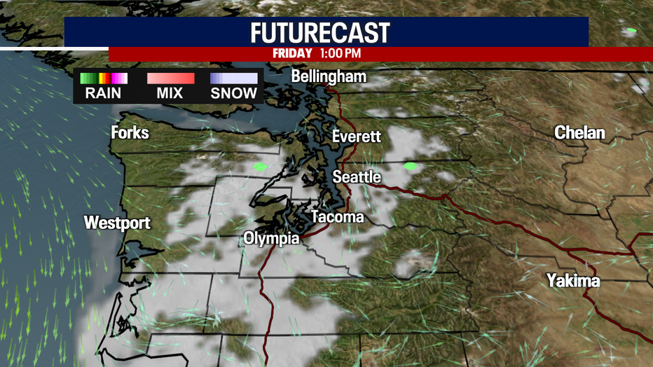
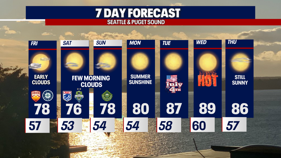
By lunchtime Friday, skies start to clear for a beautiful afternoon.
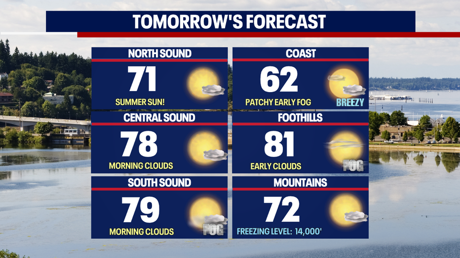
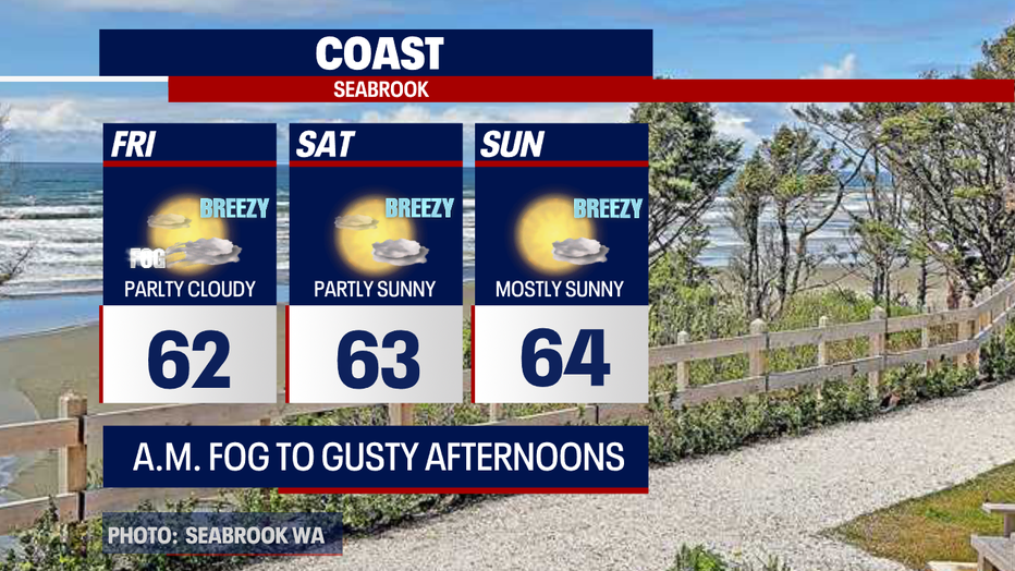
Highs tomorrow vary depending on what community you're in across Western WA. Once the marine layer burns off the coast, we will see temperatures only in the low 60s after early fog and patchy drizzle. The north sound warms into the low 70s with the central and south sound's heating into the upper 70s to low 80s.
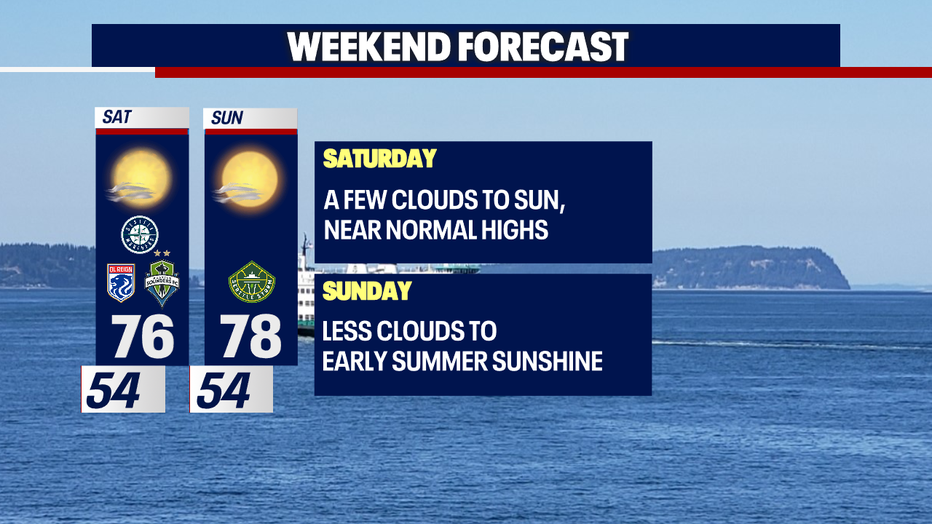
This weekend we'll hang near or slightly above average A system passing to the north of us, in British Columbia, pushes a few more high clouds into Western WA. This will keep temperatures from pushing into the 80s.
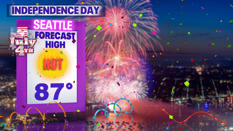
Very warm to hot conditions come our way as we move into the first week of July. By the 4th highs heat into the upper 80s for Seattle with even warmer temperatures to the southwest and southeast.
The hot highs coupled with extremely dry grounds increase the risk of fire danger. Please know your surroundings and be safe, especially during Independence Day Celebrations.
Here's a look at your 7-Day forecast! Happy Summer!
Have a great end to the week! ~Ern Mayovsky, FOX 13 Forecaster
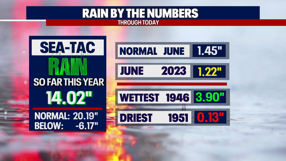
*SeaTac Rain Almanac
*Coast Forecast
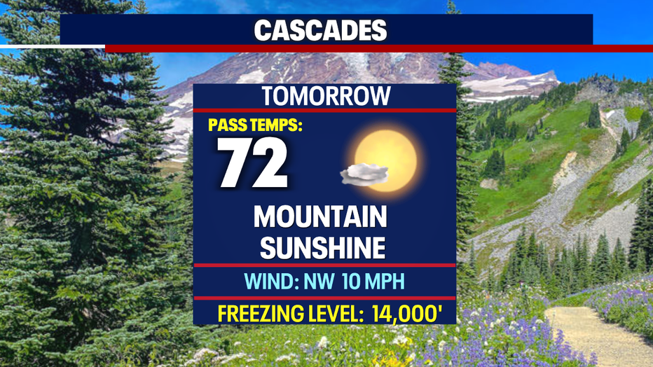
*Mountain Forecast
*Central WA Forecast
