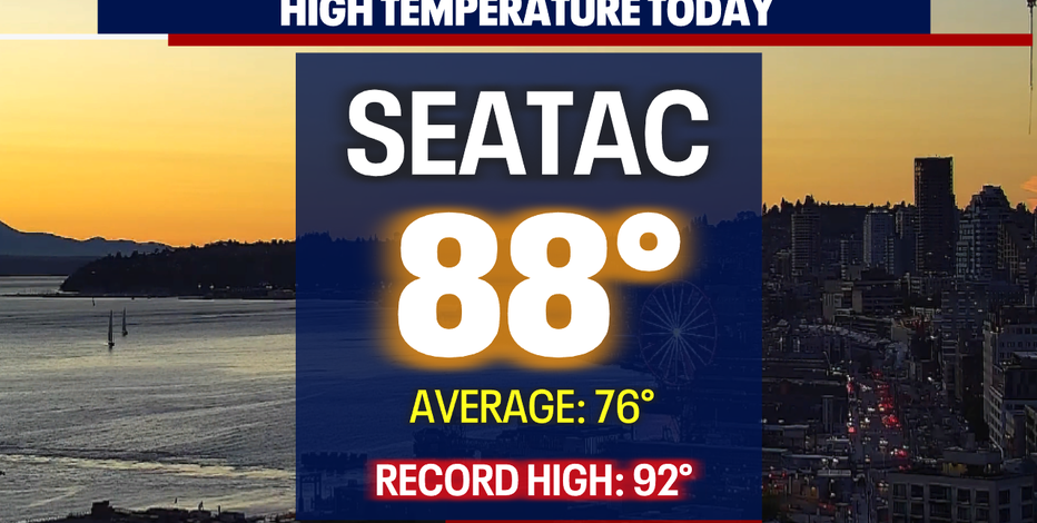
Seattle - We hit 88 Saturday at the airport in SeaTac under sunny and hazy skies. Air quality levels became worse through the day pushing values into the "unhealthy for sensitive groups" to "unhealthy". The good news is we'll slowly start to scour out bad air as low pressure sends clean air inland over the next few days.
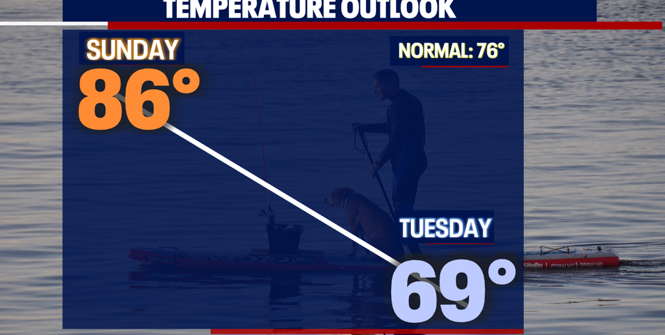
As that low moves closer to the coast clouds will increase and temperatures will cool. Highs on Sunday fall into the mid 80s and by Tuesday we only warm into the upper 60s.
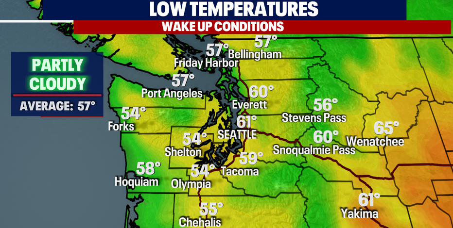
We expect a few passing clouds overnight with temperatures near 60 for the metro area.
Just a few areas waking up to clouds or patchy fog, mainly at the coast.
Temperatures will warm pretty quick tomorrow with highs landing nearly 10 degrees above average. With warmer than normal high that poses the threat of heat related illness.
A "Heat Advisory" will remain in effect through 8pm tomorrow.
Temperatures across Western WA will vary with cooler highs along the coast and much warmer temps inland.
Our air quality outlook is promising as we're moving in the right direction bringing levels back down to good by Monday.
As marine air filters inland skies will become cloudy by the end of Monday. And on the coast, we will see a few light showers.
Highs cool to below average Monday as that area of low pressure slides over the region.
By Tuesday, we're forecasting a few more showers to spread over Puget Sound. Highs will struggle to reach 70 Tuesday and if that happens, we may fall short of tying a record of most 70+ days in row at SeaTac. The record is 72 days in 2017 and as of today we sit at 67 days. Stay tuned!
A few light showers may linger into Wednesday otherwise look for slightly warmer highs in the low 70s with more heat on the way the rest of the week. Enjoy!
Have a great weekend all! ~Erin Mayovsky, FOX 13 Forecaster
*SeaTac Rain Almanac
*Coast Forecast
*Mountain Forecast
*Central WA Forecast