

Seattle weather: Lowland rain, wind and intense mountain snow
Seattle weather: Lowland rain, mountain snow & gusty conditions
Seattle weather: Lowland rain, mountain snow & gusty conditions
Buckle up for a very active day of weather. We're forecasting our classic trifecta here in Western Washington of lowland rain, wind and intense mountain snow.
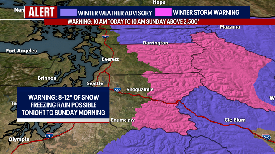
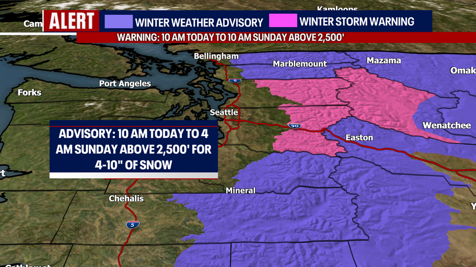
Let's start with the mountain snow. A Winter Storm Warning is in effect until 10 a.m. Sunday above 2,500 feet in the pink below. Up to eight to 12 inches of snow could fall (if not more). In the purple, a Winter Weather Advisory lingers until 4 a.m. Sunday for four to ten inches of snow.
While it's wonderful to see the snow piling up over the mountains, a good amount of it will melt tomorrow as snow levels rise to about 6,000 feet in elevation. As the warmer air moves in, there may be a period of freezing rain for Stevens and Snoqualmie Passes overnight and Sunday. Today, snow rates could be upwards of 0.5-1" an hour which means visibility will be extremely low.
Just as expected, wet snow started flying in Western Kitsap County and over the Hood Canal. The National Weather Service posted a Winter Weather Advisory for the areas highlighted below, above 500 feet until 4 p.m. An additional one to two inches could accumulate. Snow at this lower level will melt quickly as the precipitation changes to rain later this afternoon.
I can't rule out a few other neighborhoods in the lowlands seeing a brief rain/snow mix this afternoon, but precipitation below 1,500 feet will mostly be in the form of rain.

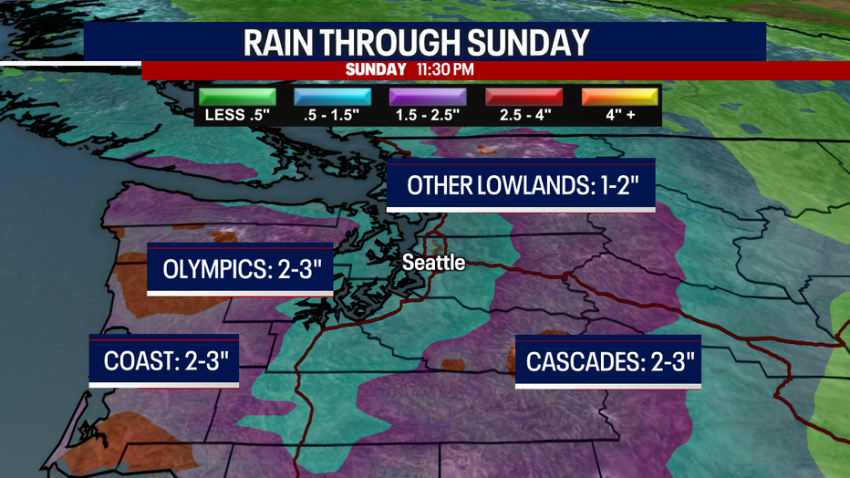
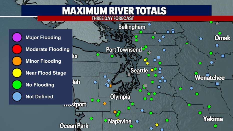
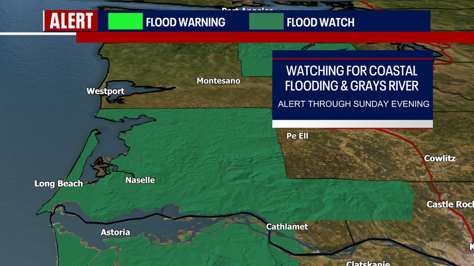
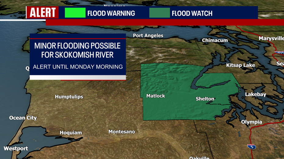
Between two and three inches of rain could fall this weekend over the coast, the Olympics and the Cascades. Between one and two inches are in the forecast for the other lower elevations of Western Washington. River levels are already running higher than usual. We need to watch the Snoqualmie, Grays, Chehalis, Skokomish and Snohomish Rivers. Flood Watches have been issued for Mason and Grays Harbor Counties. It's important to underscore that river flooding won't be nearly as bad as several days ago.
Here's a look at the three-day maximum river forecasts. Bear in mind: these river flooding outlooks are highly subject to change. Mostly minor flooding is expected.
There are some Flood Watches in effect:
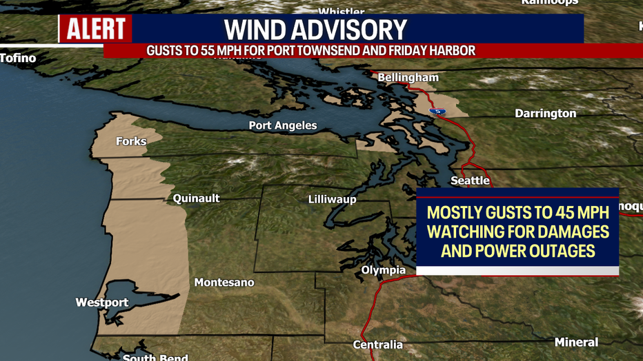
A Wind Advisory goes until 1 a.m. Sunday for the North Sound, San Juans and Port Townsend, and until 7 tonight for the coast. Southeast gusts to 50-55 mph are possible for Friday Harbor and Port Townsend. Otherwise for the Advisory, southeast gusts to 40-45 mph could trigger some minor damages and power outages. Elsewhere in Puget Sound, gusts between 20-35 mph (isolated cases to 40 mph) are possible.
With the rain we're expecting today in the lower elevations, driving will be difficult. We can't rule out localized cases of minor street flooding where heavy downpours linger over a street with bad drainage.
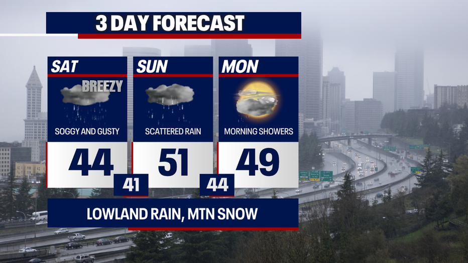
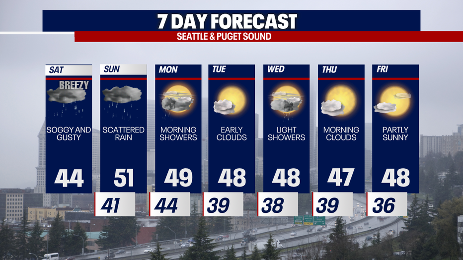
Scattered rain continues Sunday. Early showers on Monday give way to sunnier and drier weather in the afternoon. Morning clouds and afternoon sunshine are in store for Tuesday. Light, passing showers could develop on Wednesday, but Thursday and Friday look dry (for now at least!).
Thanks so much for choosing FOX 13!
Warmly,
Meteorologist Abby Acone
Follow me on X @abbyacone, Instagram @abbyaconewx, TikTok @abbyaconetv and Facebook (Meteorologist Abby Acone)