This browser does not support the Video element.
Temperatures drop, showers return Thursday
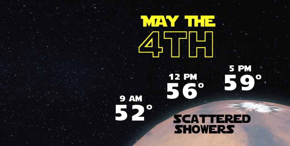
Keep a sweatshirt handy as you'll need it, with highs only warming 8–10 degrees from where we start the day. The metro will be lucky to reach 60. Plus, we're not ruling out an isolated thunderstorm Thursday as well.
SEATTLE - Scattered thunderstorms rocked the Puget Sound area late Wednesday night into Thursday morning. More rain is set to hit the area on Friday.
It's Star Wars Day, and temps will be quite cool, with highs struggling to make it out of the 50s. Expect scattered showers and a slight chance for thunderstorms today, especially in the southwest interior and along the Washington Coast.
Most of the central and south sound will be mainly dry today with mostly cloudy skies.
Thunderstorms are not very frequent in the Pacific Northwest west of the Cascades. Data over the past 30 years shows that May has brought the most amount of cloud to ground lightning, with the late spring and summer months brining the most frequency overall.
The next wet system arrives Friday morning, which will bring some heavy rain at times. North of Seattle will likely be the hardest hit from this system, which will transition to lighter showers as the day goes on.
Saturday through Monday will just bring a few scattered showers, but there will be plenty of dry times too if you have plans this weekend. Drier and warmer weather returns by the middle of next week.