

Friday night storm to bring wind, rain and mountain snow to Western Washington
Rain, gusty wind to hit Western Washington Friday
Rain and gusty wind to hit Western Washington Friday night into Saturday.
Seattle - The strongest storm of the season so far will bring wind, rain and mountain snow to Western Washington.
The biggest impact of the storm for most people will be tonight's wind. A Wind Advisory is in effect for most of Western Washington tonight through Saturday morning.

The central and south Puget Sound areas could see 35-45 mph gusts, while the Washington Coast and north Puget Sound could see up to 55 mph gusts. There may be isolated spots with even stronger gusts. Scattered power outages are likely tonight, especially overnight as winds strengthen.

Along with the wind, the lowlands will see heavy rain at times overnight as a cold front pushes through the area.
Snow levels will be between 4,000 and 5,000 feet tonight, but heavy precipitation could temporarily lower snow levels by dragging cold air down Stevens and even Snoqualmie Pass at times.
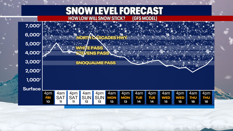
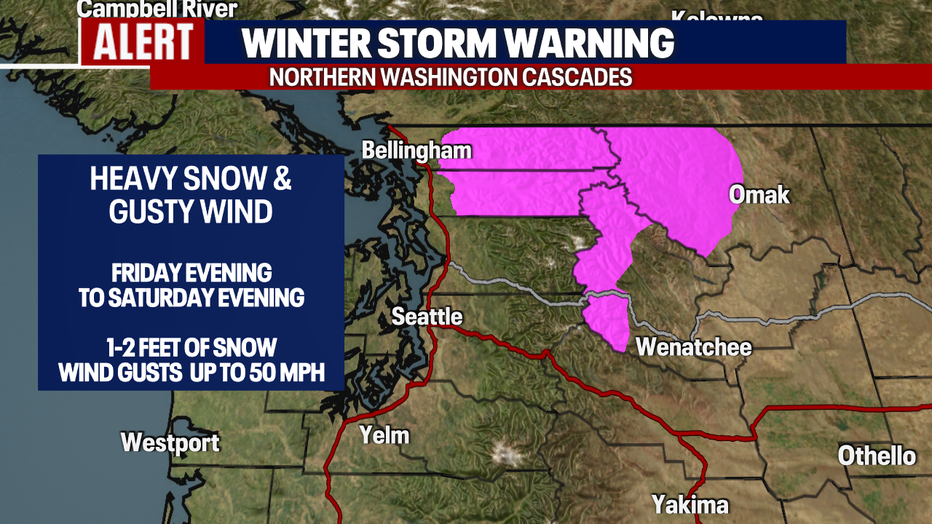
The biggest accumulations will be in the northern Washington Cascades, with one to two feet of snow expected. Areas like Stevens Pass could see four to eight inches of snow.
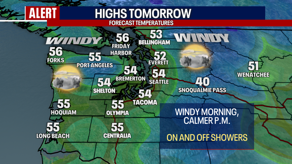
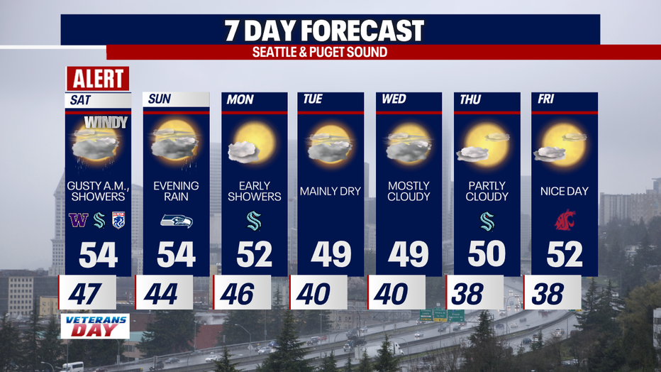
Winds will still be breezy, but not as strong on Saturday morning. Expect breezy to gusty winds for the first half of the day. Those will gradually calm down as the day goes on. On and off showers will persist most of Saturday, but there should be plenty of dry times too.
Another round of rain will hit Sunday evening through early Monday morning. That system will not be as strong but could bring breezy wind at times.
It looks like we could get a break from the rain most of next week, with mainly dry conditions and highs around 50 degrees.
Livestream: Friday storm brings wind, rain, mountain snow
Don't miss out on our weather livestreams! You can watch them and join in on the conversation on Facebook (FOX 13 Seattle) and Instagram (@fox13seattle)