

First 70s of 2024 in Seattle!
Seattle weather: First 70s of 2024!
Fox 13 Seattle Meteorologist Abby Acone has your weekend weather forecast!
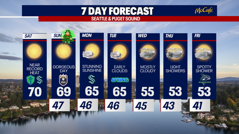
Get ready for a seriously spectacular weekend of weather. We're forecasting the first 70s of 2024 for some backyards. This will be the warmest point at Sea-Tac Airport since mid-October!
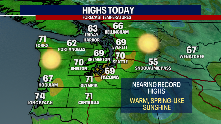
A high of 70 this afternoon at Sea-Tac would come awfully close to the record for today which stands at 72. Olympia will likely fall shy of a record today. Bellingham and Hoquiam are forecasting record-breaking temperatures today.

Sea-Tac will likely flirt with a record tomorrow as well. By Monday, temperatures will no longer be in record territory.

Check out the highs for this afternoon!
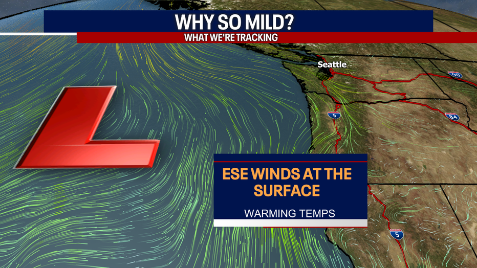
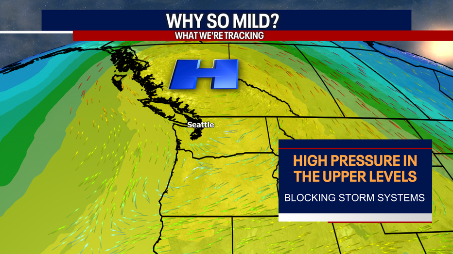
Let's break down why we'll be so mild this weekend. At the surface, we have an easterly/southeasterly flow as air blows into a low pressure system offshore. In the high levels of the atmosphere, a strong ridge of high pressure will develop over British Columbia. This will block out storm systems and keep us dry.
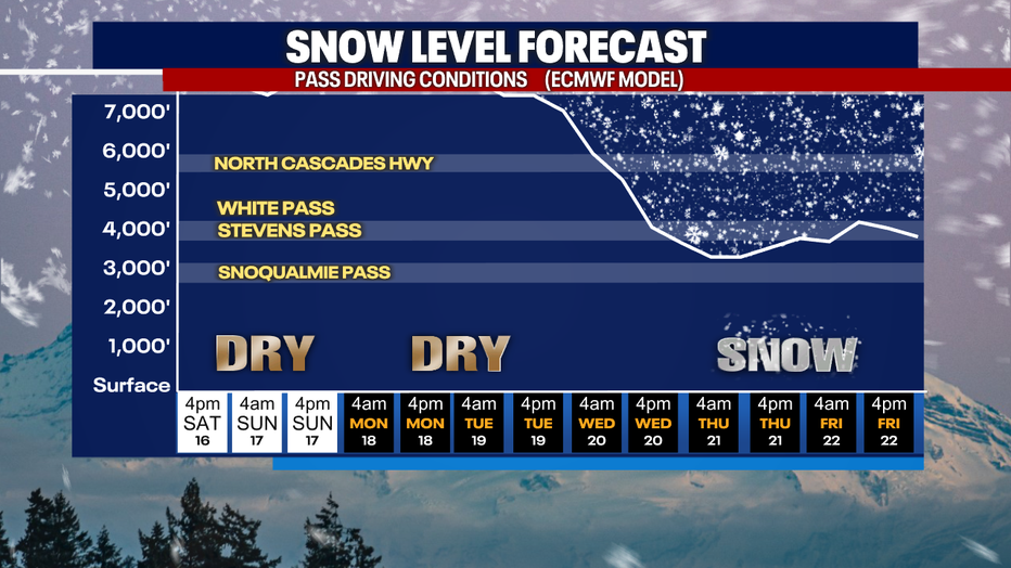
Over the mountains, freezing levels remain somewhat high through Tuesday. As cooler and wetter air returns Thursday and Friday, light snow is possible over the passes.
Mother Nature is serving up a pot of gold for Saint Patrick's Day tomorrow! Our familiar pattern of morning clouds and afternoon sunshine will welcome spring on Tuesday.
Wednesday through Friday will be noticeably cooler and cloudier.
Soak up the sunshine this weekend!
Warmly,
Meteorologist Abby Acone
Follow me on Facebook (Meteorologist Abby Acone), Instagram @abbyaconewx, TikTok @abbyaconetv and X @abbyacone