Cooler highs with cloudier skies on the way
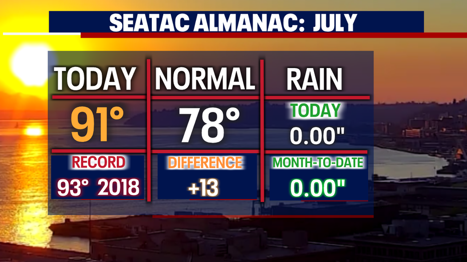
Seattle - Saturday's highs went sailing into the 90s for many areas Seattle south. SeaTac hit 91 at the airport with even warmer highs for Thurston County where Olympia heated to 94.
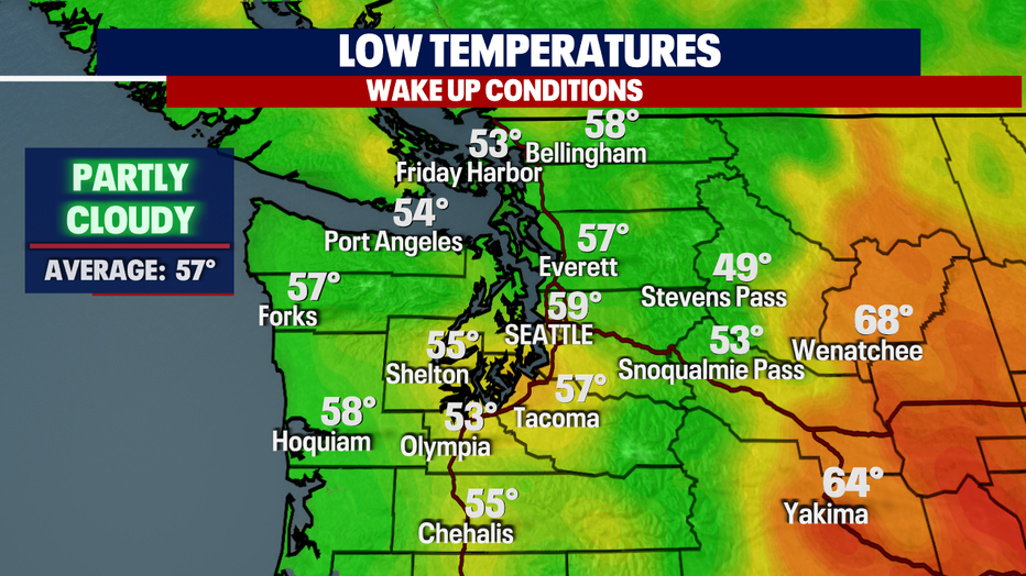
Overnight skies are mixed with clouds and clearing. Temperatures cool to near 60 for the metro area.
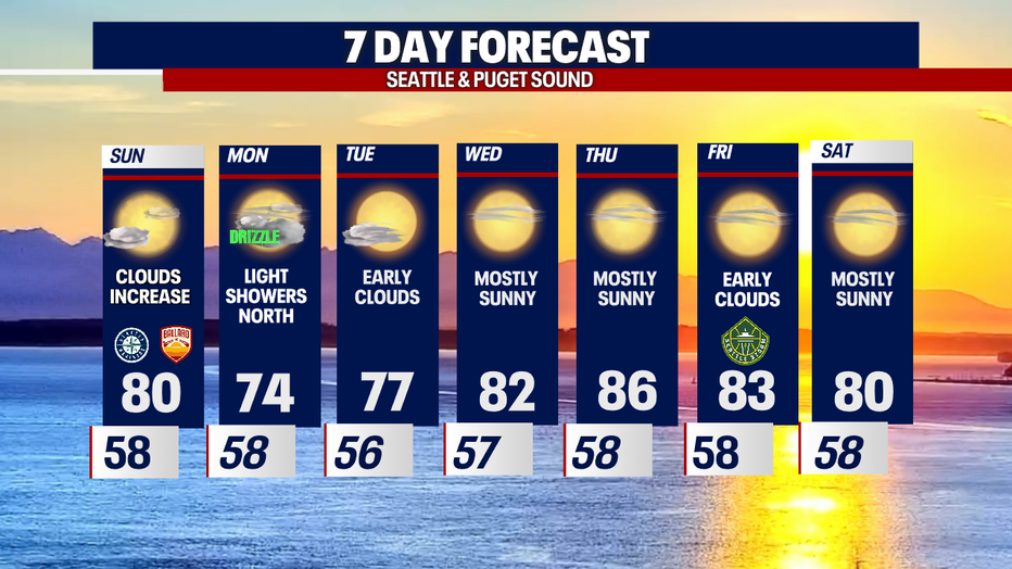
We expect a partly sunny start Sunday with increasing clouds late in the day. Marine air will continue to flow inland as a week disturbance passes just to north of us over the Canadian border.
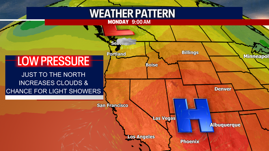
With low pressure driving our forecast temperatures will cool to near 80 for Seattle, which is still above average for this time of year.
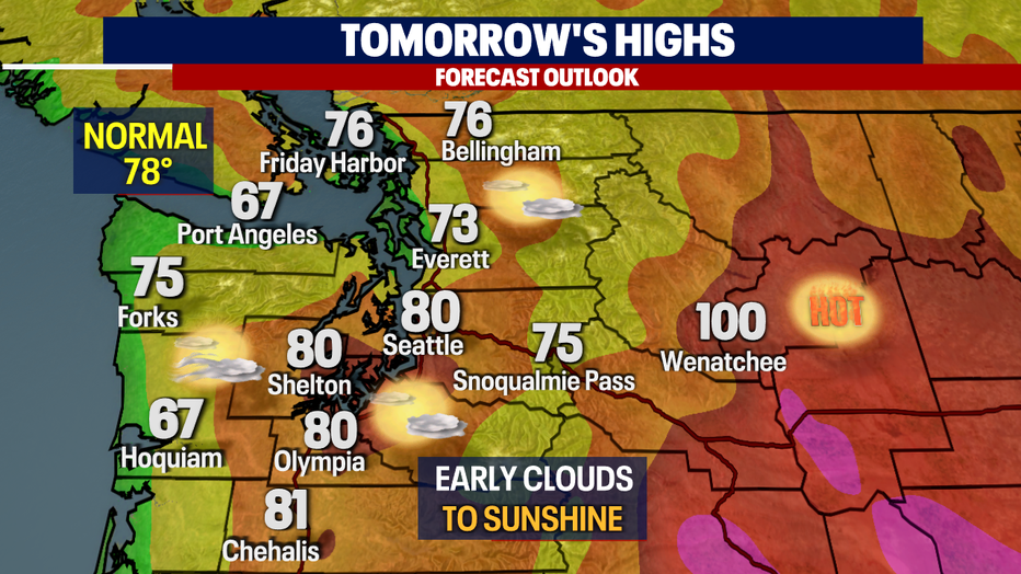
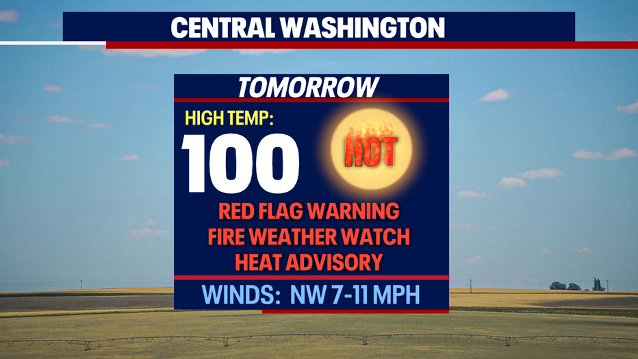
While west of the Cascades experiences some cooling Central WA and the Lower Columbia Basin sit under a "Red Flag Warning", "Heat Advisory", and a "Fire Weather Watch" as conditions are ripe for potential fires to break out.
Along with temperatures heating to near 105 winds will become active with gusts out of the west 35 and 45 mph along with relative humidities between 11 - 25%.
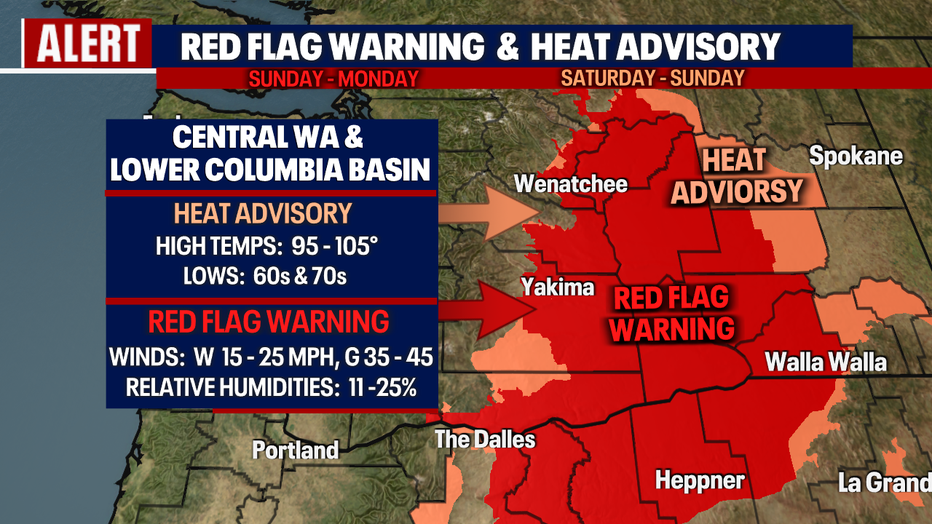
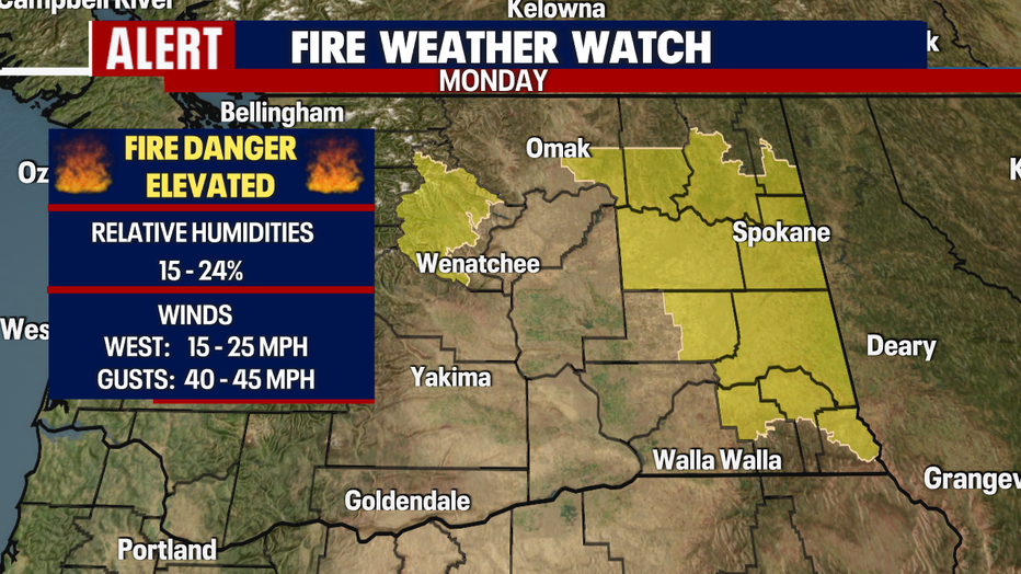
As we move into Monday most of our alerts should fall off as the threat for active fire weather lessons some.
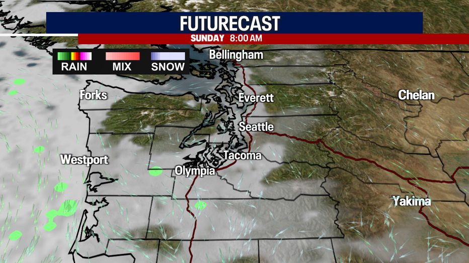
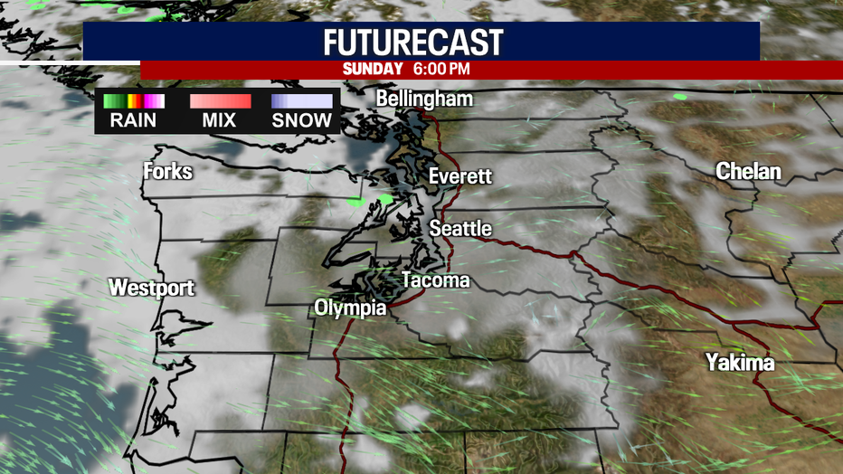
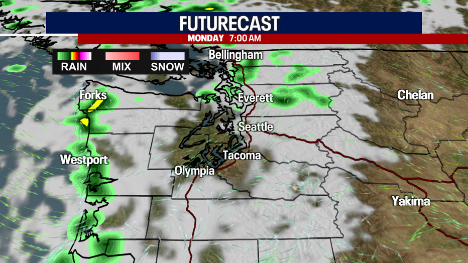
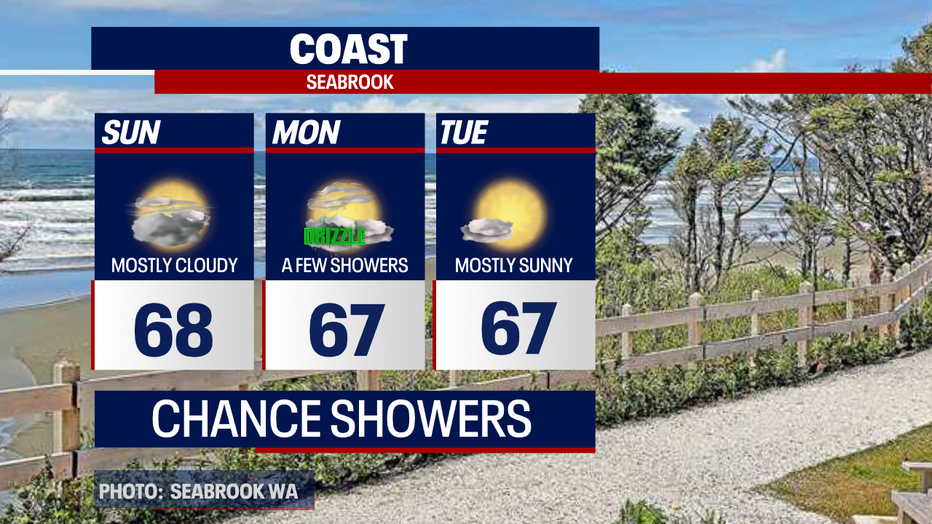
Our futurecast model is finally picking up on light to moderate showers along the coast and possibly inland.
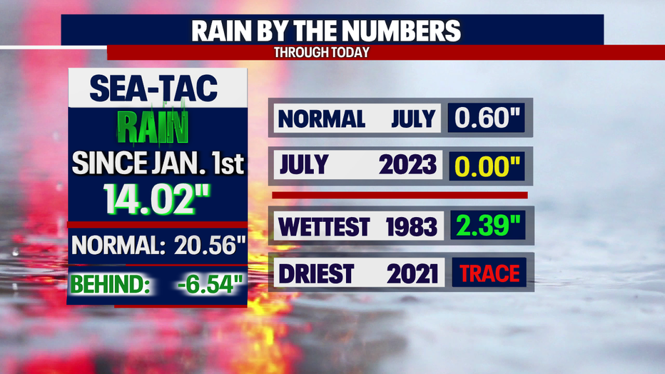
We have not seen measurable rain in Seattle since June 20th when 0.42" fell at the airport. As of now the chances for showers at the airport are looking slim with a better chance at the Coast and North Sound. Stay tuned!
High pressure rebuilds over Western WA starting Tuesday. Highs rebound back to near normal with continued heating throughout the week. Enjoy!
Have a great rest of the weekend all! ~Erin Mayovsky, FOX 13 Forecaster
*SeaTac Rain Almanac
*Coast Forecast
*Mountain Forecast

*Central WA Forecast