Seattle weather: Cool, cloudy week with scattered showers
On and off showers this week
Although we had a rainy and cool day on Tuesday, officials say the wildfire danger is still very high.
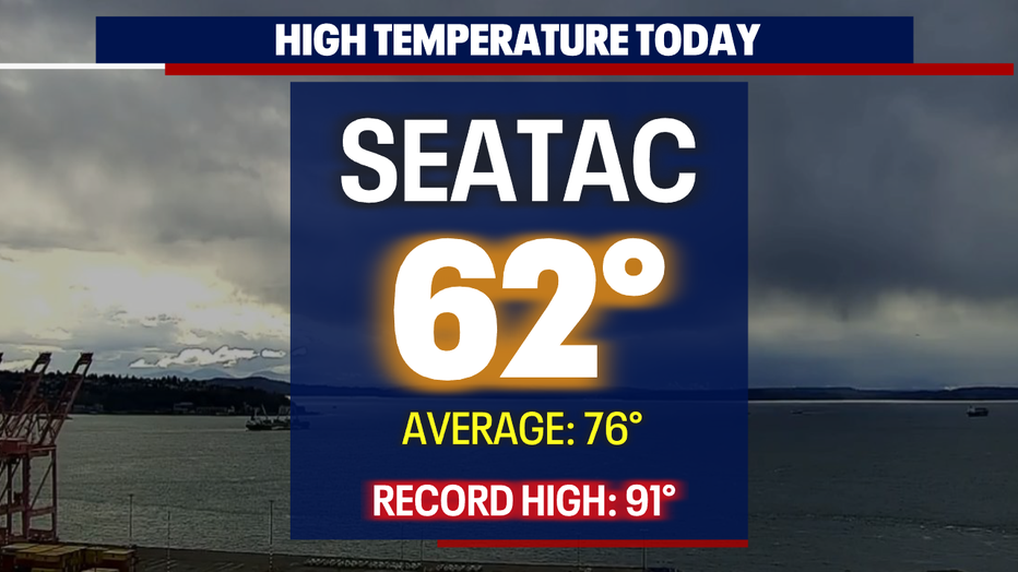
SEATTLE - Conditions Tuesday felt more like fall than summer around Western WA. Skies were ominous and let out heavy downpours of rain and hail along with thunder and lightning.
SeaTac only hit 62 at the airport, and that's 14 degrees cooler than we should be for this time of year.
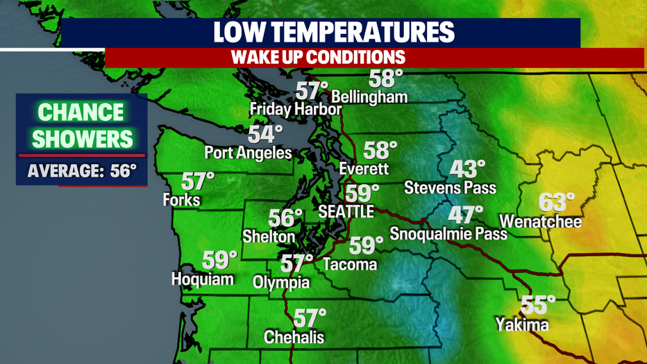
Showers will taper overnight leaving skies mostly cloudy. Temperatures cool into the mid to upper 50s for most communities.
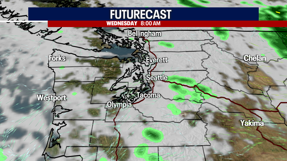
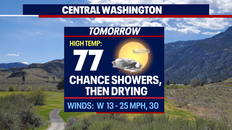
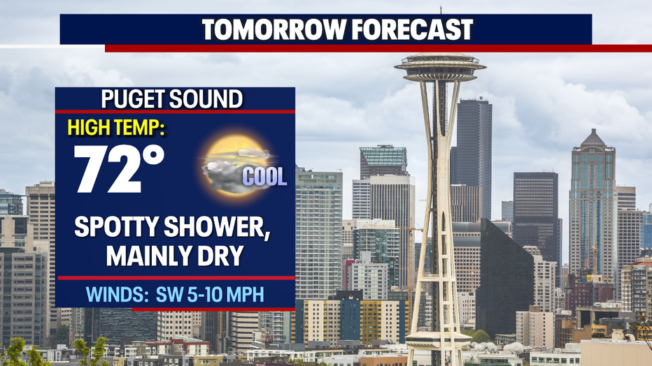
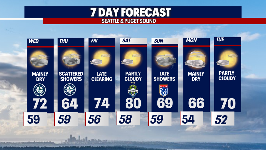
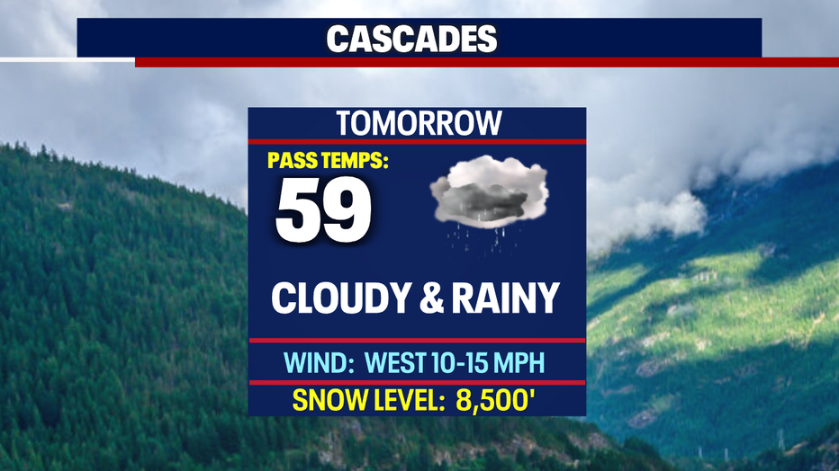
We're forecasting a drier day on Wednesday with just a few spotty showers to start the day, mainly over the foothills and mountains. Skies will stay mostly cloudy as highs warm into the upper 60s to low 70s.
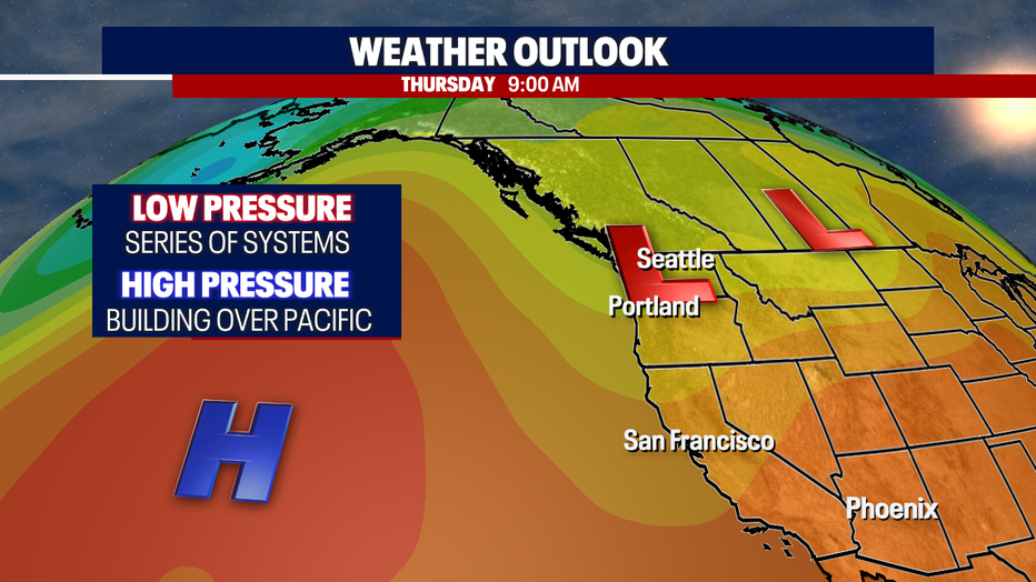
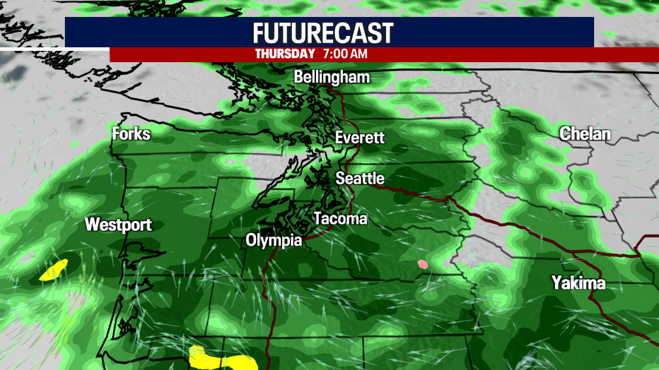
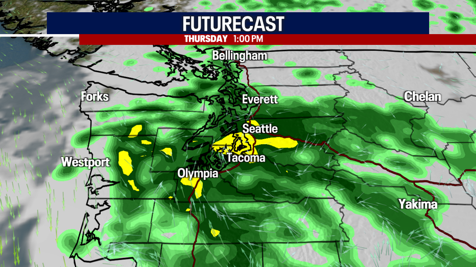
As we push into Thursday, rain is in the forecast again as another disturbance rides over Western WA. This system will cool temperatures back into the low to mid 60s.
The morning and evening commutes look very sloppy! Allow for extra time on the roads and be aware that many neighborhoods have kids heading back to school this week.
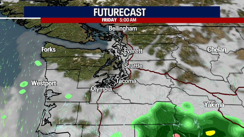
By Friday, high pressure strengthens off the coast helping us turn to a drier and warmer pattern just in time for the weekend.
Highs on Friday warm back into the 70s with even more heat coming our way Saturday with a forecast high of 80.
Don't get used to the heat though-- we'll dive back the other way as more showers and cooler highs return Sunday into the start of next week. Enjoy!
Have a great week all! ~Erin Mayovsky, FOX 13 Forecaster
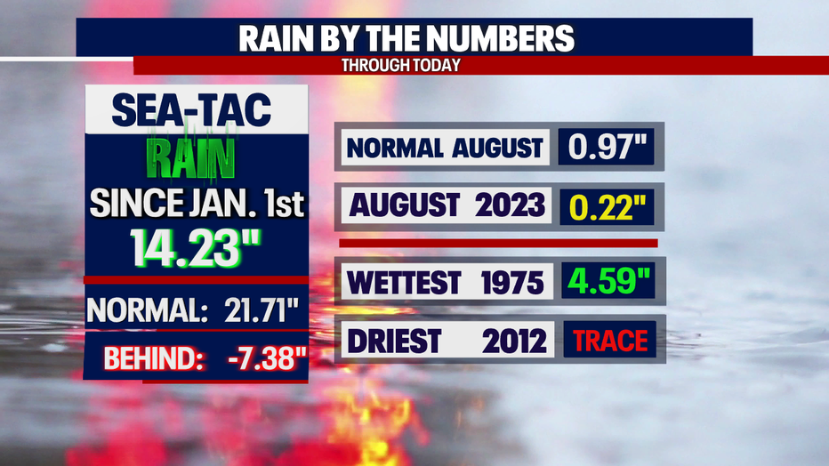
*SeaTac Rain Almanac
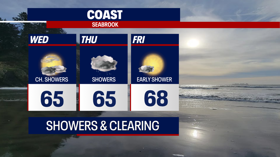
*Coast Forecast
*Mountain Forecast
*Central WA Forecast