

Washington summer storms help firefighters as drought deepens
U.S. Drought Monitor Conditions: Pacific Northwest | August 27, 2024. Red indicates Extreme Drought (red) and Severe Drought (orange) in central Washington, with Moderate Drought (tan) and Abnormally Dry (yellow) conditions across the rest of the sta
Current drought conditions
SEATTLE - Drought conditions in central Washington have degraded slightly despite stretches of cooler and wetter weather conditions this summer.
After rare thunderstorms brought lightning and heavy rain to the greater Seattle area, firefighters reported progress in battling wildfires across the region.
On Monday, the remote Washington town of Stehekin reopened to visitors as firefighting crews were able to step up Pioneer Fire containment, thanks to weekend rainfall.
Central Washington remains in extreme drought, while nearly the rest of the state remains in moderate drought or "abnormally dry" classifications, according to a new report from the Climate Prediction Center.
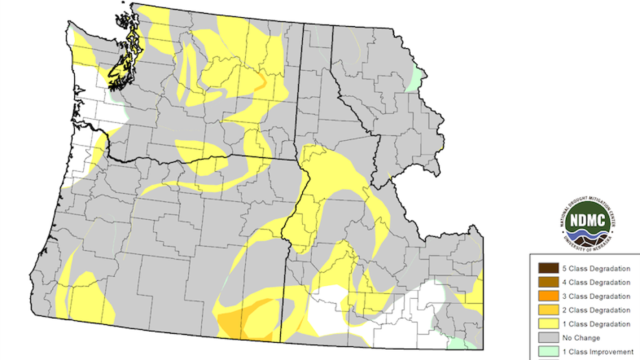
Drought intensified across central Washington, central Idaho, and southeastern Oregon, with one- to two-class degradations. Drought conditions across other parts of the region did not change from mid-July into late August. (Source: National Drought
"Mid-August storms and cooler weather brought a brief reprieve to drought and wildfire conditions for some areas of the Pacific Northwest, but did not end either," said officials at the National Integrated Drought Information System.
Washington drought outlook
There is good news on the horizon, for Washington at least. Scientists mapped out a three-month seasonal outlook for drought conditions. According to their models, Washington is predicted to improve (indicated by green shading in the below graphic) in nearly every region.
However, drought conditions are predicted to persist (indicated by brown shading in the below graphic) in Idaho, Montana, and southern Oregon.
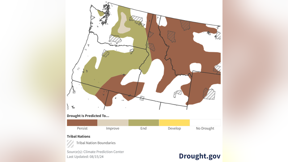
3-month seasonal drought outlook for August 15-November 30, 2024. (Courtesy of Climate Prediction Center)
Precipitation and water reservoirs
Across the water year as a whole, precipitation has been classified as "much-below-average" with "much-above-normal" temperatures.
This results in three of the five water reservoirs under their observation sitting at capacities well below 50%. Cle ELum reservoir is only at 8% of its potential capacity, according to the report.
Wildfire outlook across Pacific Northwest
Right now, nearly all of the Pacific Northwest is predicted to have above-normal chances for wildfires in September 2024. Western Oregon and northern Idaho are exceptions, with the National Interagency Coordination Center showing the areas remaining at normal risk for wildland fires.
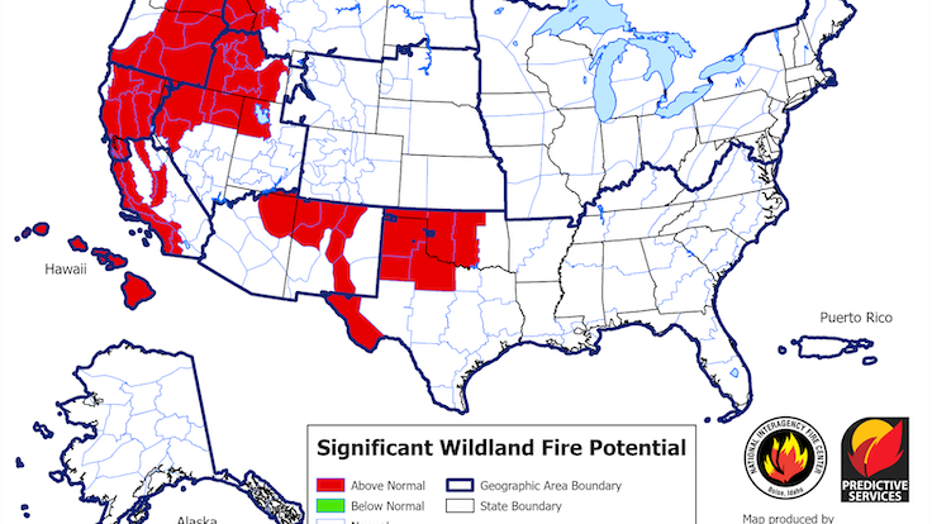
U.S. significant wildfire potential outlook for September 2024, released on August 1, 2024. Colors indicate above-normal potential (red), below-normal potential (green), and normal potential (white). Source: National Interagency Coordination Center.
MORE NEWS FROM FOX SEATTLE
Popular Portland burger chain Killer Burger to expand to 6 WA locations
‘I need answers’: Mother of Teekah Lewis wants possible sighting investigated
Kingston-Seattle fast ferry canceled until further notice
SEA Airport officials say 'some progress' made on day 4 of cyberattack
Family says gunmen fired 60-70 rounds at Burien home, killing grandmother
Sedro-Woolley residents push back against proposed lithium battery facility
When to travel, not travel in WA over Labor Day weekend
DEA details drug trafficking crisis in western Washington
Shooting in Seattle's U District leaves teen injured
To get the best local news, weather and sports in Seattle for free, sign up for the daily FOX Seattle newsletter.